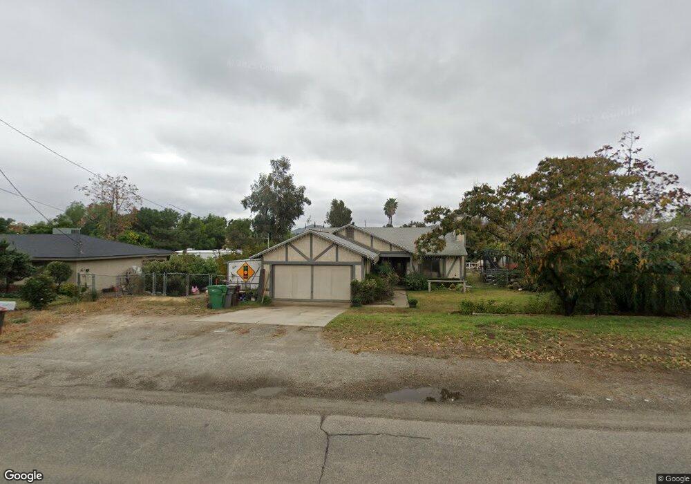
20585 Moore St Perris, CA 92570
Upton Acres NeighborhoodEstimated Value: $495,128 - $605,000
3
Beds
2
Baths
1,276
Sq Ft
$430/Sq Ft
Est. Value
About This Home
This home is located at 20585 Moore St, Perris, CA 92570 and is currently estimated at $549,032, approximately $430 per square foot. 20585 Moore St is a home located in Riverside County with nearby schools including Manuel L. Real Elementary School, Tomas Rivera Middle School, and Citrus Hill High School.
Ownership History
Date
Name
Owned For
Owner Type
Purchase Details
Closed on
Jan 25, 2021
Sold by
Guzman Stephen M and Guzman Stacey Lynn
Bought by
Guzman Stephen M and Guzman Stacey Lynn
Current Estimated Value
Home Financials for this Owner
Home Financials are based on the most recent Mortgage that was taken out on this home.
Original Mortgage
$170,940
Outstanding Balance
$152,808
Interest Rate
2.67%
Mortgage Type
FHA
Estimated Equity
$396,224
Create a Home Valuation Report for This Property
The Home Valuation Report is an in-depth analysis detailing your home's value as well as a comparison with similar homes in the area
Home Values in the Area
Average Home Value in this Area
Purchase History
| Date | Buyer | Sale Price | Title Company |
|---|---|---|---|
| Guzman Stephen M | -- | Timios |
Source: Public Records
Mortgage History
| Date | Status | Borrower | Loan Amount |
|---|---|---|---|
| Open | Guzman Stephen M | $170,940 |
Source: Public Records
Tax History
| Year | Tax Paid | Tax Assessment Tax Assessment Total Assessment is a certain percentage of the fair market value that is determined by local assessors to be the total taxable value of land and additions on the property. | Land | Improvement |
|---|---|---|---|---|
| 2025 | $2,651 | $168,392 | $38,257 | $130,135 |
| 2023 | $2,651 | $161,855 | $36,772 | $125,083 |
| 2022 | $2,536 | $158,682 | $36,051 | $122,631 |
| 2021 | $2,476 | $155,572 | $35,345 | $120,227 |
| 2020 | $2,442 | $153,978 | $34,983 | $118,995 |
| 2019 | $2,303 | $150,960 | $34,298 | $116,662 |
| 2018 | $2,281 | $148,001 | $33,627 | $114,374 |
| 2017 | $2,213 | $145,100 | $32,968 | $112,132 |
| 2016 | $2,184 | $142,256 | $32,322 | $109,934 |
| 2015 | $2,157 | $140,122 | $31,838 | $108,284 |
| 2014 | $2,047 | $137,379 | $31,215 | $106,164 |
Source: Public Records
Map
Nearby Homes
- 20785 Burns St
- 20541 Hunter St
- 20553 Hunter St
- 20521 Hunter St
- 20175 Souder St
- 20434 Myron St
- 20540 Verta St
- 21131 Martin St
- 21274 Cajalco Rd
- 21321 Cajalco Rd
- 21285 Kinney St
- 0 Marquez Rd
- 20646 Markham St
- 20398 Bailly St
- 20243 Lee Rd
- 19488 Eldorado Rd
- 0 Old Elsinore Rd Unit DW25247795
- 19128 Trail Ride Ct
- 18251 Northstar Ave
- 21701 Perry St
- 20605 Moore St
- 20590 Wells St
- 20621 Moore St
- 20570 Wells St
- 20600 Moore St
- 20580 Moore St
- 20570 Moore St
- 20630 Wells St
- 20546 Wells St
- 20541 Moore St
- 20635 Moore St
- 20650 Wells St
- 20540 Moore St
- 20605 Wells St
- 20668 Wells St
- 19410 Alexander St
- 20642 Moore St
- 20520 Moore St
- 20625 Wells St
- 20619 Burns St
Your Personal Tour Guide
Ask me questions while you tour the home.