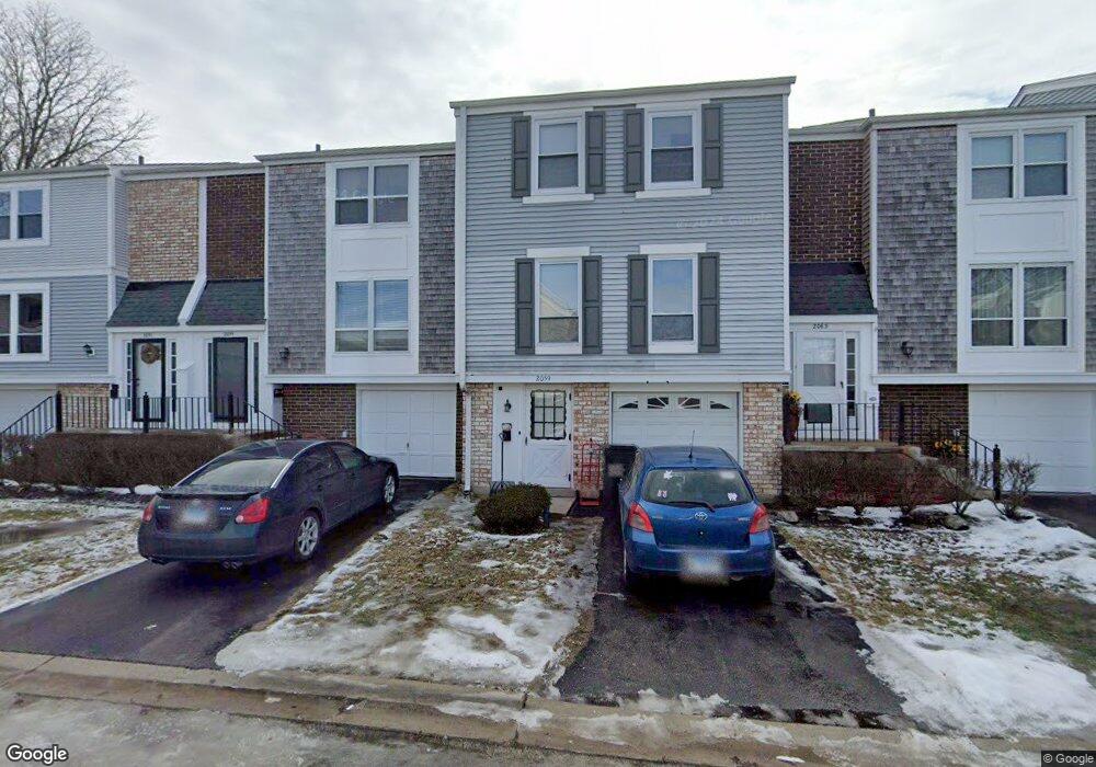
2059 Kettering Rd Unit 2 Hoffman Estates, IL 60169
South Hoffman Estates NeighborhoodEstimated Value: $275,000 - $296,000
3
Beds
2
Baths
1,384
Sq Ft
$206/Sq Ft
Est. Value
About This Home
This home is located at 2059 Kettering Rd Unit 2, Hoffman Estates, IL 60169 and is currently estimated at $284,514, approximately $205 per square foot. 2059 Kettering Rd Unit 2 is a home located in Cook County with nearby schools including John Muir Literacy Academy, Dwight D Eisenhower Junior High School, and Hoffman Estates High School.
Ownership History
Date
Name
Owned For
Owner Type
Purchase Details
Closed on
Mar 10, 2004
Sold by
Stone Michael L
Bought by
Stone Michael L and Stone Clara
Current Estimated Value
Purchase Details
Closed on
Apr 29, 1998
Sold by
Jurkiewicz Albert
Bought by
Stone Michael L
Purchase Details
Closed on
Feb 14, 1996
Sold by
Harris Bank Palatine
Bought by
Jurkiewicz Albert
Home Financials for this Owner
Home Financials are based on the most recent Mortgage that was taken out on this home.
Original Mortgage
$82,000
Interest Rate
6.62%
Create a Home Valuation Report for This Property
The Home Valuation Report is an in-depth analysis detailing your home's value as well as a comparison with similar homes in the area
Home Values in the Area
Average Home Value in this Area
Purchase History
| Date | Buyer | Sale Price | Title Company |
|---|---|---|---|
| Stone Michael L | -- | Ctc | |
| Stone Michael L | $102,000 | -- | |
| Jurkiewicz Albert | $91,500 | -- |
Source: Public Records
Mortgage History
| Date | Status | Borrower | Loan Amount |
|---|---|---|---|
| Previous Owner | Jurkiewicz Albert | $82,000 |
Source: Public Records
Tax History
| Year | Tax Paid | Tax Assessment Tax Assessment Total Assessment is a certain percentage of the fair market value that is determined by local assessors to be the total taxable value of land and additions on the property. | Land | Improvement |
|---|---|---|---|---|
| 2025 | $5,831 | $24,000 | $2,240 | $21,760 |
| 2024 | $5,831 | $19,000 | $3,000 | $16,000 |
| 2023 | $5,643 | $19,000 | $3,000 | $16,000 |
| 2022 | $5,643 | $19,000 | $3,000 | $16,000 |
| 2021 | $4,919 | $14,681 | $1,764 | $12,917 |
| 2020 | $4,804 | $14,681 | $1,764 | $12,917 |
| 2019 | $4,776 | $16,313 | $1,764 | $14,549 |
| 2018 | $5,201 | $15,949 | $1,540 | $14,409 |
| 2017 | $5,108 | $15,949 | $1,540 | $14,409 |
| 2016 | $4,752 | $15,949 | $1,540 | $14,409 |
| 2015 | $4,294 | $13,368 | $1,344 | $12,024 |
| 2014 | $4,218 | $13,368 | $1,344 | $12,024 |
| 2013 | $4,110 | $13,368 | $1,344 | $12,024 |
Source: Public Records
Map
Nearby Homes
- 1965 Cheltenham Place Unit 2
- 1936 Whitingham Ln Unit 1
- 2080 Sutherland Place Unit 1
- 2021 Kensington Ln Unit 3004
- 2027 Kensington Ln Unit 3001
- 2025 Kensington Ln Unit 3002
- 2023 Kensington Ln Unit 3003
- 1836 Stockton Dr Unit 3312
- 1985 Leiter Way Unit 1102
- 1981 Leiter Way Unit 12005
- 1979 Leiter Way Unit 12004
- 1977 Leiter Way Unit 12003
- 1982 Leiter Way Unit 13004
- 1965 Blackberry Ln Unit 101
- 1996 Leiter Way Unit 14002
- 1992 Leiter Way Unit 14004
- 1792 Williamsburg Dr
- 2267 Briar Ct Unit 65
- 1797 Queensbury Cir Unit 5764
- 1840 Huntington Blvd Unit BW511
- 2063 Kettering Rd Unit 2
- 2055 Kettering Rd Unit 2
- 2067 Kettering Rd Unit 1881
- 2071 Kettering Rd Unit 2
- 2075 Kettering Rd Unit 2
- 2075 Kettering Rd Unit 2075
- 1980 Georgetown Ln Unit 4
- 1987 Oxford Ln Unit 2
- 1982 Georgetown Ln Unit 4
- 1984 Georgetown Ln
- 1984 Georgetown Ln Unit 461
- 1986 Georgetown Ln
- 1989 Oxford Ln Unit 2
- 2081 Kettering Rd
- 1984 Oxford Ln
- 1978 Georgetown Ln Unit 4
- 1976 Chelmsford Place
- 1988 Georgetown Ln
- 1991 Oxford Ln Unit 2
- 1986 Oxford Ln Unit 2
Your Personal Tour Guide
Ask me questions while you tour the home.