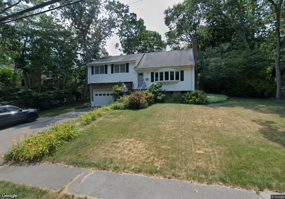
206 Bristol Rd Wellesley Hills, MA 02481
Cliff Estates NeighborhoodEstimated Value: $1,853,000
4
Beds
3
Baths
1,778
Sq Ft
$1,042/Sq Ft
Est. Value
About This Home
This home is located at 206 Bristol Rd, Wellesley Hills, MA 02481 and is currently estimated at $1,853,000, approximately $1,042 per square foot. 206 Bristol Rd is a home located in Norfolk County with nearby schools including Ernest F. Upham Elementary School, Wellesley Middle School, and Wellesley Sr High School.
Ownership History
Date
Name
Owned For
Owner Type
Purchase Details
Closed on
Mar 18, 2024
Sold by
Colby Drew W and Colby Carol A
Bought by
Haven Development Llc
Current Estimated Value
Home Financials for this Owner
Home Financials are based on the most recent Mortgage that was taken out on this home.
Original Mortgage
$3,250,000
Outstanding Balance
$3,189,599
Interest Rate
6.63%
Mortgage Type
Purchase Money Mortgage
Estimated Equity
-$1,336,599
Purchase Details
Closed on
Jun 25, 1993
Sold by
Hourihan William J and Hourihan Joan E
Bought by
Colby Drew W and Colby Carol A
Create a Home Valuation Report for This Property
The Home Valuation Report is an in-depth analysis detailing your home's value as well as a comparison with similar homes in the area
Home Values in the Area
Average Home Value in this Area
Purchase History
| Date | Buyer | Sale Price | Title Company |
|---|---|---|---|
| Haven Development Llc | $1,750,000 | None Available | |
| Haven Development Llc | $1,750,000 | None Available | |
| Colby Drew W | $327,000 | -- | |
| Colby Drew W | $327,000 | -- |
Source: Public Records
Mortgage History
| Date | Status | Borrower | Loan Amount |
|---|---|---|---|
| Open | Haven Development Llc | $3,250,000 | |
| Closed | Haven Development Llc | $3,250,000 | |
| Previous Owner | Colby Drew W | $300,000 | |
| Previous Owner | Colby Drew W | $350,600 | |
| Previous Owner | Colby Drew W | $360,000 |
Source: Public Records
Tax History Compared to Growth
Tax History
| Year | Tax Paid | Tax Assessment Tax Assessment Total Assessment is a certain percentage of the fair market value that is determined by local assessors to be the total taxable value of land and additions on the property. | Land | Improvement |
|---|---|---|---|---|
| 2025 | $13,888 | $1,351,000 | $1,351,000 | $0 |
| 2024 | $14,803 | $1,422,000 | $1,238,000 | $184,000 |
| 2023 | $14,118 | $1,233,000 | $1,081,000 | $152,000 |
| 2022 | $12,579 | $1,077,000 | $857,000 | $220,000 |
| 2021 | $12,655 | $1,077,000 | $857,000 | $220,000 |
| 2020 | $12,450 | $1,077,000 | $857,000 | $220,000 |
| 2019 | $12,461 | $1,077,000 | $857,000 | $220,000 |
| 2018 | $12,332 | $1,032,000 | $879,000 | $153,000 |
| 2017 | $12,167 | $1,032,000 | $879,000 | $153,000 |
| 2016 | $11,960 | $1,011,000 | $864,000 | $147,000 |
| 2015 | $11,699 | $1,012,000 | $864,000 | $148,000 |
Source: Public Records
Map
Nearby Homes
- 209 Bristol Rd
- 6 Norwich Rd
- 36 Oakridge Rd
- 201 Lowell Rd
- 6 Nantucket Rd
- 15 Essex Rd
- 18 Sprague Rd
- 7 Mountview Rd
- 16 Stearns Rd Unit 101
- 16 Stearns Rd Unit 302
- 16 Stearns Rd Unit 207
- 16 Stearns Rd Unit 301
- 16 Stearns Rd Unit 103
- 16 Stearns Rd Unit 202
- 16 Stearns Rd Unit 304
- 16 Stearns Rd Unit 104
- 16 Stearns Rd Unit 108
- 39 Audubon Rd
- 63 Oak St Unit B
- 33 Royalston Rd
- 210 Bristol Rd
- 2 Trinity Ct
- 198 Bristol Rd
- 205 Bristol Rd
- 104 Westgate Rd
- 108 Westgate Rd
- 217 Bristol Rd
- 6 Trinity Ct
- 112 Westgate Rd
- 3 Trinity Ct
- 100 Westgate Rd
- 194 Bristol Rd
- 197 Bristol Rd
- 107 Westgate Rd
- 103 Westgate Rd
- 221 Bristol Rd
- 111 Westgate Rd
- 116 Westgate Rd
- 10 Trinity Ct
- 193 Bristol Rd