
Seller's Agent in 2025
Eric Levin
KW Coastal and Lakes & Mountains Realty
(603) 799-1190
4 in this area
53 Total Sales
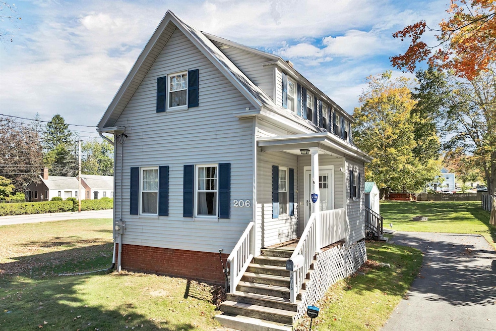
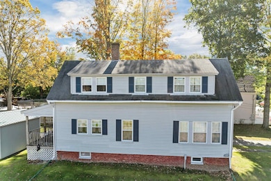
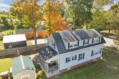
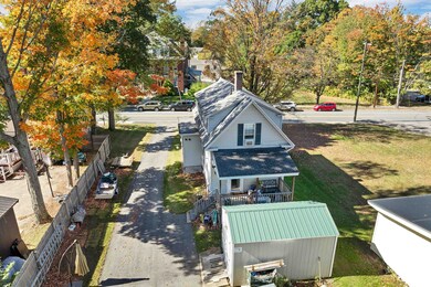
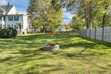
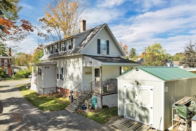
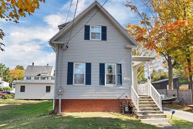
Welcome to 206 Locust Street in Dover, NH! This well-maintained 3 bedroom, 1.5 bathroom home offers comfort, efficiency, and a convenient location close to downtown Dover, schools, shopping, and major commuter routes.
The property has recently undergone a through home efficiency upgrade throughout by Unitil, improving energy performance and year-round comfort. Inside, you'll find a functional layout with bright living spaces, a spacious kitchen, and a warm, inviting atmosphere throughout. The exterior offers an oversized shed, whole house generator connection, a covered deck and room to relax or entertain, with easy access to all Dover has to offer. The location speaks for itself. Live close to downtown Dover’s restaurants, shops, parks and commuter routes, this home truly offers the best of both comfort and convenience. Don’t miss your chance to own this move-in-ready home in one of the Seacoast’s most desirable communities. Smile, you just found your new home! BTW More pics are coming soon.
Last Agent to Sell the Property
KW Coastal and Lakes & Mountains Realty License #068272 Listed on: 10/13/2025
| Date | Type | Sale Price | Title Company |
|---|---|---|---|
| Warranty Deed | $229,000 | None Available |
| Date | Status | Loan Amount | Loan Type |
|---|---|---|---|
| Open | $222,130 | Purchase Money Mortgage |
| Date | Event | Price | List to Sale | Price per Sq Ft |
|---|---|---|---|---|
| 11/14/2025 11/14/25 | Sold | $445,000 | +8.8% | $385 / Sq Ft |
| 10/16/2025 10/16/25 | Pending | -- | -- | -- |
| 10/13/2025 10/13/25 | Price Changed | $409,000 | -1.4% | $354 / Sq Ft |
| 10/13/2025 10/13/25 | For Sale | $415,000 | -- | $359 / Sq Ft |
| Year | Tax Paid | Tax Assessment Tax Assessment Total Assessment is a certain percentage of the fair market value that is determined by local assessors to be the total taxable value of land and additions on the property. | Land | Improvement |
|---|---|---|---|---|
| 2024 | $7,204 | $396,500 | $167,700 | $228,800 |
| 2023 | $6,448 | $344,800 | $143,700 | $201,100 |
| 2022 | $6,295 | $317,300 | $135,800 | $181,500 |
| 2021 | $6,371 | $293,600 | $135,800 | $157,800 |
| 2020 | $6,145 | $247,300 | $123,800 | $123,500 |
| 2019 | $5,862 | $232,700 | $111,800 | $120,900 |
| 2018 | $5,418 | $217,400 | $99,800 | $117,600 |
| 2017 | $4,915 | $190,000 | $75,900 | $114,100 |
| 2016 | $4,496 | $171,000 | $67,100 | $103,900 |
| 2015 | $4,372 | $164,300 | $62,900 | $101,400 |
| 2014 | $4,273 | $164,300 | $62,900 | $101,400 |
| 2011 | $4,393 | $174,900 | $81,400 | $93,500 |
Seller's Agent in 2025
Eric Levin
KW Coastal and Lakes & Mountains Realty
(603) 799-1190
4 in this area
53 Total Sales
W
Buyer's Agent in 2025
William Stewart
The Aland Realty Group
(603) 828-8130
2 in this area
7 Total Sales
Source: PrimeMLS
MLS Number: 5065542
APN: DOVR-015110
Disclaimer: Certain information contained herein is derived from information provided by parties other than Homes.com. All information provided is deemed reliable, but is not guaranteed to be accurate and should be independently verified.
![]() Copyright 2025 PrimeMLS, Inc. All rights reserved. This information is deemed reliable, but not guaranteed. The data relating to real estate displayed on this display comes in part from the IDX Program of PrimeMLS. The information being provided is for consumers’ personal, non-commercial use and may not be used for any purpose other than to identify prospective properties consumers may be interested in purchasing.
Copyright 2025 PrimeMLS, Inc. All rights reserved. This information is deemed reliable, but not guaranteed. The data relating to real estate displayed on this display comes in part from the IDX Program of PrimeMLS. The information being provided is for consumers’ personal, non-commercial use and may not be used for any purpose other than to identify prospective properties consumers may be interested in purchasing.