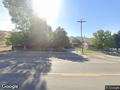
206 N Connor Ave Stockton, UT 84071
Estimated Value: $315,388 - $343,000
--
Bed
--
Bath
1,744
Sq Ft
$187/Sq Ft
Est. Value
About This Home
This home is located at 206 N Connor Ave, Stockton, UT 84071 and is currently estimated at $326,097, approximately $186 per square foot. 206 N Connor Ave is a home with nearby schools including Settlement Canyon Elementary School and Dugway.
Ownership History
Date
Name
Owned For
Owner Type
Purchase Details
Closed on
Jan 13, 2006
Sold by
Parker James D
Bought by
Johnson Michael K and Johnson Jenifer L
Current Estimated Value
Home Financials for this Owner
Home Financials are based on the most recent Mortgage that was taken out on this home.
Original Mortgage
$84,000
Interest Rate
7.65%
Mortgage Type
Adjustable Rate Mortgage/ARM
Create a Home Valuation Report for This Property
The Home Valuation Report is an in-depth analysis detailing your home's value as well as a comparison with similar homes in the area
Home Values in the Area
Average Home Value in this Area
Purchase History
| Date | Buyer | Sale Price | Title Company |
|---|---|---|---|
| Johnson Michael K | -- | Tooele Title Co |
Source: Public Records
Mortgage History
| Date | Status | Borrower | Loan Amount |
|---|---|---|---|
| Closed | Johnson Michael K | $160,000 | |
| Closed | Johnson Michael K | $113,094 | |
| Closed | Johnson Michael K | $115,500 | |
| Closed | Johnson Michael K | $84,000 | |
| Closed | Johnson Michael K | $21,000 |
Source: Public Records
Tax History Compared to Growth
Tax History
| Year | Tax Paid | Tax Assessment Tax Assessment Total Assessment is a certain percentage of the fair market value that is determined by local assessors to be the total taxable value of land and additions on the property. | Land | Improvement |
|---|---|---|---|---|
| 2024 | $2,355 | $173,580 | $33,562 | $140,018 |
| 2023 | $2,355 | $164,103 | $33,562 | $130,541 |
| 2022 | $1,882 | $152,092 | $44,715 | $107,377 |
| 2021 | $1,808 | $121,662 | $44,715 | $76,947 |
| 2020 | $1,744 | $196,410 | $6,500 | $189,910 |
| 2019 | $1,401 | $167,284 | $6,500 | $160,784 |
| 2018 | $1,290 | $143,012 | $6,500 | $136,512 |
| 2017 | $948 | $120,260 | $6,500 | $113,760 |
| 2016 | $980 | $66,143 | $3,575 | $62,568 |
| 2015 | $980 | $66,260 | $0 | $0 |
| 2014 | -- | $66,260 | $0 | $0 |
Source: Public Records
Map
Nearby Homes
- 93 N Sherman St
- 60 S Johnson St
- 25 W Pearson
- 305 S Sheridan St
- 282 S Sheridan St
- 609 E 900 S
- 0 E Bald Mountain Rd
- 0 Utah 36
- 1843 W Big Sky Dr
- 2258 W Deer Run Dr Unit 174
- 2521 W Ridgeline Rd
- 3017 W Ridgeline Rd
- 1054 S 1050 W
- 1081 S 900 W
- 799 3 O'Clock Dr
- 3214 W Ridgeline Rd
- 1018 S 810 W
- 1082 Southland Dr
- 765 1 O'Clock Dr
- 615 W 1080 S
- 206 N Connor Ave
- 194 N Connor Ave
- 182 N Connor Ave
- 36 E Dutch Ave
- 238 N Connor Ave
- 190 N Sheridan St
- 209 N Connor Ave
- 174 N Sheridan St
- 188 N Sheridan St
- 252 N Connor Ave
- 59 E Dutch Ave
- 125 N Sheridan St Unit 1&2
- 10 E Smith Ave
- 270 N Connor Ave
- 20 E Smith Ave
- 255 N Conner Ave
- 128 N Connor Ave
- 273 N Connor Ave
- 129 N Connor Ave
- 124 N Sheridan Ave
