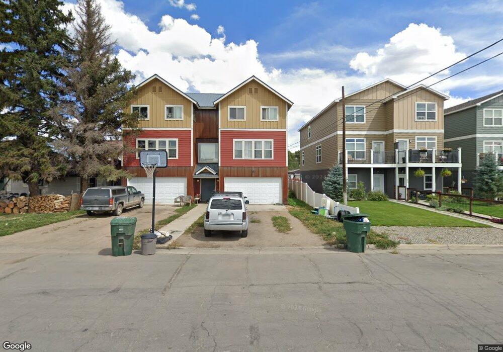
206 S 10th St Gunnison, CO 81230
Estimated Value: $535,000 - $813,000
2
Beds
1
Bath
1,164
Sq Ft
$560/Sq Ft
Est. Value
About This Home
This home is located at 206 S 10th St, Gunnison, CO 81230 and is currently estimated at $652,084, approximately $560 per square foot. 206 S 10th St is a home located in Gunnison County with nearby schools including Gunnison Elementary School, Gunnison Middle School, and Crested Butte Community School.
Ownership History
Date
Name
Owned For
Owner Type
Purchase Details
Closed on
Feb 14, 2008
Sold by
Mearsha Frank
Bought by
Weinberg Caleb
Current Estimated Value
Home Financials for this Owner
Home Financials are based on the most recent Mortgage that was taken out on this home.
Original Mortgage
$70,837
Interest Rate
5.68%
Mortgage Type
Purchase Money Mortgage
Purchase Details
Closed on
Jun 13, 2003
Sold by
Maxwell Rosemary A
Bought by
Mearsha Frank
Purchase Details
Closed on
May 16, 1997
Purchase Details
Closed on
Nov 19, 1994
Create a Home Valuation Report for This Property
The Home Valuation Report is an in-depth analysis detailing your home's value as well as a comparison with similar homes in the area
Home Values in the Area
Average Home Value in this Area
Purchase History
| Date | Buyer | Sale Price | Title Company |
|---|---|---|---|
| Weinberg Caleb | $150,000 | None Available | |
| Mearsha Frank | $125,000 | -- | |
| -- | $70,000 | -- | |
| -- | $62,500 | -- |
Source: Public Records
Mortgage History
| Date | Status | Borrower | Loan Amount |
|---|---|---|---|
| Closed | Weinberg Caleb | $70,837 |
Source: Public Records
Tax History Compared to Growth
Tax History
| Year | Tax Paid | Tax Assessment Tax Assessment Total Assessment is a certain percentage of the fair market value that is determined by local assessors to be the total taxable value of land and additions on the property. | Land | Improvement |
|---|---|---|---|---|
| 2024 | $2,347 | $47,620 | $11,180 | $36,440 |
| 2023 | $2,312 | $43,940 | $10,320 | $33,620 |
| 2022 | $2,083 | $34,420 | $4,410 | $30,010 |
| 2021 | $1,919 | $36,190 | $4,640 | $31,550 |
| 2020 | $1,483 | $26,250 | $4,570 | $21,680 |
| 2019 | $1,451 | $26,250 | $4,570 | $21,680 |
| 2018 | $1,607 | $28,390 | $4,500 | $23,890 |
| 2017 | $1,626 | $28,390 | $4,500 | $23,890 |
| 2016 | $2,019 | $35,580 | $3,090 | $32,490 |
| 2015 | $1,639 | $35,580 | $3,090 | $32,490 |
| 2014 | $1,639 | $28,180 | $3,410 | $24,770 |
Source: Public Records
Map
Nearby Homes
- 308 S 11th St Unit 1
- 718 W New York Ave
- Lots 13-16 Us Highway 50 Frontage Rd
- 417 S Boulevard St Unit A
- 114 N 8th St
- 215 S 7th St
- TBD S 6th St
- 109 N 7th St
- 304 N 9th St Unit 2A
- 1208 W Tomichi Ave Unit 4
- 220 N Boulevard St Unit 17
- 302 S 5th St
- 288 S 5th St
- 314 S 5th St
- 000 Us Highway 50
- 1314 W Tomichi Ave Unit 19
- 1310 W Tomichi Ave Unit 23
- 100 Ouray Ln Unit D
- 1412 W Gunnison Ave
- 436 N 11th St
- 811 W New York Ave
- 807 W New York Ave
- 807 W New York Ave
- 807 W New York Ave
- 807 W New York Ave
- 807 W New York Ave
- 807 W New York Ave
- 901 W New York Ave
- 214 S 10th St Unit H
- 214 S 10th St Unit E
- 214 S 10th St Unit F
- 214 S 10th St Unit G
- 214 S 10th St Unit A
- 214 S 10th St Unit C
- 214 S 10th St Unit D
- 209 S 11th St
- 912 W Gunnison Ave Unit Frontierland Mobile
- 912 W Gunnison Ave
- 119 1/2 S 11th St
- 912 W Gunnison Lot 7 Ave