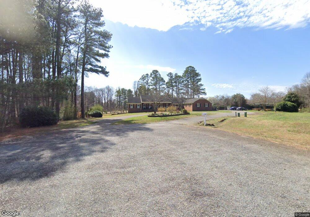
206 Sapona Rd Lexington, NC 27295
Estimated Value: $609,000 - $766,000
4
Beds
7
Baths
11,080
Sq Ft
$61/Sq Ft
Est. Value
About This Home
This home is located at 206 Sapona Rd, Lexington, NC 27295 and is currently estimated at $672,821, approximately $60 per square foot. 206 Sapona Rd is a home located in Davidson County with nearby schools including Tyro Elementary School, Tyro Middle School, and West Davidson High School.
Ownership History
Date
Name
Owned For
Owner Type
Purchase Details
Closed on
Feb 28, 2024
Sold by
Moore Nicola K
Bought by
Moore Nicola and Moore Derek
Current Estimated Value
Purchase Details
Closed on
Apr 21, 2017
Sold by
Reissman Lutz W and Reissman Ingrid F
Bought by
Reissman Franz H and Reissman Inge Z
Home Financials for this Owner
Home Financials are based on the most recent Mortgage that was taken out on this home.
Original Mortgage
$250,000
Interest Rate
4.23%
Mortgage Type
Credit Line Revolving
Purchase Details
Closed on
Nov 1, 1986
Create a Home Valuation Report for This Property
The Home Valuation Report is an in-depth analysis detailing your home's value as well as a comparison with similar homes in the area
Home Values in the Area
Average Home Value in this Area
Purchase History
| Date | Buyer | Sale Price | Title Company |
|---|---|---|---|
| Moore Nicola | -- | None Listed On Document | |
| Moore Nicola | -- | None Listed On Document | |
| Reissman Franz H | -- | None Available | |
| -- | $213,500 | -- |
Source: Public Records
Mortgage History
| Date | Status | Borrower | Loan Amount |
|---|---|---|---|
| Previous Owner | Reissman Franz H | $250,000 |
Source: Public Records
Tax History Compared to Growth
Tax History
| Year | Tax Paid | Tax Assessment Tax Assessment Total Assessment is a certain percentage of the fair market value that is determined by local assessors to be the total taxable value of land and additions on the property. | Land | Improvement |
|---|---|---|---|---|
| 2025 | $3,053 | $499,890 | $0 | $0 |
| 2024 | $3,053 | $499,890 | $0 | $0 |
| 2023 | $3,099 | $499,890 | $0 | $0 |
| 2022 | $3,053 | $499,890 | $0 | $0 |
| 2021 | $3,053 | $499,890 | $0 | $0 |
| 2020 | $2,130 | $348,760 | $0 | $0 |
| 2019 | $2,162 | $348,760 | $0 | $0 |
| 2018 | $2,162 | $348,760 | $0 | $0 |
| 2017 | $2,162 | $348,760 | $0 | $0 |
| 2016 | $1,113 | $348,760 | $0 | $0 |
| 2015 | $1,113 | $348,760 | $0 | $0 |
| 2014 | $1,239 | $393,670 | $0 | $0 |
Source: Public Records
Map
Nearby Homes
- 112 Choctaw Dr
- 138 Siouan Dr
- 114 Cherokee Dr
- 2004 Sunrise Cir
- 104 Shawnee Cir
- 102 Tomahawk Trail
- 213 Deerwood Dr
- 616 Indian Wells Cir
- 1000 Caden Village Cir
- 604 Indian Wells Cir
- 201 Indian Wells Cir
- 000 Tussey Rd
- 00 Comanche Trail
- 0000 Tussey Rd
- HOLLY SPRINGS Plan at Green Needles - Green Needles Townhomes
- ESSEX Plan at Green Needles - The Reserve
- GARDNER Plan at Green Needles - The Reserve
- DUPONT Plan at Green Needles - The Reserve
- 700 Pine Cone Ln
- 619 Pine Cone Ln