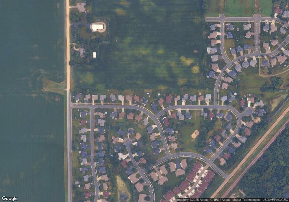
206 Spring Wheat Dr Dundas, MN 55019
Estimated Value: $378,925 - $421,000
3
Beds
2
Baths
1,090
Sq Ft
$373/Sq Ft
Est. Value
About This Home
This home is located at 206 Spring Wheat Dr, Dundas, MN 55019 and is currently estimated at $406,231, approximately $372 per square foot. 206 Spring Wheat Dr is a home located in Rice County with nearby schools including Bridgewater Elementary School, Northfield Middle School, and Northfield Senior High School.
Ownership History
Date
Name
Owned For
Owner Type
Purchase Details
Closed on
Apr 27, 2020
Sold by
Demann Jacob A
Bought by
Dodd Coty Jaye and Dodd Sean Michael
Current Estimated Value
Home Financials for this Owner
Home Financials are based on the most recent Mortgage that was taken out on this home.
Original Mortgage
$289,656
Outstanding Balance
$256,675
Interest Rate
3.3%
Mortgage Type
FHA
Estimated Equity
$149,556
Purchase Details
Closed on
Dec 2, 2011
Sold by
Anderson Erik D and Anderson Brooke E
Bought by
Demann Jacob A
Home Financials for this Owner
Home Financials are based on the most recent Mortgage that was taken out on this home.
Original Mortgage
$131,577
Interest Rate
3.75%
Mortgage Type
FHA
Purchase Details
Closed on
Feb 20, 2009
Sold by
The Pavek Family Investments Corp
Bought by
Rice County Habitat For Humanity Inc
Purchase Details
Closed on
Jul 12, 2004
Sold by
College City Homes Inc
Bought by
Anderson Brooke E and Anderson Erik D
Create a Home Valuation Report for This Property
The Home Valuation Report is an in-depth analysis detailing your home's value as well as a comparison with similar homes in the area
Purchase History
| Date | Buyer | Sale Price | Title Company |
|---|---|---|---|
| Dodd Coty Jaye | $295,000 | Burnet Title | |
| Demann Jacob A | $135,000 | -- | |
| Rice County Habitat For Humanity Inc | $100,000 | -- | |
| Anderson Brooke E | $208,126 | -- |
Source: Public Records
Mortgage History
| Date | Status | Borrower | Loan Amount |
|---|---|---|---|
| Open | Dodd Coty Jaye | $289,656 | |
| Previous Owner | Demann Jacob A | $131,577 |
Source: Public Records
Tax History Compared to Growth
Tax History
| Year | Tax Paid | Tax Assessment Tax Assessment Total Assessment is a certain percentage of the fair market value that is determined by local assessors to be the total taxable value of land and additions on the property. | Land | Improvement |
|---|---|---|---|---|
| 2025 | $5,140 | $346,300 | $92,300 | $254,000 |
| 2024 | $5,140 | $316,400 | $84,100 | $232,300 |
| 2023 | $4,328 | $316,400 | $84,100 | $232,300 |
| 2022 | $4,014 | $296,100 | $82,000 | $214,100 |
| 2021 | $3,698 | $258,900 | $67,700 | $191,200 |
| 2020 | $3,606 | $234,000 | $60,300 | $173,700 |
| 2019 | $3,492 | $228,900 | $60,300 | $168,600 |
| 2018 | $3,392 | $216,900 | $60,300 | $156,600 |
| 2017 | $3,194 | $207,800 | $60,300 | $147,500 |
| 2016 | $3,148 | $199,900 | $58,200 | $141,700 |
| 2015 | $3,108 | $185,700 | $49,600 | $136,100 |
| 2014 | -- | $187,200 | $49,600 | $137,600 |
Source: Public Records
Map
Nearby Homes
- 404 Archibald Ln
- 607 Miller Ct
- 210 Mill St W
- xxx Weaver Rd
- Outlot Honeylocust Dr
- 2620 Oak Lawn Dr
- 2804 Oak Lawn Dr
- 1900 Jefferson Rd
- 1418 Bluff St
- 546 Cannon Way
- 2004 Lincoln St S
- 513 Cannon Way
- 555 Cannon Way
- Spruce Plan at Tower Heights
- Everleigh Plan at Tower Heights
- Majestic Plan at Tower Heights
- Eastbrook Plan at Tower Heights
- Hammond Plan at Tower Heights
- Canton II Plan at Tower Heights
- Aberdeen Plan at Tower Heights
- 206 Springwheat Dr
- 210 Springwheat Dr
- 142 Miller Ln
- 138 Miller Ln
- 214 Springwheat Dr
- Xxxx Spring Wheat Dr
- 207 Springwheat Dr
- 134 Miller Ln
- 207 207 Spring Wheat-Drive-
- 207 Spring Wheat Dr
- 211 Springwheat Dr
- 203 Springwheat Dr
- 218 Springwheat Dr
- 130 Miller Ln
- 215 Springwheat Dr
- 515 Springwheat Dr
- 514 Springwheat Dr
- 514 Spring Wheat Dr
- 131 Miller Ln
- 222 Springwheat Dr
