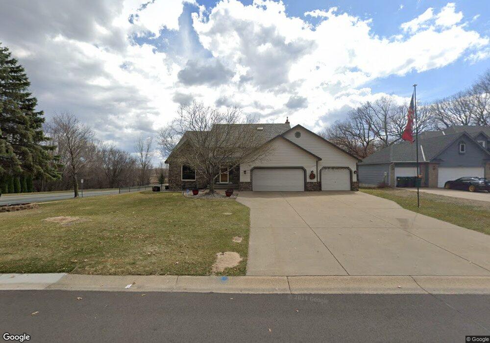
2060 127th Ave NW Coon Rapids, MN 55448
Estimated Value: $454,000 - $504,000
4
Beds
4
Baths
2,188
Sq Ft
$218/Sq Ft
Est. Value
About This Home
This home is located at 2060 127th Ave NW, Coon Rapids, MN 55448 and is currently estimated at $477,878, approximately $218 per square foot. 2060 127th Ave NW is a home located in Anoka County with nearby schools including Lucile Bruner Elementary School, Morris Bye Elementary School, and Laughlin Junior/Senior High School.
Ownership History
Date
Name
Owned For
Owner Type
Purchase Details
Closed on
Jun 23, 2017
Sold by
Haugen James A
Bought by
Wenzel David J and Wenzel Ann M
Current Estimated Value
Home Financials for this Owner
Home Financials are based on the most recent Mortgage that was taken out on this home.
Original Mortgage
$322,794
Outstanding Balance
$267,536
Interest Rate
3.89%
Mortgage Type
VA
Estimated Equity
$210,342
Purchase Details
Closed on
Jun 22, 2005
Sold by
Not Provided and Sanyal Shuddha
Bought by
Hawgen James A and Hawgen Diane E
Purchase Details
Closed on
Aug 27, 1999
Sold by
Hjelle Craig A and Hjelle Barbara A
Bought by
Sanyal Saumya Kanti and Sanyal Shuddha
Create a Home Valuation Report for This Property
The Home Valuation Report is an in-depth analysis detailing your home's value as well as a comparison with similar homes in the area
Home Values in the Area
Average Home Value in this Area
Purchase History
| Date | Buyer | Sale Price | Title Company |
|---|---|---|---|
| Wenzel David J | $316,000 | Burnet Title | |
| Hawgen James A | $332,500 | -- | |
| Sanyal Saumya Kanti | $227,400 | -- |
Source: Public Records
Mortgage History
| Date | Status | Borrower | Loan Amount |
|---|---|---|---|
| Open | Wenzel David J | $322,794 |
Source: Public Records
Tax History Compared to Growth
Tax History
| Year | Tax Paid | Tax Assessment Tax Assessment Total Assessment is a certain percentage of the fair market value that is determined by local assessors to be the total taxable value of land and additions on the property. | Land | Improvement |
|---|---|---|---|---|
| 2025 | $5,348 | $481,000 | $81,000 | $400,000 |
| 2024 | $5,348 | $467,500 | $78,300 | $389,200 |
| 2023 | $5,179 | $460,300 | $64,800 | $395,500 |
| 2022 | $4,573 | $466,600 | $64,800 | $401,800 |
| 2021 | $4,164 | $382,300 | $50,400 | $331,900 |
| 2020 | $4,592 | $364,100 | $50,400 | $313,700 |
| 2019 | $4,052 | $350,000 | $50,400 | $299,600 |
| 2018 | $3,965 | $330,800 | $0 | $0 |
| 2017 | $3,611 | $314,200 | $0 | $0 |
| 2016 | $3,456 | $266,300 | $0 | $0 |
| 2015 | $3,389 | $266,300 | $50,000 | $216,300 |
| 2014 | -- | $225,600 | $35,400 | $190,200 |
Source: Public Records
Map
Nearby Homes
- 1930 127th Cir NW
- 2147 125th Ln NW
- 12760 Raven St NW
- 12888 Nightingale St NW
- 2068 124th Ln NW
- 12759 Ibis St NW
- 12365 Jay St NW
- 12554 Grouse St NW
- 1593 126th Ln NW
- 1520 129th Ave NW
- 1450 126th Ln NW
- 2675 128th Ave NW
- 12463 Drake St NW
- 1687 131st Ln NW
- 1727 121st Ln NW
- 1776 133rd Ave NW
- 13416 Swallow St NW
- 13182 Zion St NW
- 1234 128th Cir NW
- 12010 Eagle St NW
- 2070 127th Ave NW
- 2073 127th Ave NW
- 2030 127th Ave NW
- 2080 127th Ave NW
- 2090 127th Ave NW
- 2083 127th Ave NW
- 2031 127th Ave NW
- 2093 127th Ave NW
- 12600 Shenandoah Blvd NW
- 2052 127th Ln NW
- 2062 127th Ln NW
- 2021 127th Ave NW
- 2084 127th Ln NW
- 2032 127th Ln NW
- 2094 127th Ln NW
- 2022 127th Ln NW
- 1959 127th Ave NW
- XXXX NW 125th Ln
- XXXX 125th Ln NW
- XXXXXX Shenandoah Blvd NW