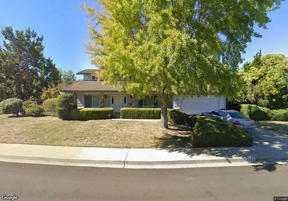
2060 Gill Port Ln Walnut Creek, CA 94598
Shadelands NeighborhoodEstimated Value: $1,280,715 - $1,523,000
4
Beds
2
Baths
2,265
Sq Ft
$613/Sq Ft
Est. Value
About This Home
This home is located at 2060 Gill Port Ln, Walnut Creek, CA 94598 and is currently estimated at $1,387,679, approximately $612 per square foot. 2060 Gill Port Ln is a home located in Contra Costa County with nearby schools including Bancroft Elementary School, Oak Grove Middle School, and Ygnacio Valley High School.
Ownership History
Date
Name
Owned For
Owner Type
Purchase Details
Closed on
Nov 10, 2004
Sold by
Lee Kenneth K K and Lee Bessie K
Bought by
Lee Kenneth and Lee Bessie
Current Estimated Value
Purchase Details
Closed on
Dec 5, 2002
Sold by
Lee Kenneth K K and Lee Bessie K
Bought by
Lee Kenneth K K and Lee Bessie K
Home Financials for this Owner
Home Financials are based on the most recent Mortgage that was taken out on this home.
Original Mortgage
$262,000
Interest Rate
6.06%
Mortgage Type
Purchase Money Mortgage
Create a Home Valuation Report for This Property
The Home Valuation Report is an in-depth analysis detailing your home's value as well as a comparison with similar homes in the area
Home Values in the Area
Average Home Value in this Area
Purchase History
| Date | Buyer | Sale Price | Title Company |
|---|---|---|---|
| Lee Kenneth | -- | -- | |
| Lee Kenneth K K | -- | Alliance Title Company |
Source: Public Records
Mortgage History
| Date | Status | Borrower | Loan Amount |
|---|---|---|---|
| Closed | Lee Kenneth K K | $262,000 |
Source: Public Records
Tax History Compared to Growth
Tax History
| Year | Tax Paid | Tax Assessment Tax Assessment Total Assessment is a certain percentage of the fair market value that is determined by local assessors to be the total taxable value of land and additions on the property. | Land | Improvement |
|---|---|---|---|---|
| 2025 | $2,873 | $193,942 | $50,624 | $143,318 |
| 2024 | $2,814 | $190,140 | $49,632 | $140,508 |
| 2023 | $2,814 | $186,412 | $48,659 | $137,753 |
| 2022 | $2,788 | $182,757 | $47,705 | $135,052 |
| 2021 | $2,716 | $179,174 | $46,770 | $132,404 |
| 2019 | $2,621 | $173,862 | $45,384 | $128,478 |
| 2018 | $2,521 | $170,454 | $44,495 | $125,959 |
| 2017 | $2,428 | $167,113 | $43,623 | $123,490 |
| 2016 | $2,351 | $163,837 | $42,768 | $121,069 |
| 2015 | $2,312 | $161,377 | $42,126 | $119,251 |
| 2014 | $2,262 | $158,217 | $41,301 | $116,916 |
Source: Public Records
Map
Nearby Homes
- 1628 Countrywood Ct
- 1533 Longford Ct
- 1605 Countrywood Ct
- 1668 Countrywood Ct
- 1865 Countrywood Ct
- 2172 La Salle Dr
- 1759 Crescent Dr
- 1905 Countrywood Ct
- 1909 Countrywood Ct
- 1836 Pomar Way
- 55 Normandy Ln
- 656 St Ives Ct
- 638 La Corso Dr
- 906 Hastings Dr
- 914 Bancroft Rd
- 1987 La Corso Ct
- 100 Alderwood Rd
- 1060 Sheppard Rd
- 913 Dartmouth Way
- 714 Wimbledon Rd
- 2050 Gill Port Ln
- 2070 Gill Port Ln
- 2053 Gill Port Ln
- 2040 Gill Port Ln
- 2059 Gill Port Ln
- 2061 Dorsch Rd
- 2065 Gill Port Ln
- 2080 Gill Port Ln
- 2053 Dorsch Rd
- 2043 Gill Port Ln
- 2069 Gill Port Ln
- 1570 Longford Ct
- 2030 Gill Port Ln
- 2079 Gill Port Ln
- 1548 Longford Ct
- 1581 Longford Ct
- 2091 Dorsch Rd
- 2035 Gill Port Ln
- 2035 Gill Port Ln Unit A Gill Port Ln
- 2067 Dorsch Rd