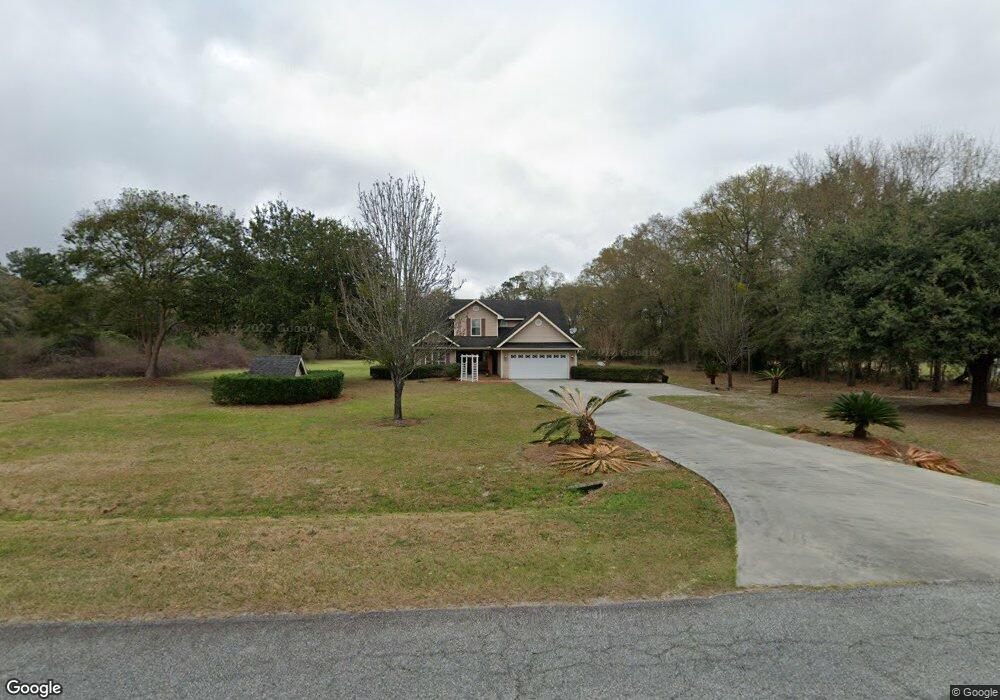
2060 Westside Rd Valdosta, GA 31601
Estimated Value: $162,000 - $293,000
--
Bed
1
Bath
599
Sq Ft
$403/Sq Ft
Est. Value
About This Home
This home is located at 2060 Westside Rd, Valdosta, GA 31601 and is currently estimated at $241,323, approximately $402 per square foot. 2060 Westside Rd is a home located in Lowndes County with nearby schools including Westside Elementary School, Hahira Middle School, and Lowndes High School.
Ownership History
Date
Name
Owned For
Owner Type
Purchase Details
Closed on
Sep 29, 2005
Sold by
Temples Pamela H
Bought by
Temples Seab J
Current Estimated Value
Home Financials for this Owner
Home Financials are based on the most recent Mortgage that was taken out on this home.
Original Mortgage
$252,000
Interest Rate
5.37%
Mortgage Type
New Conventional
Purchase Details
Closed on
Sep 16, 2005
Sold by
Temples Seab J
Bought by
Temples Pamela H
Home Financials for this Owner
Home Financials are based on the most recent Mortgage that was taken out on this home.
Original Mortgage
$252,000
Interest Rate
5.37%
Mortgage Type
New Conventional
Purchase Details
Closed on
Mar 19, 1984
Bought by
Temples Seab J
Create a Home Valuation Report for This Property
The Home Valuation Report is an in-depth analysis detailing your home's value as well as a comparison with similar homes in the area
Home Values in the Area
Average Home Value in this Area
Purchase History
| Date | Buyer | Sale Price | Title Company |
|---|---|---|---|
| Temples Seab J | -- | -- | |
| Temples Pamela H | -- | -- | |
| Temples Seab J | $3,000 | -- |
Source: Public Records
Mortgage History
| Date | Status | Borrower | Loan Amount |
|---|---|---|---|
| Closed | Temples Pamela H | $252,000 |
Source: Public Records
Tax History Compared to Growth
Tax History
| Year | Tax Paid | Tax Assessment Tax Assessment Total Assessment is a certain percentage of the fair market value that is determined by local assessors to be the total taxable value of land and additions on the property. | Land | Improvement |
|---|---|---|---|---|
| 2024 | $2,251 | $100,363 | $11,965 | $88,398 |
| 2023 | $2,251 | $99,580 | $11,182 | $88,398 |
| 2022 | $1,864 | $72,876 | $11,182 | $61,694 |
| 2021 | $1,947 | $72,876 | $11,182 | $61,694 |
| 2020 | $1,806 | $72,794 | $11,100 | $61,694 |
| 2019 | $1,825 | $72,794 | $11,100 | $61,694 |
| 2018 | $1,844 | $72,794 | $11,100 | $61,694 |
| 2017 | $1,846 | $71,785 | $10,091 | $61,694 |
| 2016 | $1,851 | $71,785 | $10,091 | $61,694 |
| 2015 | $1,773 | $71,785 | $10,091 | $61,694 |
| 2014 | $1,730 | $68,894 | $7,200 | $61,694 |
Source: Public Records
Map
Nearby Homes
- 0 James Rd
- 2097 Lynnhaven Rd
- 2048 Dean St
- 2419 Treeview Dr
- 201 Norman Dr
- 211 Stella St
- 1817 W Hill Ave
- 303 Nan St
- 2337 W Savannah Ave
- 605 N Saint Augustine Rd
- 230 Saint Augustine Rd
- 0 Saint Augustine Rd
- 107 Jordan St
- 219 N St Augustine Rd
- TBD Moss Oak Dr
- 2.54 Ac N St Augustine Rd
- 203 N Saint Augustine Rd
- 1690 Ridgecrest St
- 1430 W Magnolia St
- 1501 Harmon Dr
- 2056 Westside Rd
- 2068 Westside Rd
- 2044 Westside Rd
- 2100 Westside Rd
- 2026 Westside Rd
- 2057 Westside Rd
- 2027 Westside Rd
- 2117 Westside Rd
- 2117 Westside Dr
- 2128 Westside Rd
- 2146 Westside Rd
- 2570 James Rd
- 2103 Westside Rd
- 2152 Westside Rd
- 2452 James Rd
- 2550 James Rd
- 2564 James Rd
- 2107 Briarwood Rd
- 2114 Briarwood Rd
- 2114 Briarwood Rd