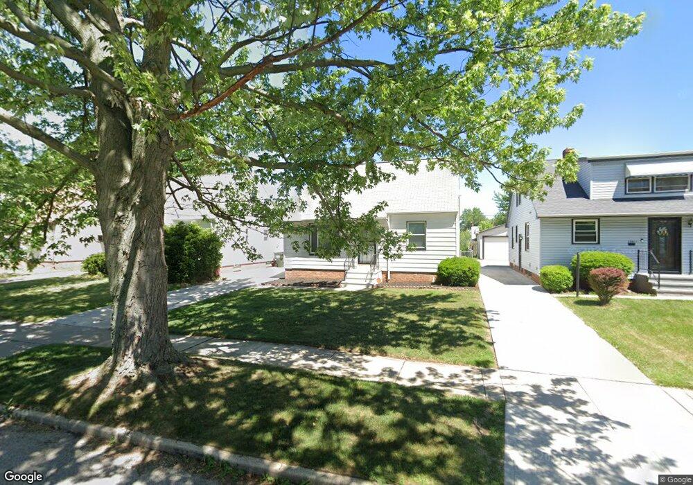
20601 Westport Ave Euclid, OH 44123
Estimated Value: $99,334 - $182,000
2
Beds
1
Bath
897
Sq Ft
$146/Sq Ft
Est. Value
About This Home
This home is located at 20601 Westport Ave, Euclid, OH 44123 and is currently estimated at $131,084, approximately $146 per square foot. 20601 Westport Ave is a home located in Cuyahoga County with nearby schools including Arbor Elementary School, Euclid Middle School, and Euclid High School.
Ownership History
Date
Name
Owned For
Owner Type
Purchase Details
Closed on
Jun 12, 2006
Sold by
Rohr Kenneth and Rohr Cindy Sue
Bought by
Wilson Kanisha
Current Estimated Value
Home Financials for this Owner
Home Financials are based on the most recent Mortgage that was taken out on this home.
Original Mortgage
$99,000
Outstanding Balance
$58,561
Interest Rate
6.68%
Mortgage Type
Fannie Mae Freddie Mac
Estimated Equity
$72,523
Purchase Details
Closed on
Apr 2, 1990
Sold by
Burris Kimberly A
Bought by
Rohr Kenneth
Purchase Details
Closed on
Jan 27, 1987
Sold by
Burris Robert R
Bought by
Burris Kimberly A
Purchase Details
Closed on
May 16, 1977
Sold by
Brandes Kenneth R and Brandes Giovanna
Bought by
Burris Robert R
Purchase Details
Closed on
Jan 1, 1975
Bought by
Brandes Kenneth R and Brandes Giovanna
Create a Home Valuation Report for This Property
The Home Valuation Report is an in-depth analysis detailing your home's value as well as a comparison with similar homes in the area
Home Values in the Area
Average Home Value in this Area
Purchase History
| Date | Buyer | Sale Price | Title Company |
|---|---|---|---|
| Wilson Kanisha | $99,500 | Executive Title Agency | |
| Rohr Kenneth | $60,000 | -- | |
| Burris Kimberly A | -- | -- | |
| Burris Robert R | $39,500 | -- | |
| Brandes Kenneth R | -- | -- |
Source: Public Records
Mortgage History
| Date | Status | Borrower | Loan Amount |
|---|---|---|---|
| Open | Wilson Kanisha | $99,000 |
Source: Public Records
Tax History Compared to Growth
Tax History
| Year | Tax Paid | Tax Assessment Tax Assessment Total Assessment is a certain percentage of the fair market value that is determined by local assessors to be the total taxable value of land and additions on the property. | Land | Improvement |
|---|---|---|---|---|
| 2024 | $2,300 | $32,830 | $8,015 | $24,815 |
| 2023 | $2,068 | $23,450 | $6,300 | $17,150 |
| 2022 | $2,022 | $23,450 | $6,300 | $17,150 |
| 2021 | $2,244 | $23,450 | $6,300 | $17,150 |
| 2020 | $1,890 | $17,750 | $4,760 | $12,990 |
| 2019 | $1,695 | $50,700 | $13,600 | $37,100 |
| 2018 | $1,710 | $17,750 | $4,760 | $12,990 |
| 2017 | $1,739 | $15,060 | $3,190 | $11,870 |
| 2016 | $1,743 | $15,060 | $3,190 | $11,870 |
| 2015 | $1,590 | $15,060 | $3,190 | $11,870 |
| 2014 | $1,590 | $15,060 | $3,190 | $11,870 |
Source: Public Records
Map
Nearby Homes
- 20561 Westport Ave
- 20760 Westport Ave
- 20671 Wilmore Ave
- 21051 Westport Ave
- 20450 Wilmore Ave
- 21030 Priday Ave
- 20801 Morris Ave
- 21181 Ball Ave
- 20330 S Lake Shore Blvd
- 275 E 200th St
- 21170 Wilmore Ave
- 311 E 197th St
- 20830 Tracy Ave
- 20400 Tracy Ave
- 21440 Fuller Ave
- 21051 S Lake Shore Blvd
- 20101 Tracy Ave
- 21481 Ball Ave
- 20231 Nicholas Ave
- 21251 S Lake Shore Blvd
- 20611 Westport Ave
- 20591 Westport Ave
- 20651 Westport Ave
- 20701 Westport Ave
- 20600 Ball Ave
- 20531 Westport Ave
- 20650 Ball Ave
- 20570 Ball Ave
- 20550 Ball Ave
- 20614 Westport Ave
- 20707 Westport Ave
- 20688 Ball Ave
- 20630 Westport Ave
- 20570 Westport Ave
- 20521 Westport Ave
- 20670 Westport Ave
- 20520 Ball Ave Unit 2
- 20550 Westport Ave
- 20530 Westport Ave
- 20694 Westport Ave