NOT LISTED FOR SALE

20605 Sunbeam Ln Bend, OR 97701

Estimated Value: $2,144,000 - $2,707,679

10 Acres
$251,428 Price per Acre
416,869 Sq Ft Lot

Last Sold June 24, 2013

Last sale price $190,000

Est. 1,166% increase in value since last sale

Current estimated payment $14,370/month

66 Days on Market

About This Lot

As of June 2013

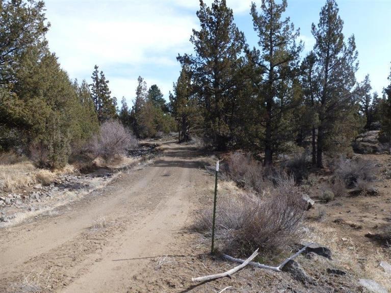
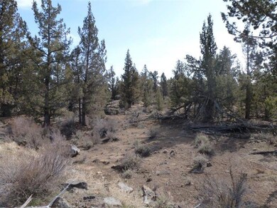
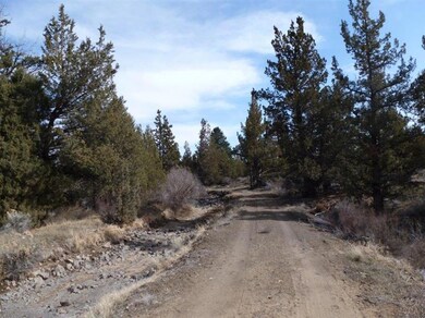
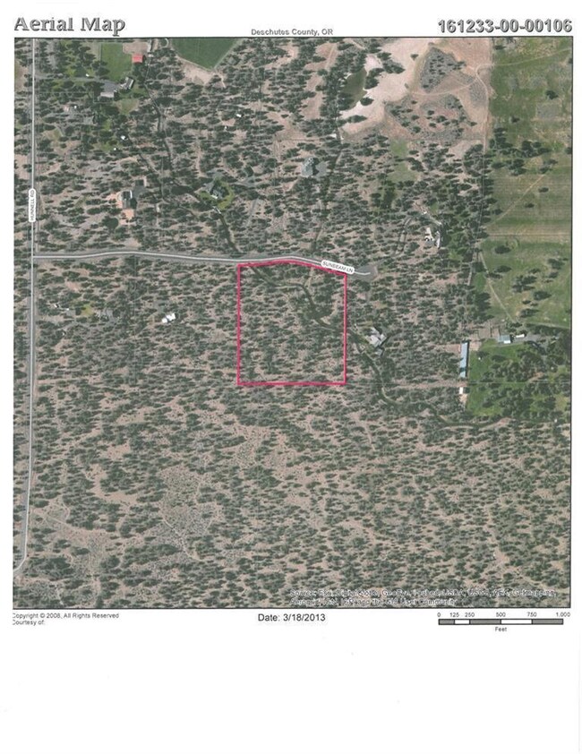
Sun Cloud Estates 9.6 acre parcel with meandering irrigation canal running through. Nicely treed, private cul-de-sac. Horses are allowed. Build your dream home.

Last Agent to Sell the Property

Dana Furlan

Bend Premier Real Estate LLC License #200309231 Listed on: 05/13/2013

Bend Premier Real Estate LLC

Last Buyer's Agent

Kathleen O'Connor

Team Birtola High Desert License #200105007

Property Details

Property Type

  • Land

Est. Annual Taxes

  • $2,139

Lot Details

  • 9.57 Acre Lot
  • Property is zoned MUA10, MUA10

Schools

  • Lava Ridge Elementary School
  • Sky View Middle School
  • Mountain View Sr High School

Utilities

  • Private Water Source

Community Details

  • No Home Owners Association
  • Sun Cloud Estate Subdivision

Listing and Financial Details

  • Tax Lot 06
  • Assessor Parcel Number 191527

Property Details

Property Type

Land

Est. Annual Taxes

$2,139

Lot Details

0

Listing Details

  • Lot Size Acres: 9.57
  • Prop. Type: Land
  • Property Sub Type: Residential Lots
  • Road Surface Type: Paved
  • Subdivision Name: Sun Cloud Estate
  • Co List Office Phone: 541-323-2779
  • MLS Status: Closed
  • General Property Information:Zoning2: MUA10
  • Road Surface Type:Paved: Yes
  • Location Tax and Legal:Tax Lot: 06
  • Location Tax and Legal:Tax Block: 0000
  • Special Features: None

Utilities

  • Water Source: Private

Condo/Co-op/Association

  • Association: No

Association/Amenities

  • General Property Information:Association YN: No

Schools

  • Elementary School: Lava Ridge Elem
  • High School: Mountain View Sr High
  • Middle Or Junior School: Sky View Middle

Lot Info

  • Lot Size Sq Ft: 416869.2
  • Parcel #: 191527
  • Irrigation Water Rights: No
  • ResoLotSizeUnits: Acres
  • Zoning Description: MUA10
  • ResoLotSizeUnits: Acres

Tax Info

  • Tax Annual Amount: 2139.0
  • Tax Block: 0000
  • Tax Lot: 06
  • Tax Map Number: 161233OO

Ownership History

Date Name Owned For Owner Type

Purchase Details

Closed on
Feb 6, 2024
Sold by
Thorneycroft Roy and Thorneycroft Karen E
Bought by
Roy And Karen Thorneycroft Trust and Thorneycroft
Total Days on Market
66
Current Estimated Value
$2,406,170

Purchase Details

Listed on
May 13, 2013
Closed on
Jun 20, 2013
Sold by
Hill Rhoda Grace
Bought by
Hill Rhonda Grace and Rhonda Grace Hill Revocable Trust
Seller's Agent
Dana Furlan
Bend Premier Real Estate LLC
Buyer's Agent
Kathleen O'Connor
Team Birtola High Desert
List Price
$199,000
Sold Price
$190,000
Premium/Discount to List
-$9,000
-4.52%

Home Financials for this Owner

Home Financials are based on the most recent Mortgage that was taken out on this home.
Avg. Annual Appreciation
22.71%
Source: Public Records

Similar Properties in Bend, OR

  • 21620 NE Butler Market Rd, Bend, OR 97701

    $2,750,000

    • Land
    • 10 Acres
    • $275,000 per Acre
    • 21620 NE Butler Market Rd
    • Bend, OR

    This level parcel was approved as part of the 2016 Bend UGB expansion and is designated to be zoned for standard residential development. The property adjoins the new Pahlisch development Petrosa which is currently under construction. 8 acres of COID irrigation water rights are included, and currently leased back to the Deschutes River

    Brian Meece RE/MAX Key Properties

    Section Image
  • 18715 Macalpine Loop Unit 37, Bend, OR 97702

    $2,000,000

    • Land
    • 10 Acres
    • $197,824 per Acre
    • 18715 Macalpine Loop
    • Unit 37
    • Bend, OR

    This 10.11 acre parcel is tucked in, away from the bustling of Skyline Ranch Road, with impressive mountain views! The Highlands at Broken Top is a stunning, exclusive and gated community bordering Tetherow and the Deschutes National Forest. Just moments from downtown Bend, these 500-acres possess around 50 homesites that wind through unmatched and diverse terrain, each being approximately 10

    Lori Coon Alleda Real Estate

    Section Image
  • 18862 Sutherland Ct, Bend, OR 97702

    $2,250,000

    • Land
    • 10 Acres
    • $222,772 per Acre
    • 18862 Sutherland Ct
    • Bend, OR

    One of the premier and last available 10 acre parcels in the Highlands at Broken Top. Perched on a flat shelf, the natural topography allows design options to maximize views towards an expansive open meadow mixed with mature ponderosa pines. This is one of the few lots in the development with this unique mix of trees and meadow. The orientation also welcomes plenty of East and South facing

    Bryant Green Cascade Hasson SIR

    Section Image

Range of Values:

Collateral Analytics

Collateral Analytics Collateral Analytics AVMs (Automated Valuation Model) employ a number of statistical approaches combined with neighborhood-specific comparable selection guarantees the most up-to-date and precise valuations.

Not Available

Collateral Analytics does not have data for the current month. Please view the chart for historical values.

ICE

ICE Mortgage Technology ICE Mortgage Technology’s AVM (Automated Valuation Model) is a state-of-the-art online residential property valuation tool that provides a quick and accurate estimate of the value of almost any home in the U.S.

Not Available

ICE Mortgage Technology does not have data for the current month. Please view the chart for historical values.

First American

First American First American Data & Analytics’ next-generation AVM combines unrivaled data assets with a blended ensemble of valuation models to produce highly accurate, reliable valuations you can trust.

Not Available

First American does not have data for the current month. Please view the chart for historical values.

Quantarium

Quantarium Quantarium’s valuation service, repeatedly proven the industry’s most accurate and comprehensive, is supercharged with a self-learning and auto-tuning AI engine that continually becomes smarter and more accurate as it processes daily inputs from the industry’s leading RE data lake.

Not Available

Quantarium does not have data for the current month. Please view the chart for historical values.

Average Value
Not Available
List Price
Sold Price
Create a Home Valuation Report for This Property
The Home Valuation Report is an in-depth analysis detailing your home's value as well as a comparison with similar homes in the area

Home Values in the Area

Source: Public Records

Average Home Value in this Area


Source: Public Records

Purchase History

Date Buyer Sale Price Title Company
Roy And Karen Thorneycroft Trust -- None Listed On Document
Hill Rhonda Grace $190,000 Western Title & Escrow
Source: Public Records

Property History

Date Event Price Change Sq Ft Price
06/24/2013 06/24/13 Sold $190,000 -4.5% --
05/23/2013 05/23/13 Pending -- -- --
03/18/2013 03/18/13 For Sale $199,000 -- --
Source: Oregon Datashare

Tax History Compared to Growth

Source: Public Records

Tax History

Year Tax Paid Tax Assessment Tax Assessment Total Assessment is a certain percentage of the fair market value that is determined by local assessors to be the total taxable value of land and additions on the property. Land Improvement
2024 $11,591 $785,220 -- --
2023 $10,907 $762,350 $0 $0
2022 $10,058 $262,490 $0 $0
2021 $3,696 $201,200 $0 $0
2020 $2,755 $201,200 $0 $0
2019 $2,678 $195,340 $0 $0
2018 $2,599 $189,660 $0 $0
2017 $2,531 $184,140 $0 $0
2016 $2,405 $178,780 $0 $0
2015 $2,337 $173,580 $0 $0
2014 $2,262 $168,530 $0 $0
Source: Public Records

Agents Affiliated with this Home

  • Section Image
  • Section Image
See All Agents

Map

Source: Oregon Datashare

MLS Number: 201302032

Oregon Datashare

APN: 191527