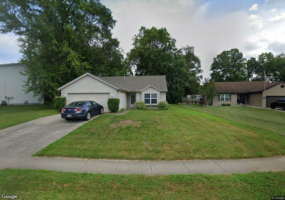
2061 Apple Ridge Ct Middletown, OH 45044
Estimated Value: $270,000 - $343,000
4
Beds
3
Baths
1,313
Sq Ft
$237/Sq Ft
Est. Value
About This Home
This home is located at 2061 Apple Ridge Ct, Middletown, OH 45044 and is currently estimated at $310,550, approximately $236 per square foot. 2061 Apple Ridge Ct is a home located in Butler County with nearby schools including Monroe Primary School, Monroe Elementary School, and Monroe Junior High School.
Ownership History
Date
Name
Owned For
Owner Type
Purchase Details
Closed on
Feb 23, 2022
Sold by
Brown Gary W and Brown Susan E
Bought by
Worthington Properties Llc
Current Estimated Value
Purchase Details
Closed on
Sep 24, 2003
Sold by
Brown Gary W
Bought by
Brown Gary W
Home Financials for this Owner
Home Financials are based on the most recent Mortgage that was taken out on this home.
Original Mortgage
$100,000
Interest Rate
6.4%
Mortgage Type
Credit Line Revolving
Create a Home Valuation Report for This Property
The Home Valuation Report is an in-depth analysis detailing your home's value as well as a comparison with similar homes in the area
Home Values in the Area
Average Home Value in this Area
Purchase History
| Date | Buyer | Sale Price | Title Company |
|---|---|---|---|
| Worthington Properties Llc | -- | Parrish Lee H | |
| Brown Gary W | -- | -- |
Source: Public Records
Mortgage History
| Date | Status | Borrower | Loan Amount |
|---|---|---|---|
| Previous Owner | Brown Gary W | $100,000 |
Source: Public Records
Tax History Compared to Growth
Tax History
| Year | Tax Paid | Tax Assessment Tax Assessment Total Assessment is a certain percentage of the fair market value that is determined by local assessors to be the total taxable value of land and additions on the property. | Land | Improvement |
|---|---|---|---|---|
| 2024 | $3,623 | $78,230 | $14,410 | $63,820 |
| 2023 | $3,599 | $75,520 | $14,410 | $61,110 |
| 2022 | $2,959 | $56,660 | $14,410 | $42,250 |
| 2021 | $2,852 | $56,660 | $14,410 | $42,250 |
| 2020 | $2,954 | $56,660 | $14,410 | $42,250 |
| 2019 | $3,225 | $47,030 | $14,370 | $32,660 |
| 2018 | $2,646 | $47,030 | $14,370 | $32,660 |
| 2017 | $2,702 | $47,030 | $14,370 | $32,660 |
| 2016 | $2,593 | $43,260 | $14,370 | $28,890 |
| 2015 | $2,564 | $43,260 | $14,370 | $28,890 |
| 2014 | $2,584 | $43,260 | $14,370 | $28,890 |
| 2013 | $2,584 | $43,850 | $11,730 | $32,120 |
Source: Public Records
Map
Nearby Homes
- 176 Lakeview Dr
- 401 Granny Smith Ln
- 75 Bayberry Ln
- 27 Kameron Dr
- 2043 Bridgewater Ln
- 5346 Roden Park Dr
- 912 Morgan Dr
- 389 David Lee Ct
- 393 David Lee Ct
- 395 David Lee Ct
- 1952 Michelle Ln
- 390 David Lee Ct
- 404 David Lee Ct
- 511 Shawn Dr
- 5330 Hamilton Middletown Rd
- 925 Morgan Dr
- BENNETT Plan at Estates of Monroe Crossings
- STRATTON Plan at Estates of Monroe Crossings
- PARKETTE Plan at Estates of Monroe Crossings
- VANDERBURGH Plan at Estates of Monroe Crossings
- 2069 Apple Ridge Ct
- 2053 Apple Ridge Ct
- 177 Apple Ridge Ln
- 2077 Apple Ridge Ct
- 2040 Apple Ridge2040 Apple
- 2045 Apple Ridge Ct
- 2040 Apple Ridge Ct
- 163 Anne Rd
- 0 Apple Ridge Ct Unit 1754403
- 2085 Apple Ridge Ct
- 2037 Apple Ridge Ct
- 153 Anne Rd
- 177 Anne Rd
- 2050 Apple Ridge Ct
- 2029 Apple Ridge Ct
- 2060 Apple Ridge Ct
- 2070 Apple Ridge Ct
- 143 Anne Rd
- 2020 Apple Ridge Ct
- 101 Wine Sap Ln