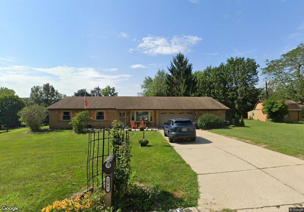
2061 Dane Ln Bellbrook, OH 45305
Estimated Value: $305,886 - $354,000
4
Beds
2
Baths
1,758
Sq Ft
$188/Sq Ft
Est. Value
About This Home
This home is located at 2061 Dane Ln, Bellbrook, OH 45305 and is currently estimated at $330,472, approximately $187 per square foot. 2061 Dane Ln is a home located in Greene County with nearby schools including Stephen Bell Elementary School, Bell Creek Intermediate School, and Bellbrook Middle School.
Ownership History
Date
Name
Owned For
Owner Type
Purchase Details
Closed on
Jan 12, 2017
Sold by
Glenora J Mercer
Bought by
Mercer William and Mercer Merriam
Current Estimated Value
Home Financials for this Owner
Home Financials are based on the most recent Mortgage that was taken out on this home.
Original Mortgage
$94,911
Outstanding Balance
$78,215
Interest Rate
4.12%
Estimated Equity
$252,257
Create a Home Valuation Report for This Property
The Home Valuation Report is an in-depth analysis detailing your home's value as well as a comparison with similar homes in the area
Home Values in the Area
Average Home Value in this Area
Purchase History
| Date | Buyer | Sale Price | Title Company |
|---|---|---|---|
| Mercer William | -- | -- |
Source: Public Records
Mortgage History
| Date | Status | Borrower | Loan Amount |
|---|---|---|---|
| Open | Mercer William | $94,911 | |
| Closed | Mercer William | -- |
Source: Public Records
Tax History Compared to Growth
Tax History
| Year | Tax Paid | Tax Assessment Tax Assessment Total Assessment is a certain percentage of the fair market value that is determined by local assessors to be the total taxable value of land and additions on the property. | Land | Improvement |
|---|---|---|---|---|
| 2024 | $4,040 | $81,690 | $15,730 | $65,960 |
| 2023 | $4,040 | $81,690 | $15,730 | $65,960 |
| 2022 | $3,588 | $60,840 | $12,590 | $48,250 |
| 2021 | $3,624 | $60,840 | $12,590 | $48,250 |
| 2020 | $3,387 | $60,840 | $12,590 | $48,250 |
| 2019 | $3,308 | $54,980 | $9,790 | $45,190 |
| 2018 | $3,312 | $54,980 | $9,790 | $45,190 |
| 2017 | $3,035 | $54,980 | $9,790 | $45,190 |
| 2016 | $3,035 | $50,750 | $9,790 | $40,960 |
| 2015 | $3,044 | $50,750 | $9,790 | $40,960 |
| 2014 | $2,820 | $50,750 | $9,790 | $40,960 |
Source: Public Records
Map
Nearby Homes
- 3930 Beechwood Dr
- 2013 Wentworth Village Dr Unit 2013
- 3720 Shiraz Ct
- 2426 Portage Path
- 2264 S Linda Dr
- 1692 Glenwood Way
- 2215 S Linda Dr
- 4184 Wood Acre Dr
- 3553 Shellbark Dr
- 2298 S Lakeman Dr
- 3509 Marwood Dr
- 4267 Sugar Point Way
- 4353 Napa Valley Dr
- 4206 N Golden Clove Bend Unit 56-303
- 4204 N Golden Clove Bend Unit 56-305
- 1630 S Golden Clove Bend Unit 52A
- 4208 N Golden Clove Bend Unit 56-103
- 4222 N Golden Clove Bend Unit 56-201
- 4220 N Golden Clove Bend Unit 56-301
- 4216 N Golden Clove Bend Unit 56-302
- 2079 Firebird Dr
- 2055 Firebird Dr
- 2089 Firebird Dr
- 2076 Dane Ln
- 2063 Dane Ln
- 2074 Firebird Dr
- 2045 Firebird Dr
- 2094 Firebird Dr
- 2065 Dane Ln
- 2099 Firebird Dr
- 3879 W Franklin St
- 3879 W Franklin St
- 2075 Dane Ln
- 2104 Firebird Dr
- 2083 Sheffield Ct
- 2035 Firebird Dr
- 2083 Dane Ln
- 2109 Firebird Dr
- 3930 Dane Ct
- 2114 Firebird Dr
