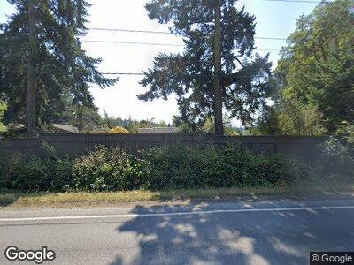
2061 Hastings Ave W Port Townsend, WA 98368
Estimated Value: $846,000 - $1,133,000
5
Beds
3
Baths
2,643
Sq Ft
$399/Sq Ft
Est. Value
About This Home
This home is located at 2061 Hastings Ave W, Port Townsend, WA 98368 and is currently estimated at $1,053,409, approximately $398 per square foot. 2061 Hastings Ave W is a home located in Jefferson County with nearby schools including Grant Street Elementary School, Blue Heron Middle School, and Port Townsend High School.
Ownership History
Date
Name
Owned For
Owner Type
Purchase Details
Closed on
Jul 2, 2010
Sold by
Finch Steven H and Finch Joyce A
Bought by
Stearns Denis W
Current Estimated Value
Home Financials for this Owner
Home Financials are based on the most recent Mortgage that was taken out on this home.
Original Mortgage
$150,000
Outstanding Balance
$101,936
Interest Rate
4.79%
Mortgage Type
New Conventional
Estimated Equity
$951,473
Purchase Details
Closed on
Jun 23, 2008
Sold by
Mason Shirley M and Reithel Shirley M
Bought by
Finch Steven H and Finch Joyce A
Home Financials for this Owner
Home Financials are based on the most recent Mortgage that was taken out on this home.
Original Mortgage
$30,307
Interest Rate
6.27%
Mortgage Type
Unknown
Create a Home Valuation Report for This Property
The Home Valuation Report is an in-depth analysis detailing your home's value as well as a comparison with similar homes in the area
Home Values in the Area
Average Home Value in this Area
Purchase History
| Date | Buyer | Sale Price | Title Company |
|---|---|---|---|
| Stearns Denis W | $489,000 | None Available | |
| Finch Steven H | -- | None Available |
Source: Public Records
Mortgage History
| Date | Status | Borrower | Loan Amount |
|---|---|---|---|
| Open | Stearns Denis W | $150,000 | |
| Previous Owner | Finch Steven H | $388,000 | |
| Previous Owner | Finch Steven H | $72,500 | |
| Previous Owner | Finch Steven H | $15,000 | |
| Previous Owner | Finch Steven | $30,307 | |
| Previous Owner | Finch Steven H | $379,950 |
Source: Public Records
Tax History Compared to Growth
Tax History
| Year | Tax Paid | Tax Assessment Tax Assessment Total Assessment is a certain percentage of the fair market value that is determined by local assessors to be the total taxable value of land and additions on the property. | Land | Improvement |
|---|---|---|---|---|
| 2023 | $8,419 | $959,422 | $193,880 | $765,542 |
| 2022 | $6,563 | $876,747 | $180,800 | $695,947 |
| 2021 | $6,378 | $680,066 | $152,834 | $527,232 |
| 2020 | $6,299 | $620,326 | $138,940 | $481,386 |
| 2019 | $5,907 | $597,403 | $138,940 | $458,463 |
| 2018 | $5,288 | $597,403 | $138,940 | $458,463 |
| 2017 | $4,976 | $469,424 | $124,604 | $344,820 |
| 2016 | $4,694 | $469,424 | $124,604 | $344,820 |
| 2015 | $4,709 | $469,424 | $124,604 | $344,820 |
| 2014 | -- | $469,424 | $124,604 | $344,820 |
| 2013 | -- | $447,070 | $118,670 | $328,400 |
Source: Public Records
Map
Nearby Homes
- 326 Cook Ave
- 1042 Crest Ave
- 3202 Cliff St
- 2108 Cliff St
- 4692 Albatross St
- 2475 15th St
- 99 NKA Peary Ave
- 9999 NKA Peary Ave
- 2872 Claremont St
- 1403 Thomas St
- 2012 Queen Anne Place
- 0 Eye St Unit NWM2312945
- 3000 Rosecrans St
- 1652 S Jacob Miller Rd
- 2078 11th St
- 925 Bell St
- 926 Bell St
- 1304 Rosecrans St
- 0 Sherman St
- 2997 Hancock St
- 2061 Hastings Ave W
- 0 N Jacob Miller Rd
- 0 Jacob N Unit 224632
- 2191 Hastings Ave W
- 91 S Jacob Miller Rd
- 141 S Jacob Miller Rd
- 2250 Hastings Ave W
- 2281 Hastings Ave W
- 1924 Hastings Ave W
- 255 N Jacob Miller Rd
- 2327 Hastings Ave W
- 1851 Hastings Ave W
- 2260 Hastings Ave W
- 250 N Jacob Miller Rd
- 2325 Hastings Ave W
- 2323 Hastings Ave W
- 2370 Hastings Ave W
- 2371 Hastings Ave W
