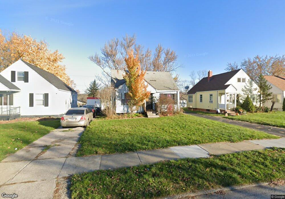
20611 Watson Rd Maple Heights, OH 44137
Estimated Value: $84,850 - $117,000
2
Beds
1
Bath
720
Sq Ft
$133/Sq Ft
Est. Value
About This Home
This home is located at 20611 Watson Rd, Maple Heights, OH 44137 and is currently estimated at $95,463, approximately $132 per square foot. 20611 Watson Rd is a home located in Cuyahoga County with nearby schools including Abraham Lincoln Elementary School, Rockside/ J.F. Kennedy School, and Italy High School.
Ownership History
Date
Name
Owned For
Owner Type
Purchase Details
Closed on
Apr 15, 2017
Sold by
Moon James
Bought by
Darden Carila T
Current Estimated Value
Purchase Details
Closed on
Mar 14, 2017
Sold by
Abbott Gary D and Abbott Sharon L
Bought by
Moon James
Purchase Details
Closed on
Oct 14, 1988
Sold by
Fassinger John E
Bought by
Abbott Gary D
Purchase Details
Closed on
Apr 21, 1988
Sold by
Slivka Andrew P and Slivka Yolanda M
Bought by
Fassinger John E
Purchase Details
Closed on
Mar 22, 1985
Sold by
Slivka Andrew P and Slivka Yolanda M
Bought by
Slivka Andrew P and Slivka Yolanda M
Purchase Details
Closed on
Jan 1, 1975
Bought by
Slivka Andrew P and Slivka Yolanda M
Create a Home Valuation Report for This Property
The Home Valuation Report is an in-depth analysis detailing your home's value as well as a comparison with similar homes in the area
Home Values in the Area
Average Home Value in this Area
Purchase History
| Date | Buyer | Sale Price | Title Company |
|---|---|---|---|
| Darden Carila T | $3,500 | None Available | |
| Moon James | $34,018 | None Available | |
| Abbott Gary D | $44,000 | -- | |
| Fassinger John E | -- | -- | |
| Slivka Andrew P | -- | -- | |
| Slivka Andrew P | -- | -- |
Source: Public Records
Tax History Compared to Growth
Tax History
| Year | Tax Paid | Tax Assessment Tax Assessment Total Assessment is a certain percentage of the fair market value that is determined by local assessors to be the total taxable value of land and additions on the property. | Land | Improvement |
|---|---|---|---|---|
| 2024 | $2,382 | $24,955 | $7,140 | $17,815 |
| 2023 | $1,920 | $17,020 | $4,310 | $12,710 |
| 2022 | $1,913 | $17,010 | $4,305 | $12,705 |
| 2021 | $2,033 | $17,010 | $4,310 | $12,710 |
| 2020 | $1,751 | $12,880 | $3,260 | $9,630 |
| 2019 | $1,739 | $36,800 | $9,300 | $27,500 |
| 2018 | $1,976 | $12,880 | $3,260 | $9,630 |
| 2017 | $2,479 | $12,220 | $3,010 | $9,210 |
| 2016 | $1,782 | $12,220 | $3,010 | $9,210 |
| 2015 | $15,835 | $12,220 | $3,010 | $9,210 |
| 2014 | $15,835 | $13,450 | $3,330 | $10,120 |
Source: Public Records
Map
Nearby Homes
- 20715 Watson Rd
- 20120 Mccracken Rd
- 20814 Watson Rd
- 20907 Watson Rd
- 21102 Raymond St
- 21207 Franklin Rd
- 19807 Gardenview Dr
- 20510 Mountville Dr
- 20701 Kenyon Dr
- 20814 Kenyon Dr
- 20107 Libby Rd
- 19309 Nitra Ave
- 19806 Mountville Dr
- 19520 Maple Heights Blvd
- 5165 Camden Rd
- 19812 Stockton Ave
- 21416 Gardenview Dr
- 19289 Stafford Ave
- 5265 Bellview St
- 19221 Stafford Ave
- 20605 Watson Rd
- 20615 Watson Rd
- 20601 Watson Rd
- 20619 Watson Rd
- 20608 Hansen Rd
- 20517 Watson Rd
- 20604 Hansen Rd
- 20612 Hansen Rd
- 20600 Hansen Rd
- 20616 Hansen Rd
- 20612 Watson Rd
- 20608 Watson Rd
- 20516 Hansen Rd
- 20616 Watson Rd
- 20604 Watson Rd
- 20513 Watson Rd
- 20701 Watson Rd
- 20620 Watson Rd
- 20600 Watson Rd
- 20512 Hansen Rd