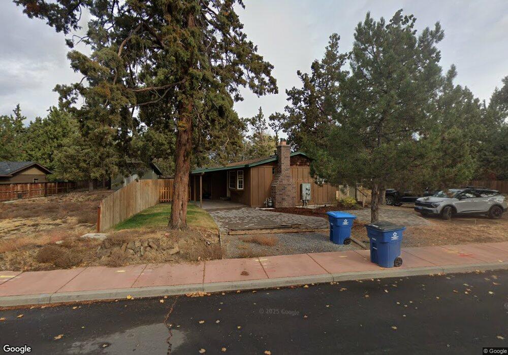
20618 Silas Dr Bend, OR 97701
Boyd Acres NeighborhoodEstimated Value: $482,000 - $560,000
3
Beds
2
Baths
1,166
Sq Ft
$439/Sq Ft
Est. Value
About This Home
This home is located at 20618 Silas Dr, Bend, OR 97701 and is currently estimated at $511,808, approximately $438 per square foot. 20618 Silas Dr is a home located in Deschutes County with nearby schools including Lava Ridge Elementary School, Sky View Middle School, and Mountain View Senior High School.
Ownership History
Date
Name
Owned For
Owner Type
Purchase Details
Closed on
Sep 4, 2015
Sold by
Rose River Llc
Bought by
Dahlen R Scott and Dahlen Ann
Current Estimated Value
Purchase Details
Closed on
Sep 23, 2005
Sold by
Dahlen R Scott and Dahlen Ann
Bought by
Rose River Llc
Purchase Details
Closed on
Jun 1, 2005
Sold by
Rose River Llc
Bought by
Dahlen R Scott and Dahlen Ann
Create a Home Valuation Report for This Property
The Home Valuation Report is an in-depth analysis detailing your home's value as well as a comparison with similar homes in the area
Home Values in the Area
Average Home Value in this Area
Purchase History
| Date | Buyer | Sale Price | Title Company |
|---|---|---|---|
| Dahlen R Scott | -- | None Available | |
| Rose River Llc | -- | -- | |
| Dahlen R Scott | -- | -- |
Source: Public Records
Tax History Compared to Growth
Tax History
| Year | Tax Paid | Tax Assessment Tax Assessment Total Assessment is a certain percentage of the fair market value that is determined by local assessors to be the total taxable value of land and additions on the property. | Land | Improvement |
|---|---|---|---|---|
| 2025 | $3,260 | $192,940 | -- | -- |
| 2024 | $3,137 | $187,330 | -- | -- |
| 2023 | $2,908 | $181,880 | $0 | $0 |
| 2022 | $2,713 | $171,450 | $0 | $0 |
| 2021 | $2,717 | $166,460 | $0 | $0 |
| 2020 | $2,578 | $166,460 | $0 | $0 |
| 2019 | $2,506 | $161,620 | $0 | $0 |
| 2018 | $2,435 | $156,920 | $0 | $0 |
| 2017 | $2,364 | $152,350 | $0 | $0 |
| 2016 | $2,254 | $147,920 | $0 | $0 |
| 2015 | $2,192 | $143,620 | $0 | $0 |
| 2014 | $2,128 | $139,440 | $0 | $0 |
Source: Public Records
Map
Nearby Homes
- 20629 Whitewing Ct
- 63217 Carly Ln
- 63221 Carly Ln
- 63225 Carly Ln
- 63229 NE Carly Ln
- 63233 Carly Ln
- 63210 Carly Ln
- 63218 Carly Ln
- 63222 Carly Ln
- 63226 Carly Ln
- 63249 Carly Ln
- 63230 Carly Ln
- 63238 Carly Ln
- 63246 NE Carly Ln
- 63250 NE Carly Ln
- 63254 Carly Ln
- 20570 Fred Meyers Rd
- 20676 Morningstar Dr
- 20585 Fred Meyers Rd
- Avery Plan at Acadia Pointe
- 20612 Silas Dr
- 20702 NE Town Dr
- 20734 NE Town Dr
- 63244 Logan Ave
- 20608 Silas Dr
- 63240 Logan Ave
- 20626 Silas Dr
- 63245 Logan Ave
- 20604 Silas Dr
- 20631 Whitewing Ct
- 63239 Brad St
- 20634 Whitewing Ct
- 63241 Logan Ave
- 63241 NE Logan Ave
- 20630 Silas Dr
- 63236 Logan Ave
- 63235 Brad St
- 63237 Logan Ave
- 63231 Brad St
- 63232 Logan Ave