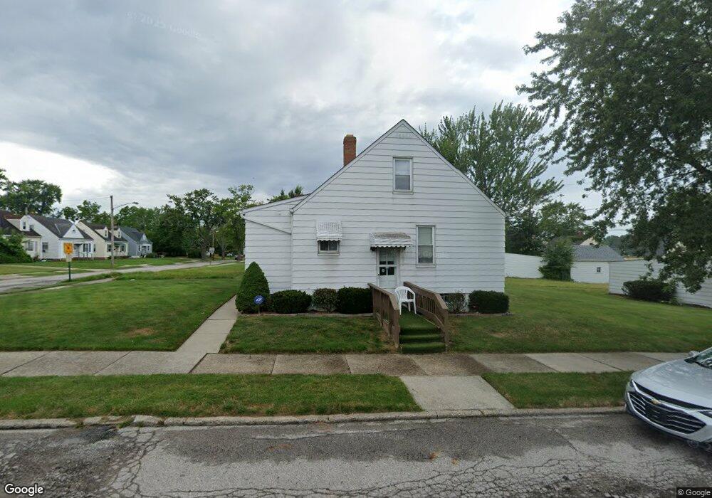
20619 Watson Rd Maple Heights, OH 44137
Estimated Value: $98,000 - $125,000
3
Beds
1
Bath
1,064
Sq Ft
$105/Sq Ft
Est. Value
About This Home
This home is located at 20619 Watson Rd, Maple Heights, OH 44137 and is currently estimated at $111,308, approximately $104 per square foot. 20619 Watson Rd is a home located in Cuyahoga County with nearby schools including Abraham Lincoln Elementary School, Rockside/ J.F. Kennedy School, and Barack Obama School.
Ownership History
Date
Name
Owned For
Owner Type
Purchase Details
Closed on
Aug 29, 2007
Sold by
Estate Of Geraldine Camino
Bought by
Camino Michael R and Camino Mark A
Current Estimated Value
Purchase Details
Closed on
Aug 28, 2007
Sold by
Camino Mark A and Camino Arleen C
Bought by
Camino Michael R
Purchase Details
Closed on
Jan 1, 1975
Bought by
Camino Lucian and Camino Gilda
Create a Home Valuation Report for This Property
The Home Valuation Report is an in-depth analysis detailing your home's value as well as a comparison with similar homes in the area
Home Values in the Area
Average Home Value in this Area
Purchase History
| Date | Buyer | Sale Price | Title Company |
|---|---|---|---|
| Camino Michael R | -- | Blvd Title | |
| Camino Michael R | $40,000 | Boulevard Title Agency | |
| Camino Lucian | -- | -- |
Source: Public Records
Tax History
| Year | Tax Paid | Tax Assessment Tax Assessment Total Assessment is a certain percentage of the fair market value that is determined by local assessors to be the total taxable value of land and additions on the property. | Land | Improvement |
|---|---|---|---|---|
| 2024 | $2,904 | $31,290 | $7,560 | $23,730 |
| 2023 | $2,103 | $18,870 | $4,590 | $14,280 |
| 2022 | $2,096 | $18,870 | $4,590 | $14,280 |
| 2021 | $2,228 | $18,870 | $4,590 | $14,280 |
| 2020 | $1,916 | $14,280 | $3,470 | $10,820 |
| 2019 | $1,902 | $40,800 | $9,900 | $30,900 |
| 2018 | $1,769 | $14,280 | $3,470 | $10,820 |
| 2017 | $1,785 | $12,990 | $3,220 | $9,770 |
| 2016 | $1,725 | $12,990 | $3,220 | $9,770 |
| 2015 | $1,715 | $12,990 | $3,220 | $9,770 |
| 2014 | $1,715 | $14,290 | $3,540 | $10,750 |
Source: Public Records
Map
Nearby Homes
- 20715 Watson Rd
- 20600 Watson Rd
- 20705 Hansen Rd
- 20517 Raymond St
- 5147 Warrensville Center Rd
- 20905 Clare Ave
- 19931 Raymond St
- 21207 Franklin Rd
- 20806 Clare Ave
- 21202 Hillgrove Ave
- 21600 Franklin Rd
- 21202 Gardenview Dr
- 19520 Maple Heights Blvd
- 21860 Louis Rd
- 5165 Camden Rd
- 21607 Libby Rd
- 18990 Raymond St
- 0 Miles Rd Unit 5188561
- 19289 Stafford Ave
- 5194 Homewood Ave
- 20615 Watson Rd
- 20701 Watson Rd
- 20611 Watson Rd
- 20616 Hansen Rd
- 20605 Watson Rd
- 20705 Watson Rd
- 20700 Hansen Rd
- 20608 Hansen Rd
- 20620 Watson Rd
- 20616 Watson Rd
- 20601 Watson Rd
- 20711 Watson Rd
- 20604 Hansen Rd
- 20612 Watson Rd
- 20706 Hansen Rd
- 20702 Watson Rd
- 20608 Watson Rd
- 20600 Hansen Rd
- 20517 Watson Rd
- 20710 Hansen Rd
Your Personal Tour Guide
Ask me questions while you tour the home.