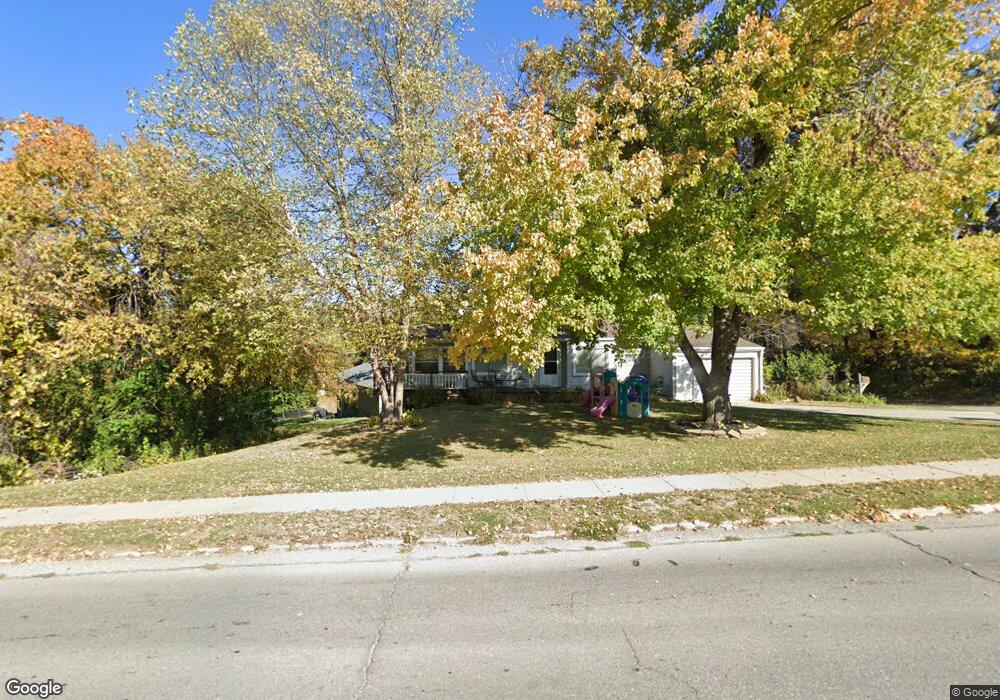
2064 1st Ave W Newton, IA 50208
Estimated Value: $153,000 - $157,000
2
Beds
1
Bath
728
Sq Ft
$213/Sq Ft
Est. Value
About This Home
This home is located at 2064 1st Ave W, Newton, IA 50208 and is currently estimated at $155,191, approximately $213 per square foot. 2064 1st Ave W is a home located in Jasper County with nearby schools including Thomas Jefferson Elementary School, Woodrow Wilson Elementary School, and Berg Middle School.
Ownership History
Date
Name
Owned For
Owner Type
Purchase Details
Closed on
Oct 20, 2025
Sold by
Hunnell Virginia M
Bought by
Anderson Rachel C
Current Estimated Value
Home Financials for this Owner
Home Financials are based on the most recent Mortgage that was taken out on this home.
Original Mortgage
$110,000
Outstanding Balance
$110,000
Interest Rate
6.35%
Mortgage Type
New Conventional
Estimated Equity
$45,191
Purchase Details
Closed on
Aug 24, 2021
Sold by
Mefferd Michael R
Bought by
Hunnell Virginia M
Home Financials for this Owner
Home Financials are based on the most recent Mortgage that was taken out on this home.
Original Mortgage
$105,730
Interest Rate
2.8%
Mortgage Type
New Conventional
Purchase Details
Closed on
Jul 7, 2016
Sold by
Hanson Dara L and Hanson Gregory
Bought by
Mefferd Michael R
Create a Home Valuation Report for This Property
The Home Valuation Report is an in-depth analysis detailing your home's value as well as a comparison with similar homes in the area
Home Values in the Area
Average Home Value in this Area
Purchase History
| Date | Buyer | Sale Price | Title Company |
|---|---|---|---|
| Anderson Rachel C | $155,000 | None Listed On Document | |
| Hunnell Virginia M | $109,000 | None Listed On Document | |
| Mefferd Michael R | $64,125 | None Available |
Source: Public Records
Mortgage History
| Date | Status | Borrower | Loan Amount |
|---|---|---|---|
| Open | Anderson Rachel C | $110,000 | |
| Previous Owner | Hunnell Virginia M | $105,730 |
Source: Public Records
Tax History Compared to Growth
Tax History
| Year | Tax Paid | Tax Assessment Tax Assessment Total Assessment is a certain percentage of the fair market value that is determined by local assessors to be the total taxable value of land and additions on the property. | Land | Improvement |
|---|---|---|---|---|
| 2025 | $1,710 | $141,920 | $19,130 | $122,790 |
| 2024 | $1,710 | $107,250 | $19,130 | $88,120 |
| 2023 | $1,708 | $107,250 | $19,130 | $88,120 |
| 2022 | $1,396 | $88,430 | $19,130 | $69,300 |
| 2021 | $1,240 | $82,740 | $19,130 | $63,610 |
| 2020 | $1,240 | $71,170 | $14,750 | $56,420 |
| 2019 | $1,296 | $69,730 | $0 | $0 |
| 2018 | $1,296 | $83,650 | $0 | $0 |
| 2017 | $1,772 | $83,650 | $0 | $0 |
| 2016 | $1,772 | $83,650 | $0 | $0 |
| 2015 | $1,740 | $83,650 | $0 | $0 |
| 2014 | $1,704 | $83,650 | $0 | $0 |
Source: Public Records
Map
Nearby Homes
- 6911-10 Highway F 48 W
- 124 Emerson Hough Dr
- 1221 Monroe Dr
- 210 W 13th St S
- 299 Hickory St
- 1431 Cardinal Ridge Dr
- 237 W 12th St S
- 913 W 18th St S
- 8 Chancery Ct
- 1100 1st Ave W
- 1000 1st Ave W
- 549 W 10th St N
- 308 W 8th St S
- 1149 W 28th St S
- 726 W 9th St S
- 625 S 3rd Ave W
- 860 W 28th St S
- TBD W 28th St S
- 623 S 4th Ave W
- 1401 W 16th St S Unit 2
- 2064 Highway F 48 W
- 2024 1st Ave W
- 100 Pioneer Dr
- 105 Emerson Hough Dr
- 104 Emerson Hough Dr
- 101 Pioneer Dr
- 100 Thomas Jefferson Dr
- 104 Pioneer Dr
- 111 Emerson Hough Dr
- 105 Thomas Jefferson Dr
- 106 Park Ln
- 109 Thomas Jefferson Dr
- 2214 1st Ave W
- 0 Hwy F-48 W
- 107 Waterbury Rd
- 110 Pioneer Dr
- 111 Thomas Jefferson Dr
- 110 Waterbury Rd
- 117 Emerson Hough Dr
- 111 Pioneer Dr