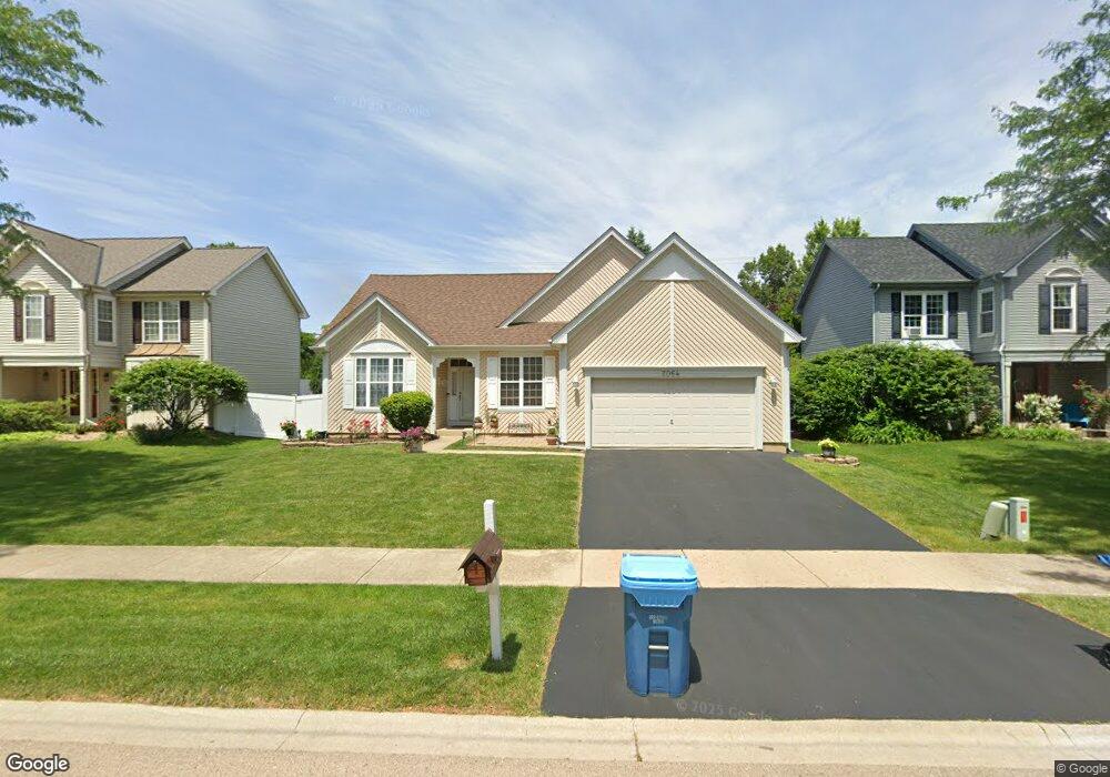
2064 Edinburgh Ln Aurora, IL 60504
South Farnsworth NeighborhoodEstimated Value: $342,016 - $370,000
3
Beds
2
Baths
1,410
Sq Ft
$252/Sq Ft
Est. Value
About This Home
This home is located at 2064 Edinburgh Ln, Aurora, IL 60504 and is currently estimated at $355,254, approximately $251 per square foot. 2064 Edinburgh Ln is a home located in Kane County with nearby schools including The Wheatlands Elementary School, Bednarcik Jr. High School, and Oswego East High School.
Ownership History
Date
Name
Owned For
Owner Type
Purchase Details
Closed on
Mar 17, 2004
Sold by
Elizondo Ramon
Bought by
Rodriguez Guadalupe
Current Estimated Value
Purchase Details
Closed on
May 1, 2000
Sold by
Bauer Robert F and Bauer Georgina G
Bought by
Rodriguez Gaudalupe and Elizondo Ramon
Home Financials for this Owner
Home Financials are based on the most recent Mortgage that was taken out on this home.
Original Mortgage
$125,200
Interest Rate
7.83%
Purchase Details
Closed on
Jul 28, 1997
Sold by
Wiseman Hughes Enterprises Inc
Bought by
Bauer Robert F and Bauer Georgina G
Home Financials for this Owner
Home Financials are based on the most recent Mortgage that was taken out on this home.
Original Mortgage
$133,000
Interest Rate
7.87%
Create a Home Valuation Report for This Property
The Home Valuation Report is an in-depth analysis detailing your home's value as well as a comparison with similar homes in the area
Home Values in the Area
Average Home Value in this Area
Purchase History
| Date | Buyer | Sale Price | Title Company |
|---|---|---|---|
| Rodriguez Guadalupe | -- | -- | |
| Rodriguez Gaudalupe | $156,500 | -- | |
| Bauer Robert F | $93,333 | Chicago Title Insurance Co |
Source: Public Records
Mortgage History
| Date | Status | Borrower | Loan Amount |
|---|---|---|---|
| Previous Owner | Rodriguez Gaudalupe | $125,200 | |
| Previous Owner | Bauer Robert F | $133,000 |
Source: Public Records
Tax History
| Year | Tax Paid | Tax Assessment Tax Assessment Total Assessment is a certain percentage of the fair market value that is determined by local assessors to be the total taxable value of land and additions on the property. | Land | Improvement |
|---|---|---|---|---|
| 2024 | $7,246 | $101,059 | $21,211 | $79,848 |
| 2023 | $7,017 | $90,296 | $18,952 | $71,344 |
| 2022 | $5,640 | $82,387 | $17,292 | $65,095 |
| 2021 | $5,809 | $76,703 | $16,099 | $60,604 |
| 2020 | $5,670 | $71,246 | $14,954 | $56,292 |
| 2019 | $6,254 | $71,724 | $13,855 | $57,869 |
| 2018 | $6,233 | $69,421 | $12,816 | $56,605 |
| 2017 | $6,399 | $67,850 | $11,809 | $56,041 |
| 2016 | $5,753 | $61,199 | $10,123 | $51,076 |
| 2015 | -- | $55,001 | $8,705 | $46,296 |
| 2014 | -- | $51,463 | $8,372 | $43,091 |
| 2013 | -- | $50,730 | $8,253 | $42,477 |
Source: Public Records
Map
Nearby Homes
- 2100 Hammel Ave
- 1875 Keating Dr
- 1874 Keating Dr
- 1871 Keating Dr
- 1868 Keating Dr
- 1866 Keating Dr
- 1862 Keating Dr
- 1859 Keating Dr
- 1858 Keating Dr
- 1855 Keating Dr
- 1850 Wisteria Dr Unit 343
- 1740 Baler Ave
- 1715 Baler Ave
- 1847 Baler Ave
- 1738 Baler Ave
- 1733 Baler Ave
- 1853 Baler Ave
- 1841 Baler Ave
- 1740 Cumberland Rd Unit 8B
- 1622 Captiva Dr
- 2056 Edinburgh Ln
- 2072 Edinburgh Ln
- 2048 Edinburgh Ln
- 2071 Edinburgh Ln
- 2080 Edinburgh Ln
- 1938 Pointe Blvd
- 2088 Edinburgh Ln
- 1956 Pointe Blvd
- 2081 Edinburgh Ln
- 2096 Edinburgh Ln
- 2040 Edinburgh Ln
- 1974 Pointe Blvd
- 2104 Edinburgh Ln
- 2051 Edinburgh Ln
- 2091 Edinburgh Ln
- 2032 Edinburgh Ln
- 1992 Pointe Blvd
- 1955 Pointe Blvd
- 2041 Edinburgh Ln
- 2112 Edinburgh Ln
Your Personal Tour Guide
Ask me questions while you tour the home.