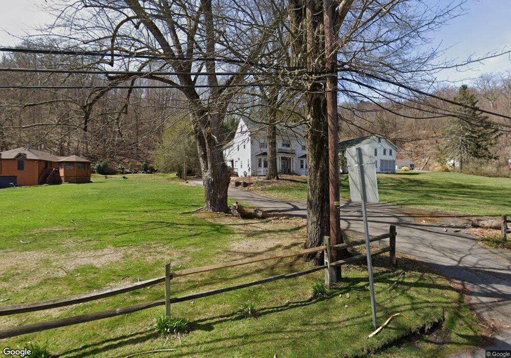
2064 State Route 92 Hwy Harding, PA 18643
Estimated Value: $220,000 - $352,135
6
Beds
3
Baths
3,056
Sq Ft
$95/Sq Ft
Est. Value
About This Home
This home is located at 2064 State Route 92 Hwy, Harding, PA 18643 and is currently estimated at $289,034, approximately $94 per square foot. 2064 State Route 92 Hwy is a home located in Luzerne County with nearby schools including Wyoming Area Secondary Center.
Ownership History
Date
Name
Owned For
Owner Type
Purchase Details
Closed on
Jun 22, 2018
Sold by
Deutsche Bank National Trust
Bought by
Dobinson Vincent Michael
Current Estimated Value
Home Financials for this Owner
Home Financials are based on the most recent Mortgage that was taken out on this home.
Original Mortgage
$96,852
Interest Rate
4.5%
Mortgage Type
New Conventional
Purchase Details
Closed on
Dec 21, 2017
Sold by
Malinowski Stanley C and Malinowski Mary Theresa
Bought by
Deutsche Bank National Trust Co and Home Equity Mortgage Loan Asset Backed T
Purchase Details
Closed on
Sep 25, 2012
Sold by
United States Of America
Bought by
Deutsche Bank National Trust Company
Create a Home Valuation Report for This Property
The Home Valuation Report is an in-depth analysis detailing your home's value as well as a comparison with similar homes in the area
Home Values in the Area
Average Home Value in this Area
Purchase History
| Date | Buyer | Sale Price | Title Company |
|---|---|---|---|
| Dobinson Vincent Michael | $121,065 | Premium Title Services Inc | |
| Deutsche Bank National Trust Co | $1,476 | None Available | |
| Deutsche Bank National Trust Company | $1,367 | None Available |
Source: Public Records
Mortgage History
| Date | Status | Borrower | Loan Amount |
|---|---|---|---|
| Previous Owner | Dobinson Vincent Michael | $96,852 |
Source: Public Records
Tax History Compared to Growth
Tax History
| Year | Tax Paid | Tax Assessment Tax Assessment Total Assessment is a certain percentage of the fair market value that is determined by local assessors to be the total taxable value of land and additions on the property. | Land | Improvement |
|---|---|---|---|---|
| 2025 | $5,090 | $175,400 | $30,400 | $145,000 |
| 2024 | $4,865 | $175,400 | $30,400 | $145,000 |
| 2023 | $4,539 | $175,400 | $30,400 | $145,000 |
| 2022 | $4,507 | $175,400 | $30,400 | $145,000 |
| 2021 | $4,444 | $175,400 | $30,400 | $145,000 |
| 2020 | $7,006 | $283,200 | $30,400 | $252,800 |
| 2019 | $6,807 | $283,200 | $30,400 | $252,800 |
| 2018 | $6,576 | $283,200 | $30,400 | $252,800 |
| 2017 | $6,428 | $283,200 | $30,400 | $252,800 |
| 2016 | -- | $283,200 | $30,400 | $252,800 |
| 2015 | -- | $283,200 | $30,400 | $252,800 |
| 2014 | -- | $283,200 | $30,400 | $252,800 |
Source: Public Records
Map
Nearby Homes
- 675 Apple Tree Rd
- 3018 Main St
- 3061 Main St
- 2356 Newton Ransom Blvd
- 2352 Newton Ransom Blvd
- 314 Terrace Ave
- 750 Slocum Ave
- 2694 Ransom Rd
- 2607 Ransom Rd
- 0 Spring & Red Oak Dr Unit GSBSC1753
- 0 Lockville Rd Church Rd Unit 25-1114
- 41 Gashi Rd
- 633 Campground Rd
- 0 Wintermoot Island Unit 25-5891
- 212 Bennett St
- 456 Village Rd
- 846 Exeter Ave
- 827 Luzerne Ave
- 1523 W 8th St
- 707 Exeter Ave
- 2060 State Route 92 Hwy
- 2058 State Route 92 Hwy
- 2056 State Route 92 Hwy
- 605 Apple Tree Rd
- 2052 State Route 92 Hwy
- 2050 State Route 92 Hwy
- 133 Rr 1
- 2046 Pennsylvania 92
- 0 Sullivan Trail
- 2040 State Route 92 Hwy
- 2092 State Route 92 Hwy
- 132 Rr 1
- 2032 Sullivan Trail
- 2032 Pennsylvania 92
- 2032 State Route 92 Hwy
- 2030 Pennsylvania 92
- 658 Apple Tree Rd
- 2014 State Route 92 Hwy
- 476 Apple Tree Rd
- 662 Apple Tree Rd