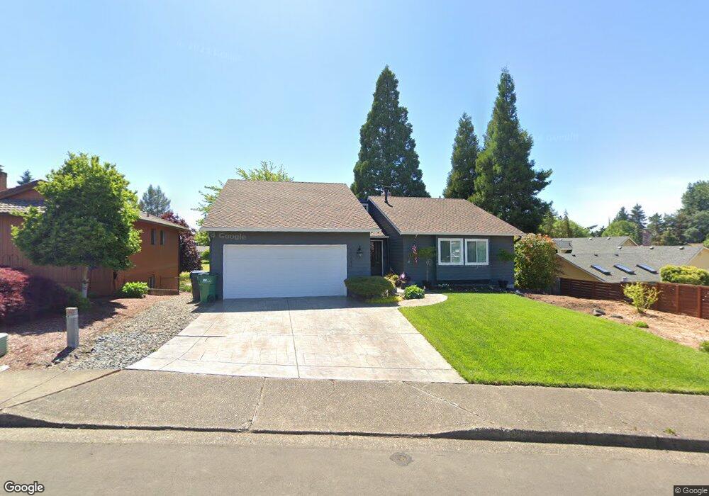
20640 SW Westside Dr Beaverton, OR 97007
Estimated Value: $589,980 - $660,000
4
Beds
3
Baths
1,326
Sq Ft
$468/Sq Ft
Est. Value
About This Home
This home is located at 20640 SW Westside Dr, Beaverton, OR 97007 and is currently estimated at $620,995, approximately $468 per square foot. 20640 SW Westside Dr is a home located in Washington County with nearby schools including Butternut Creek Elementary School, R.A. Brown Middle School, and Century High School.
Ownership History
Date
Name
Owned For
Owner Type
Purchase Details
Closed on
Feb 16, 2007
Sold by
Fernstrom Bruce and Fernstrom Marie
Bought by
Fernstrom Bruce and Fernstrom Marie
Current Estimated Value
Purchase Details
Closed on
Oct 17, 2002
Sold by
Matthews Michael K and Matthews Janet G C
Bought by
Fernstrom Bruce and Fernstrom Marie
Home Financials for this Owner
Home Financials are based on the most recent Mortgage that was taken out on this home.
Original Mortgage
$166,400
Outstanding Balance
$70,764
Interest Rate
6.62%
Mortgage Type
Purchase Money Mortgage
Estimated Equity
$550,231
Purchase Details
Closed on
Aug 22, 1995
Sold by
Chadwick Paul H and Chadwick Valentine K
Bought by
Matthews Michael K and Matthews Janet G C
Home Financials for this Owner
Home Financials are based on the most recent Mortgage that was taken out on this home.
Original Mortgage
$119,600
Interest Rate
7.5%
Mortgage Type
Purchase Money Mortgage
Create a Home Valuation Report for This Property
The Home Valuation Report is an in-depth analysis detailing your home's value as well as a comparison with similar homes in the area
Home Values in the Area
Average Home Value in this Area
Purchase History
| Date | Buyer | Sale Price | Title Company |
|---|---|---|---|
| Fernstrom Bruce | -- | None Available | |
| Fernstrom Bruce | $208,000 | Fidelity National Title Co | |
| Matthews Michael K | $130,000 | Fidelity National Title Co |
Source: Public Records
Mortgage History
| Date | Status | Borrower | Loan Amount |
|---|---|---|---|
| Open | Fernstrom Bruce | $166,400 | |
| Previous Owner | Matthews Michael K | $119,600 | |
| Closed | Fernstrom Bruce | $41,600 |
Source: Public Records
Tax History Compared to Growth
Tax History
| Year | Tax Paid | Tax Assessment Tax Assessment Total Assessment is a certain percentage of the fair market value that is determined by local assessors to be the total taxable value of land and additions on the property. | Land | Improvement |
|---|---|---|---|---|
| 2026 | $4,967 | $341,020 | -- | -- |
| 2025 | $4,967 | $331,090 | -- | -- |
| 2024 | $4,827 | $321,450 | -- | -- |
| 2023 | $4,827 | $312,090 | $0 | $0 |
| 2022 | $4,640 | $312,090 | $0 | $0 |
| 2021 | $4,493 | $290,380 | $0 | $0 |
| 2020 | $4,399 | $281,930 | $0 | $0 |
| 2019 | $4,165 | $267,230 | $0 | $0 |
| 2018 | $3,880 | $252,600 | $0 | $0 |
| 2017 | $3,736 | $245,250 | $0 | $0 |
| 2016 | $3,639 | $238,110 | $0 | $0 |
| 2015 | $3,509 | $231,180 | $0 | $0 |
| 2014 | $3,457 | $224,450 | $0 | $0 |
Source: Public Records
Map
Nearby Homes
- 20675 SW Rosa Dr
- Morgan Plan at Butternut Creek - The Ember Collection
- 5820 SW 206th Ave
- 4658 SW Stoddard Dr
- 4895 SW 202nd Ave
- 20591 SW Ravenswood St
- 20020 SW Walquin Ct
- 20478 SW Ravenswood St
- 6105 SW Zabaco Terrace
- 6050 SW Cross Creek Dr
- 6800 SE 82nd Ave
- 8058 SE Reddington St
- 19753 SW Celebrity St
- 20865 SW Quintessa Ct
- 20669 SW Skiver St
- 19901 SW Meadowbrook Ct
- 19735 SW Rosa Rd
- 7736 SE Affinity Ln
- 7724 SE Affinity Ln
- Conifer Plan at Butternut Creek - The Forrest Collection
- 20620 SW Westside Dr
- 20730 SW Deline St
- 20680 SW Deline St
- 20600 SW Westside Dr
- 20625 SW Westside Dr
- 20655 SW Westside Dr
- 20595 SW Westside Dr
- 20580 SW Westside Dr
- 20725 SW Deline St
- 20610 SW Deline St
- 20675 SW Deline St
- 20645 SW Deline St
- 20575 SW Westside Dr
- 20575 SW Westside St
- 20560 SW Westside Dr
- 20790 SW Deline St
- 20580 SW Deline St
- 5400 SW 208th Ave
- 20715 SW Deline St
- 5430 SW 208th Ave