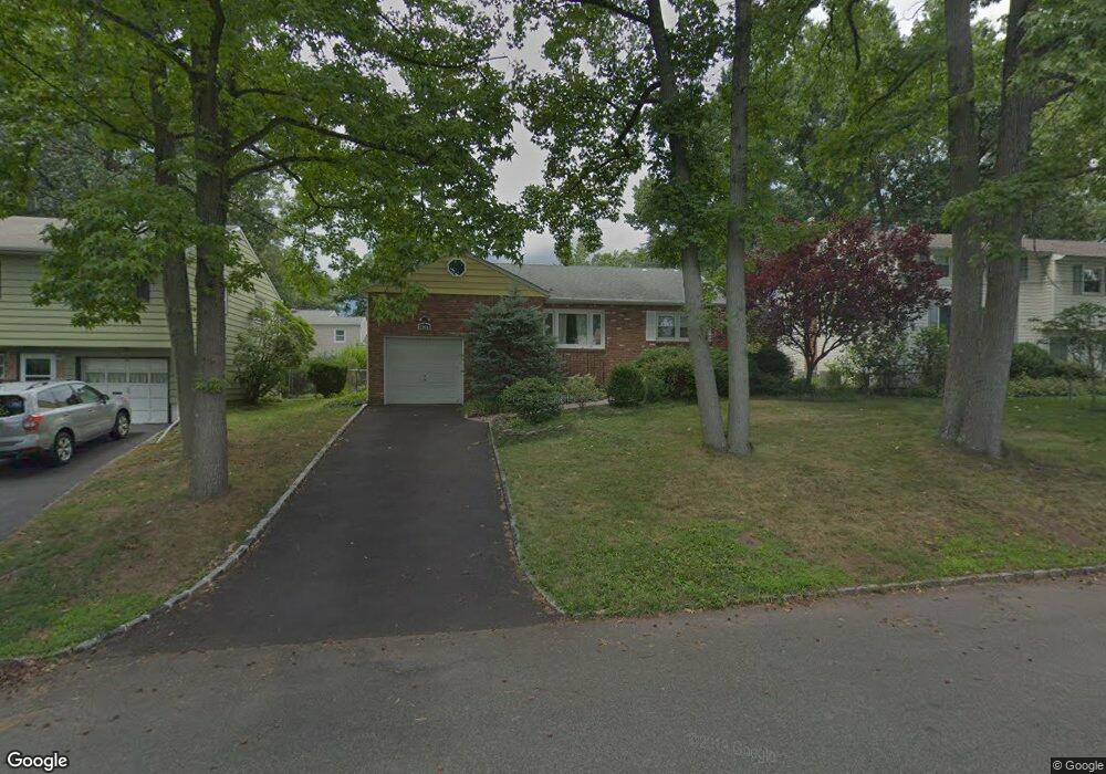
2065 Algonquin Dr Scotch Plains, NJ 07076
Estimated Value: $587,175 - $838,000
--
Bed
--
Bath
1,429
Sq Ft
$532/Sq Ft
Est. Value
About This Home
This home is located at 2065 Algonquin Dr, Scotch Plains, NJ 07076 and is currently estimated at $760,794, approximately $532 per square foot. 2065 Algonquin Dr is a home located in Union County with nearby schools including William J. McGinn Elementary School, Terrill Middle School, and Scotch Plains-Fanwood High School.
Ownership History
Date
Name
Owned For
Owner Type
Purchase Details
Closed on
Oct 25, 2001
Sold by
Kosuda Frank J and Kosuda Victoria M
Bought by
Tian Wen Qing and He Zhi Qing
Current Estimated Value
Home Financials for this Owner
Home Financials are based on the most recent Mortgage that was taken out on this home.
Original Mortgage
$230,000
Interest Rate
6.1%
Purchase Details
Closed on
Jul 29, 1999
Sold by
Sturm David J and Sturm Roberta W
Bought by
Kosuda Frank J and Kosuda Victoria M
Home Financials for this Owner
Home Financials are based on the most recent Mortgage that was taken out on this home.
Original Mortgage
$180,000
Interest Rate
7.76%
Create a Home Valuation Report for This Property
The Home Valuation Report is an in-depth analysis detailing your home's value as well as a comparison with similar homes in the area
Home Values in the Area
Average Home Value in this Area
Purchase History
| Date | Buyer | Sale Price | Title Company |
|---|---|---|---|
| Tian Wen Qing | $294,900 | Stewart Title Guaranty Compa | |
| Kosuda Frank J | $225,000 | -- |
Source: Public Records
Mortgage History
| Date | Status | Borrower | Loan Amount |
|---|---|---|---|
| Previous Owner | Tian Wen Qing | $230,000 | |
| Previous Owner | Kosuda Frank J | $33,750 | |
| Previous Owner | Kosuda Frank J | $180,000 |
Source: Public Records
Tax History Compared to Growth
Tax History
| Year | Tax Paid | Tax Assessment Tax Assessment Total Assessment is a certain percentage of the fair market value that is determined by local assessors to be the total taxable value of land and additions on the property. | Land | Improvement |
|---|---|---|---|---|
| 2025 | $12,192 | $103,600 | $28,300 | $75,300 |
| 2024 | $11,832 | $103,600 | $28,300 | $75,300 |
| 2023 | $11,832 | $103,600 | $28,300 | $75,300 |
| 2022 | $11,691 | $103,600 | $28,300 | $75,300 |
| 2021 | $11,672 | $103,600 | $28,300 | $75,300 |
| 2020 | $11,616 | $103,600 | $28,300 | $75,300 |
| 2019 | $11,530 | $103,600 | $28,300 | $75,300 |
| 2018 | $11,336 | $103,600 | $28,300 | $75,300 |
| 2017 | $11,084 | $103,600 | $28,300 | $75,300 |
| 2016 | $10,871 | $103,600 | $28,300 | $75,300 |
| 2015 | $10,693 | $103,600 | $28,300 | $75,300 |
| 2014 | $10,340 | $103,600 | $28,300 | $75,300 |
Source: Public Records
Map
Nearby Homes
- 2212 Shady Ln
- 2116 Newark Ave
- 2219 North Ave Unit 6
- 345 La Grande Ave
- 2314 Longfellow Ave
- 21 Old South Ave
- 120 S Martine Ave
- 40 1st St
- 1933 Mary Ellen Ln
- 1933 W Broad St
- 9 Timberline Dr
- 2286 Stocker Ln
- 187 King St
- 5 Robin Rd
- 2154 W Broad St
- 36 2nd St
- 4 Lois Place
- 119 Lamberts Mill Rd
- 869 Ternay Ave
- 193 South Ave
- 2071 Algonquin Dr
- 2059 Algonquin Dr
- 2070 Princeton Ave
- 2064 Princeton Ave
- 2076 Princeton Ave
- 2077 Algonquin Dr
- 2053 Algonquin Dr
- 2066 Algonquin Dr
- 2058 Princeton Ave
- 2072 Algonquin Dr
- 2078 Princeton Ave
- 2060 Algonquin Dr
- 2083 Algonquin Dr
- 2078 Algonquin Dr
- 2054 Algonquin Dr
- 2084 Princeton Ave
- 2082 Algonquin Dr
- 2048 Algonquin Dr
- 2089 Algonquin Dr
- 2063 Princeton Ave