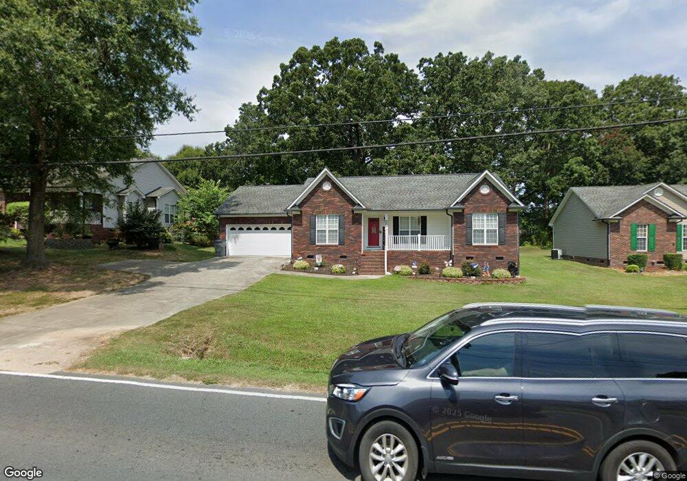
2065 Centergrove Rd Kannapolis, NC 28083
Estimated Value: $298,164 - $318,000
3
Beds
2
Baths
1,341
Sq Ft
$230/Sq Ft
Est. Value
About This Home
This home is located at 2065 Centergrove Rd, Kannapolis, NC 28083 and is currently estimated at $308,291, approximately $229 per square foot. 2065 Centergrove Rd is a home located in Cabarrus County with nearby schools including Forest Park Elementary School, Kannapolis Middle, and A.L. Brown High School.
Ownership History
Date
Name
Owned For
Owner Type
Purchase Details
Closed on
Jul 14, 2006
Sold by
Gary W Laton Llc
Bought by
Safrit Donna R
Current Estimated Value
Home Financials for this Owner
Home Financials are based on the most recent Mortgage that was taken out on this home.
Original Mortgage
$133,000
Outstanding Balance
$78,741
Interest Rate
6.6%
Mortgage Type
Purchase Money Mortgage
Estimated Equity
$229,550
Purchase Details
Closed on
Dec 1, 1994
Bought by
Means Rebecca D
Create a Home Valuation Report for This Property
The Home Valuation Report is an in-depth analysis detailing your home's value as well as a comparison with similar homes in the area
Home Values in the Area
Average Home Value in this Area
Purchase History
| Date | Buyer | Sale Price | Title Company |
|---|---|---|---|
| Safrit Donna R | $140,000 | None Available | |
| Means Rebecca D | -- | -- |
Source: Public Records
Mortgage History
| Date | Status | Borrower | Loan Amount |
|---|---|---|---|
| Open | Safrit Donna R | $133,000 |
Source: Public Records
Tax History
| Year | Tax Paid | Tax Assessment Tax Assessment Total Assessment is a certain percentage of the fair market value that is determined by local assessors to be the total taxable value of land and additions on the property. | Land | Improvement |
|---|---|---|---|---|
| 2025 | $3,445 | $303,400 | $50,000 | $253,400 |
| 2024 | $3,445 | $303,400 | $50,000 | $253,400 |
| 2023 | $2,528 | $184,550 | $35,000 | $149,550 |
| 2022 | $2,528 | $184,550 | $35,000 | $149,550 |
| 2021 | $2,528 | $184,550 | $35,000 | $149,550 |
| 2020 | $2,528 | $184,550 | $35,000 | $149,550 |
| 2019 | $1,955 | $142,700 | $20,400 | $122,300 |
| 2018 | $1,926 | $142,700 | $20,400 | $122,300 |
| 2017 | $1,898 | $142,700 | $20,400 | $122,300 |
| 2016 | $1,898 | $143,240 | $24,000 | $119,240 |
| 2015 | $1,805 | $143,240 | $24,000 | $119,240 |
| 2014 | $1,805 | $143,240 | $24,000 | $119,240 |
Source: Public Records
Map
Nearby Homes
- 2485 Acadia Ct
- 1655 Garnett St
- 1365 Eagle Claw Dr
- 2458 Saguaro Ln
- 307 S Little Texas Rd
- 1699 Mission Oaks St
- 304 Athens Hills Place
- 1838 Summit Ridge Ln
- 1768 Concord Lake Rd
- 00 Dixie Dr
- 1052 Mclain Rd
- 2271 Knowles St
- 2990 Dale Earnhardt Blvd
- 1010 A-B Tennessee St
- 621 Norland Ave
- 610 Eddleman Rd
- 2203 Florida Ave
- 611 Sumner St
- 108 S Little Texas Rd
- 620 Marigold Dr
- 2061 Centergrove Rd
- 2069 Centergrove Rd
- 2057 Centergrove Rd
- 2115 Centergrove Rd
- 2114 Centergrove Rd
- 2111 Centergrove Rd
- 2049 Centergrove Rd
- 2049 Centergrove Rd Unit 2
- 517 Villa St
- 2112 Centergrove Rd
- 515 Villa St
- 519 Villa St
- 2041 Centergrove Rd Unit 3
- 1604 Cambridge St
- 2117 Centergrove Rd
- 2116 Centergrove Rd
- 513 Villa St
- 521 Villa St
- 1606 Cambridge St
- 2033 Centergrove Rd
Your Personal Tour Guide
Ask me questions while you tour the home.