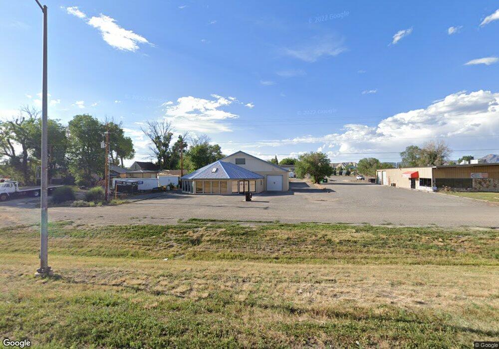
2065 Main St - Unit C&d Unit North Warehouse Montrose, CO 81401
--
Bed
--
Bath
4,400
Sq Ft
0.9
Acres
About This Home
This home is located at 2065 Main St - Unit C&d Unit North Warehouse, Montrose, CO 81401. 2065 Main St - Unit C&d Unit North Warehouse is a home located in Montrose County with nearby schools including Johnson Elementary School, Centennial Middle School, and Montrose High School.
Ownership History
Date
Name
Owned For
Owner Type
Purchase Details
Closed on
Aug 12, 2025
Sold by
Bradburn Paul L
Bought by
Paul Bradburn Trust
Purchase Details
Closed on
Mar 30, 2022
Sold by
Bradburn Charlotte K
Bought by
Bradburn Paul L
Purchase Details
Closed on
Feb 11, 1994
Sold by
Rebeck Andrew J and Rebeck Mary Rebeck
Bought by
Bradburn Paul L and Bradburn Charlotte K
Purchase Details
Closed on
Feb 26, 1987
Sold by
Rebeck M Mary M and Rebeck Andrew J
Bought by
Rebeck M Mary M and Rebeck Andrew J
Purchase Details
Closed on
Jun 4, 1986
Sold by
Spadafora Frank
Bought by
Rebeck M Mary
Purchase Details
Closed on
Feb 5, 1985
Sold by
Gilbert Vera J
Bought by
Rebeck M Mary
Purchase Details
Closed on
Oct 4, 1984
Sold by
Cannan William J
Bought by
Rebeck M Mary
Purchase Details
Closed on
Apr 12, 1979
Sold by
Brown Robert Dale and Brown Deann Kaye
Bought by
Cannan William J
Create a Home Valuation Report for This Property
The Home Valuation Report is an in-depth analysis detailing your home's value as well as a comparison with similar homes in the area
Home Values in the Area
Average Home Value in this Area
Purchase History
| Date | Buyer | Sale Price | Title Company |
|---|---|---|---|
| Paul Bradburn Trust | -- | None Listed On Document | |
| Bradburn Paul L | -- | None Listed On Document | |
| Bradburn Paul L | $47,400 | -- | |
| Rebeck M Mary M | -- | -- | |
| Rebeck M Mary | -- | -- | |
| Rebeck M Mary | -- | -- | |
| Rebeck M Mary | -- | -- | |
| Cannan William J | $48,900 | -- |
Source: Public Records
Tax History Compared to Growth
Tax History
| Year | Tax Paid | Tax Assessment Tax Assessment Total Assessment is a certain percentage of the fair market value that is determined by local assessors to be the total taxable value of land and additions on the property. | Land | Improvement |
|---|---|---|---|---|
| 2024 | $375 | $191,530 | $46,000 | $145,530 |
| 2023 | $375 | $207,770 | $47,810 | $159,960 |
| 2022 | $829 | $174,890 | $39,860 | $135,030 |
| 2021 | $830 | $174,890 | $39,860 | $135,030 |
| 2020 | $752 | $163,270 | $36,900 | $126,370 |
| 2019 | $757 | $163,270 | $36,900 | $126,370 |
| 2016 | $662 | $60,720 | $2,470 | $58,250 |
| 2015 | $650 | $9,660 | $2,470 | $7,190 |
Source: Public Records
Map
Nearby Homes
- 133 Castle Ave
- 2091 Locust Rd
- 381 6600 Rd
- 383 S Hillcrest Dr Unit 62
- 383 S Hillcrest Dr Unit 30
- 13.33 Acres Highway 50
- 67133 Locust Rd
- TBD N Cedar
- 665 6600 Rd
- 505 Miami Rd
- TBD Lot 11 E Star Ct
- TBD Lot 9 E Star Ct
- TBD Lot 10 E Star Ct
- TBD Lot 12 E Star Ct
- TBD Highway 50 Iron Horse Dr
- 1809 Draft Horse Rd
- 1512 Branding Iron Dr
- 338 N Stough Ave
- 218 N Stough Ave
- 1367 Corral Dr
- 50 N Hillcrest Dr
- 2065 E Main St Unit South retail
- N Hillcrest Dr
- 60 N Hillcrest Dr
- 46 N Hillcrest Dr
- 70 N Hillcrest Dr
- 2125 E Main St
- 100 N Hillcrest Dr
- 1871 E Main St
- 2000-2048 U S 50
- 1869 E Main St
- 2121 E Main St
- TBD Tract 12 Highway 50
- TBD Track 11 Highway 50
- Tract 12 Highway 50
- 13.33 Acres U S 50
- Tract 12 U S 50
- TBD Trackt 11 U S 50
- 1869 E 1865 1871 Main St and Tbd Hillcrest
- 0 Hillcrest Plaza Way Unit 761488