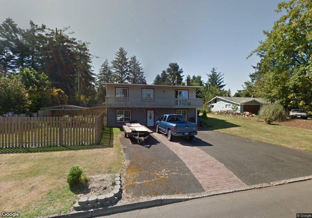
2065 Maple St Seaside, OR 97138
Estimated Value: $545,000 - $706,000
4
Beds
3
Baths
2,656
Sq Ft
$236/Sq Ft
Est. Value
About This Home
This home is located at 2065 Maple St, Seaside, OR 97138 and is currently estimated at $627,704, approximately $236 per square foot. 2065 Maple St is a home located in Clatsop County with nearby schools including Seaside High School.
Ownership History
Date
Name
Owned For
Owner Type
Purchase Details
Closed on
Jan 15, 2013
Sold by
Federal Home Loan Mortgage Corporation
Bought by
Wright Matthew and Wright Jacque
Current Estimated Value
Home Financials for this Owner
Home Financials are based on the most recent Mortgage that was taken out on this home.
Original Mortgage
$181,632
Outstanding Balance
$125,663
Interest Rate
3.34%
Mortgage Type
New Conventional
Estimated Equity
$502,041
Purchase Details
Closed on
Mar 27, 2012
Sold by
Lynes Anne M and Fritter Patrick H
Bought by
Federal Home Loan Mortgage Corporation
Purchase Details
Closed on
May 14, 2007
Sold by
Collins Diana I
Bought by
Fritter Patrick H and Lynes Ann M
Home Financials for this Owner
Home Financials are based on the most recent Mortgage that was taken out on this home.
Original Mortgage
$116,250
Interest Rate
5.83%
Mortgage Type
Unknown
Create a Home Valuation Report for This Property
The Home Valuation Report is an in-depth analysis detailing your home's value as well as a comparison with similar homes in the area
Purchase History
| Date | Buyer | Sale Price | Title Company |
|---|---|---|---|
| Wright Matthew | $178,000 | Service Link | |
| Federal Home Loan Mortgage Corporation | $318,000 | None Available | |
| Fritter Patrick H | $465,000 | Ticor Title Ins Co |
Source: Public Records
Mortgage History
| Date | Status | Borrower | Loan Amount |
|---|---|---|---|
| Open | Wright Matthew | $181,632 | |
| Previous Owner | Fritter Patrick H | $116,250 | |
| Previous Owner | Fritter Patrick H | $348,750 |
Source: Public Records
Tax History
| Year | Tax Paid | Tax Assessment Tax Assessment Total Assessment is a certain percentage of the fair market value that is determined by local assessors to be the total taxable value of land and additions on the property. | Land | Improvement |
|---|---|---|---|---|
| 2025 | $4,912 | $341,801 | -- | -- |
| 2024 | $4,767 | $331,846 | -- | -- |
| 2023 | $4,626 | $322,181 | $0 | $0 |
| 2022 | $4,500 | $312,798 | $0 | $0 |
| 2021 | $4,405 | $303,689 | $0 | $0 |
| 2020 | $4,302 | $294,844 | $0 | $0 |
| 2019 | $3,822 | $261,456 | $0 | $0 |
Source: Public Records
Map
Nearby Homes
- 360 Hilltop Dr
- Vacant Alpine St
- 0 Alpine St Unit 601537278
- 325 Alpine St
- 1659 Whispering Pines Dr
- 2270 Skyline Dr
- 1295 Jeffrey Dr
- 1269 Avenue D
- 1265 Avenue D
- VL Spruce Dr
- 0 Spruce Dr Unit 533082968
- 1255 Avenue A Unit 1 and 2
- 1255 Avenue A
- 481 Hillside Loop
- 285 S Lincoln St
- 1299 6th Ave
- 805 S King St
- 0 Way
- 911 1st Ave
- 1110 6th Ave
Your Personal Tour Guide
Ask me questions while you tour the home.