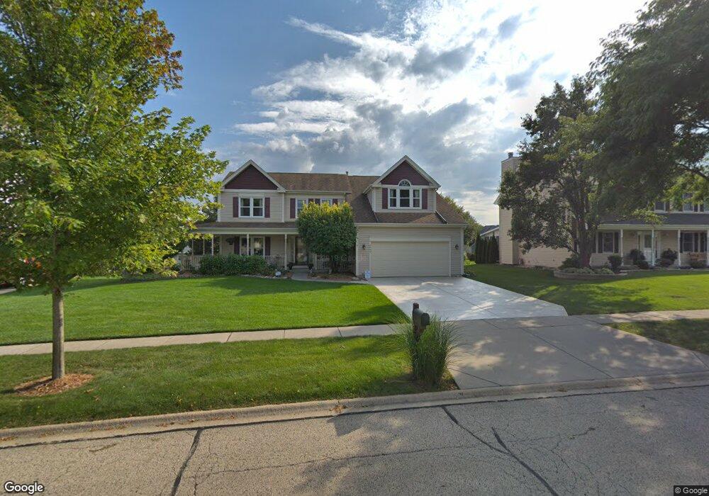
2065 Spaulding Ave West Dundee, IL 60118
Estimated Value: $442,381 - $497,000
4
Beds
--
Bath
2,683
Sq Ft
$178/Sq Ft
Est. Value
About This Home
This home is located at 2065 Spaulding Ave, West Dundee, IL 60118 and is currently estimated at $476,345, approximately $177 per square foot. 2065 Spaulding Ave is a home located in Kane County with nearby schools including Dundee Highlands Elementary School, Dundee Middle School, and Harry D Jacobs High School.
Ownership History
Date
Name
Owned For
Owner Type
Purchase Details
Closed on
Apr 1, 2022
Sold by
Baran Darlene
Bought by
Baran Darlene and Baran Danielle
Current Estimated Value
Purchase Details
Closed on
May 1, 2003
Sold by
Stankiewicz Edward J and Gorman Martha C
Bought by
Baran Daniel and Baran Darlene
Home Financials for this Owner
Home Financials are based on the most recent Mortgage that was taken out on this home.
Original Mortgage
$110,000
Interest Rate
5.78%
Mortgage Type
Purchase Money Mortgage
Purchase Details
Closed on
Jul 29, 1994
Sold by
Poole Charles R and Poole Lois J
Bought by
Stankiewicz Edward J and Gorman Martha C
Create a Home Valuation Report for This Property
The Home Valuation Report is an in-depth analysis detailing your home's value as well as a comparison with similar homes in the area
Home Values in the Area
Average Home Value in this Area
Purchase History
| Date | Buyer | Sale Price | Title Company |
|---|---|---|---|
| Baran Darlene | -- | None Listed On Document | |
| Baran Daniel | $316,500 | Chicago Title Insurance Co | |
| Stankiewicz Edward J | -- | Plm Title Company |
Source: Public Records
Mortgage History
| Date | Status | Borrower | Loan Amount |
|---|---|---|---|
| Previous Owner | Baran Daniel | $110,000 | |
| Closed | Stankiewicz Edward J | $0 |
Source: Public Records
Tax History
| Year | Tax Paid | Tax Assessment Tax Assessment Total Assessment is a certain percentage of the fair market value that is determined by local assessors to be the total taxable value of land and additions on the property. | Land | Improvement |
|---|---|---|---|---|
| 2024 | $9,329 | $130,453 | $25,730 | $104,723 |
| 2023 | $8,675 | $117,377 | $23,151 | $94,226 |
| 2022 | $8,767 | $110,508 | $23,151 | $87,357 |
| 2021 | $8,434 | $104,341 | $21,859 | $82,482 |
| 2020 | $8,722 | $101,996 | $21,368 | $80,628 |
| 2019 | $8,443 | $96,826 | $20,285 | $76,541 |
| 2018 | $8,880 | $99,109 | $19,883 | $79,226 |
| 2017 | $8,459 | $92,712 | $18,600 | $74,112 |
| 2016 | $8,667 | $90,193 | $23,811 | $66,382 |
| 2015 | -- | $84,514 | $22,312 | $62,202 |
| 2014 | -- | $82,180 | $21,696 | $60,484 |
| 2013 | -- | $84,695 | $22,360 | $62,335 |
Source: Public Records
Map
Nearby Homes
- 817 Lindsay Ln
- 809 Lindsay Ln
- 815 Lindsay Ln
- 850 Tartans Dr
- 1107 Pember Cir Unit 2
- 822 Lindsay Ln
- 816 Lindsay Ln
- 818 Lindsay Ln
- 1811 W Main St
- 1146 Pember Cir Unit 2
- 801 Lindsay Ln
- 820 Lindsay Ln
- 804 Lindsay Ln
- 808 Lindsay Ln
- 810 Lindsay Ln
- 821 Lindsay Ln
- 1023 Shagbark Ln
- 1031 Shagbark Ln
- 1601 Higgins Rd
- 805 Lindsay Ln
- 2109 Spaulding Ave Unit 2
- 2061 Spaulding Ave
- 728 Campbell Ct
- 716 Campbell Ct
- 2113 Spaulding Ave
- 2053 Spaulding Ave
- 2068 Spaulding Ave
- 730 Macgregor Ct
- 2110 Spaulding Ave
- 2054 Spaulding Ave
- 731 Campbell Ct
- 2127 Spaulding Ave
- 2114 Spaulding Ave
- 734 Macgregor Ct
- 712 Campbell Ct
- 2039 Spaulding Ct Unit 2
- 2046 Spaulding Ave
- 2047 Spaulding Ct
- 721 Macgregor Ct
- 2128 Spaulding Ave Unit 2
Your Personal Tour Guide
Ask me questions while you tour the home.