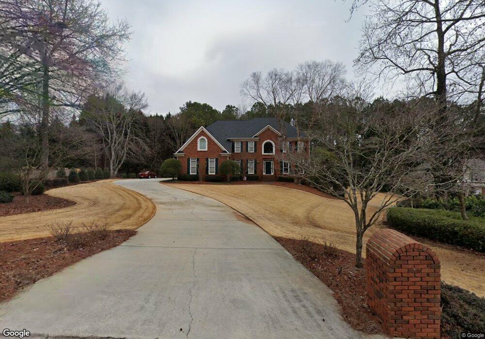
2065 Spencers Way Stone Mountain, GA 30087
Estimated Value: $714,000 - $879,000
5
Beds
4
Baths
3,921
Sq Ft
$206/Sq Ft
Est. Value
About This Home
This home is located at 2065 Spencers Way, Stone Mountain, GA 30087 and is currently estimated at $805,809, approximately $205 per square foot. 2065 Spencers Way is a home located in DeKalb County with nearby schools including Smoke Rise Elementary School, Tucker Middle School, and Tucker High School.
Ownership History
Date
Name
Owned For
Owner Type
Purchase Details
Closed on
Apr 15, 2025
Sold by
Kisling Owen Alan
Bought by
Kisling Owen Alan Tr and Kisling Patricia Ann Tr
Current Estimated Value
Purchase Details
Closed on
Dec 8, 1997
Sold by
Ross Larry T
Bought by
Kisling Owen A and Kisling Patricia A
Home Financials for this Owner
Home Financials are based on the most recent Mortgage that was taken out on this home.
Original Mortgage
$316,000
Interest Rate
7.26%
Mortgage Type
New Conventional
Create a Home Valuation Report for This Property
The Home Valuation Report is an in-depth analysis detailing your home's value as well as a comparison with similar homes in the area
Home Values in the Area
Average Home Value in this Area
Purchase History
| Date | Buyer | Sale Price | Title Company |
|---|---|---|---|
| Kisling Owen Alan Tr | -- | -- | |
| Kisling Owen A | $395,000 | -- |
Source: Public Records
Mortgage History
| Date | Status | Borrower | Loan Amount |
|---|---|---|---|
| Previous Owner | Kisling Owen A | $316,000 |
Source: Public Records
Tax History Compared to Growth
Tax History
| Year | Tax Paid | Tax Assessment Tax Assessment Total Assessment is a certain percentage of the fair market value that is determined by local assessors to be the total taxable value of land and additions on the property. | Land | Improvement |
|---|---|---|---|---|
| 2025 | $9,488 | $308,320 | $92,000 | $216,320 |
| 2024 | $8,872 | $269,720 | $51,247 | $218,473 |
| 2023 | $8,872 | $269,720 | $51,247 | $218,473 |
| 2022 | $9,174 | $288,440 | $50,000 | $238,440 |
| 2021 | $8,130 | $236,920 | $50,000 | $186,920 |
| 2020 | $7,249 | $213,880 | $49,800 | $164,080 |
| 2019 | $7,257 | $217,080 | $49,800 | $167,280 |
| 2018 | $6,442 | $208,560 | $49,800 | $158,760 |
| 2017 | $7,684 | $217,800 | $49,800 | $168,000 |
| 2016 | $5,642 | $164,400 | $49,320 | $115,080 |
| 2014 | $4,741 | $164,400 | $49,800 | $114,600 |
Source: Public Records
Map
Nearby Homes
- 507 Castleaire Dr Unit 1
- 507 Castlearie Dr
- 353 Old Rosser Rd
- 483 Rollingwood Dr
- 5401 Smoke Rise Dr
- 5363 Rosser Rd
- 2350 Oxbow Cir
- 292 Old Rosser Rd
- 127 Roe Hampton Ln
- 5632 Stillwater Ct
- 5523 Bahia Mar Cir
- 5169 Oxbow Rd
- 262 Harmony Grove Rd
- 5211 Hugh Howell Rd
- 2174 Deer Ridge Dr
- 5633 Breezy Ct SW
- 2037 Stoneleigh Dr
- 127 Old Rosser Rd SW
- 2075 Spencers Way
- 2328 Spencers Way
- 2340 Spencers Way
- 2414 Spencers Way
- 2424 Spencers Way
- 2070 Spencers Way
- 2382 Spencers Way
- 2400 Spencers Way
- 2434 Spencers Way
- 2306 Spencers Way
- 2050 Spencers Way
- 2360 Spencers Way
- 2084 Spencers Way
- 2099 Spencers Way
- 2446 Spencers Way
- 2339 Spencers Way
- 2327 Spencers Way
- 2415 Spencers Way
- 2096 Spencers Way
- 2429 Spencers Way