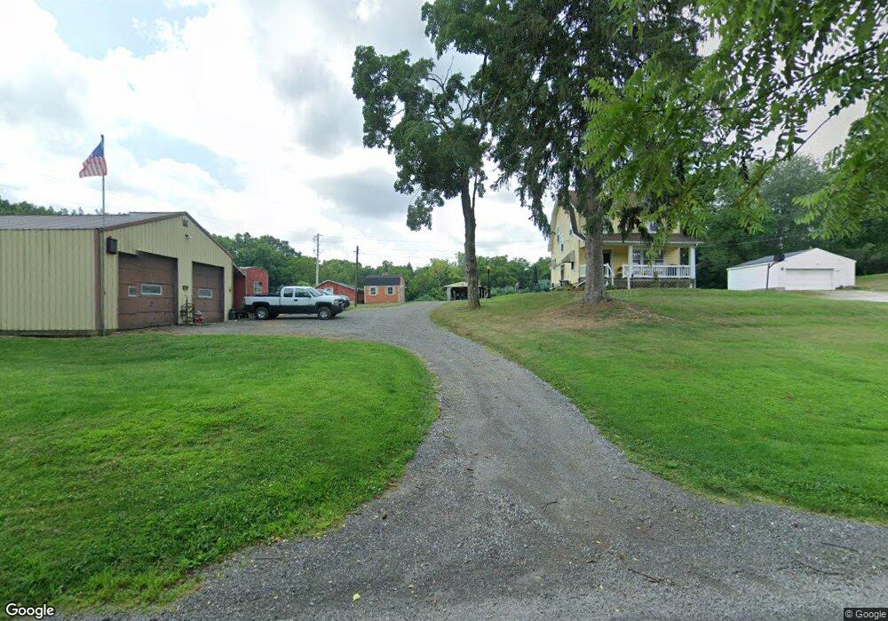
2065 Stringtown Rd NE Lancaster, OH 43130
Estimated Value: $245,000 - $350,000
3
Beds
1
Bath
1,340
Sq Ft
$222/Sq Ft
Est. Value
About This Home
This home is located at 2065 Stringtown Rd NE, Lancaster, OH 43130 and is currently estimated at $296,991, approximately $221 per square foot. 2065 Stringtown Rd NE is a home located in Fairfield County with nearby schools including St Mary Elementary School, Fairfield Christian Academy, and William V Fisher Catholic High School.
Ownership History
Date
Name
Owned For
Owner Type
Purchase Details
Closed on
Dec 17, 2003
Sold by
Boch Thomas J and Northup Karen A
Bought by
Boch John K
Current Estimated Value
Home Financials for this Owner
Home Financials are based on the most recent Mortgage that was taken out on this home.
Original Mortgage
$80,000
Interest Rate
5.84%
Mortgage Type
Purchase Money Mortgage
Create a Home Valuation Report for This Property
The Home Valuation Report is an in-depth analysis detailing your home's value as well as a comparison with similar homes in the area
Home Values in the Area
Average Home Value in this Area
Purchase History
| Date | Buyer | Sale Price | Title Company |
|---|---|---|---|
| Boch John K | $100,000 | -- |
Source: Public Records
Mortgage History
| Date | Status | Borrower | Loan Amount |
|---|---|---|---|
| Closed | Boch John K | $80,000 |
Source: Public Records
Tax History Compared to Growth
Tax History
| Year | Tax Paid | Tax Assessment Tax Assessment Total Assessment is a certain percentage of the fair market value that is determined by local assessors to be the total taxable value of land and additions on the property. | Land | Improvement |
|---|---|---|---|---|
| 2024 | $6,638 | $68,360 | $30,130 | $38,230 |
| 2023 | $2,763 | $68,360 | $30,130 | $38,230 |
| 2022 | $2,797 | $68,360 | $30,130 | $38,230 |
| 2021 | $2,387 | $56,690 | $27,390 | $29,300 |
| 2020 | $2,295 | $56,690 | $27,390 | $29,300 |
| 2019 | $2,190 | $56,690 | $27,390 | $29,300 |
| 2018 | $2,074 | $50,710 | $27,390 | $23,320 |
| 2017 | $2,075 | $50,710 | $27,390 | $23,320 |
| 2016 | $1,925 | $50,710 | $27,390 | $23,320 |
| 2015 | $1,949 | $49,760 | $27,390 | $22,370 |
| 2014 | $1,860 | $49,760 | $27,390 | $22,370 |
| 2013 | $1,860 | $49,760 | $27,390 | $22,370 |
Source: Public Records
Map
Nearby Homes
- 715 Sherman Bluff Way Unit 14715
- 173 Lakeview Dr NE
- 2149 Pleasantview Dr NE
- 1801 Pleasantview Dr NE
- 1916 Country Place
- 1700 Rosewood Dr NE
- 2865 Stringtown Rd NW
- 626 Rainbow Dr NW
- 0 Coonpath Rd NW Unit Tract 7 224028097
- 0 Coonpath Rd NW Unit Tract 4 224028093
- 0 Tschopp Rd NE Unit Lot 33 225027324
- 0 Tschopp Rd NE Unit Lot 17 225027320
- 980 Coonpath Rd NE
- 0 Old Millersport Rd NE Unit Lot 10 225033491
- 0 Old Millersport Rd NE Unit 225010386
- 0 Old Millersport Rd NE Unit Tract 8 224028101
- 2444 Sheridan Dr
- 3340 Stringtown Rd NE
- 1189 Ridge Rd NE
- 1760 Rainbow Dr NE
- 2054 Stringtown Rd NE
- 2040 Stringtown Rd NE
- 2081 Stringtown Rd NE
- 1995 Stringtown Rd NE
- 2105 Stringtown Rd NE
- 437 Rainbow Dr NE
- 333 Rainbow Dr NE
- 1935 Stringtown Rd NE
- 286 Rainbow Dr NE
- 266 Rainbow Dr NE
- 267 Rainbow Dr NE
- 267 Rainbow Dr NE
- 1865 Stringtown Rd NE
- 1920 Stringtown Rd NE
- 246 Rainbow Dr NE
- 575 Rainbow Dr NE
- 245 Rainbow Dr NE
- 1845 Stringtown Rd NE
- 1825 Stringtown Rd NE
- 605 Rainbow Dr NE