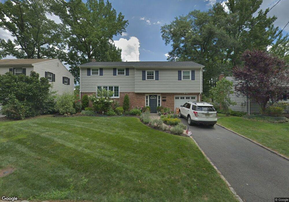
2066 Algonquin Dr Scotch Plains, NJ 07076
Estimated Value: $738,204 - $920,000
--
Bed
--
Bath
2,204
Sq Ft
$384/Sq Ft
Est. Value
About This Home
This home is located at 2066 Algonquin Dr, Scotch Plains, NJ 07076 and is currently estimated at $845,801, approximately $383 per square foot. 2066 Algonquin Dr is a home located in Union County with nearby schools including William J. McGinn Elementary School, Terrill Middle School, and Scotch Plains-Fanwood High School.
Ownership History
Date
Name
Owned For
Owner Type
Purchase Details
Closed on
Nov 14, 2008
Sold by
Billard William F and Billard Margaret B
Bought by
Calabrese Alexis and Calabrese John J
Current Estimated Value
Home Financials for this Owner
Home Financials are based on the most recent Mortgage that was taken out on this home.
Original Mortgage
$336,000
Outstanding Balance
$221,103
Interest Rate
6.13%
Mortgage Type
Purchase Money Mortgage
Estimated Equity
$624,698
Create a Home Valuation Report for This Property
The Home Valuation Report is an in-depth analysis detailing your home's value as well as a comparison with similar homes in the area
Home Values in the Area
Average Home Value in this Area
Purchase History
| Date | Buyer | Sale Price | Title Company |
|---|---|---|---|
| Calabrese Alexis | $420,000 | None Available |
Source: Public Records
Mortgage History
| Date | Status | Borrower | Loan Amount |
|---|---|---|---|
| Open | Calabrese Alexis | $336,000 |
Source: Public Records
Tax History Compared to Growth
Tax History
| Year | Tax Paid | Tax Assessment Tax Assessment Total Assessment is a certain percentage of the fair market value that is determined by local assessors to be the total taxable value of land and additions on the property. | Land | Improvement |
|---|---|---|---|---|
| 2025 | $12,980 | $110,300 | $28,100 | $82,200 |
| 2024 | $12,597 | $110,300 | $28,100 | $82,200 |
| 2023 | $12,597 | $110,300 | $28,100 | $82,200 |
| 2022 | $12,447 | $110,300 | $28,100 | $82,200 |
| 2021 | $12,426 | $110,300 | $28,100 | $82,200 |
| 2020 | $12,367 | $110,300 | $28,100 | $82,200 |
| 2019 | $12,275 | $110,300 | $28,100 | $82,200 |
| 2018 | $12,069 | $110,300 | $28,100 | $82,200 |
| 2017 | $11,801 | $110,300 | $28,100 | $82,200 |
| 2016 | $11,574 | $110,300 | $28,100 | $82,200 |
| 2015 | $11,384 | $110,300 | $28,100 | $82,200 |
| 2014 | $11,009 | $110,300 | $28,100 | $82,200 |
Source: Public Records
Map
Nearby Homes
- 2116 Newark Ave
- 2212 Shady Ln
- 2219 North Ave Unit 6
- 345 La Grande Ave
- 2314 Longfellow Ave
- 21 Old South Ave
- 1933 Mary Ellen Ln
- 120 S Martine Ave
- 40 1st St
- 1933 W Broad St
- 187 King St
- 2154 W Broad St
- 5 Robin Rd
- 2286 Stocker Ln
- 9 Timberline Dr
- 119 Lamberts Mill Rd
- 36 2nd St
- 4 Lois Place
- 869 Ternay Ave
- 2 Brookside Ct
- 2060 Algonquin Dr
- 2072 Algonquin Dr
- 2067 Maple View Ct
- 2073 Maple View Ct
- 2054 Algonquin Dr
- 2078 Algonquin Dr
- 2061 Maple View Ct
- 2065 Algonquin Dr
- 2079 Maple View Ct
- 2059 Algonquin Dr
- 2071 Algonquin Dr
- 2048 Algonquin Dr
- 2082 Algonquin Dr
- 2057 Maple View Ct
- 2053 Algonquin Dr
- 2077 Algonquin Dr
- 2083 Maple View Ct
- 2088 Algonquin Dr
- 2051 Maple View Ct
- 2083 Algonquin Dr