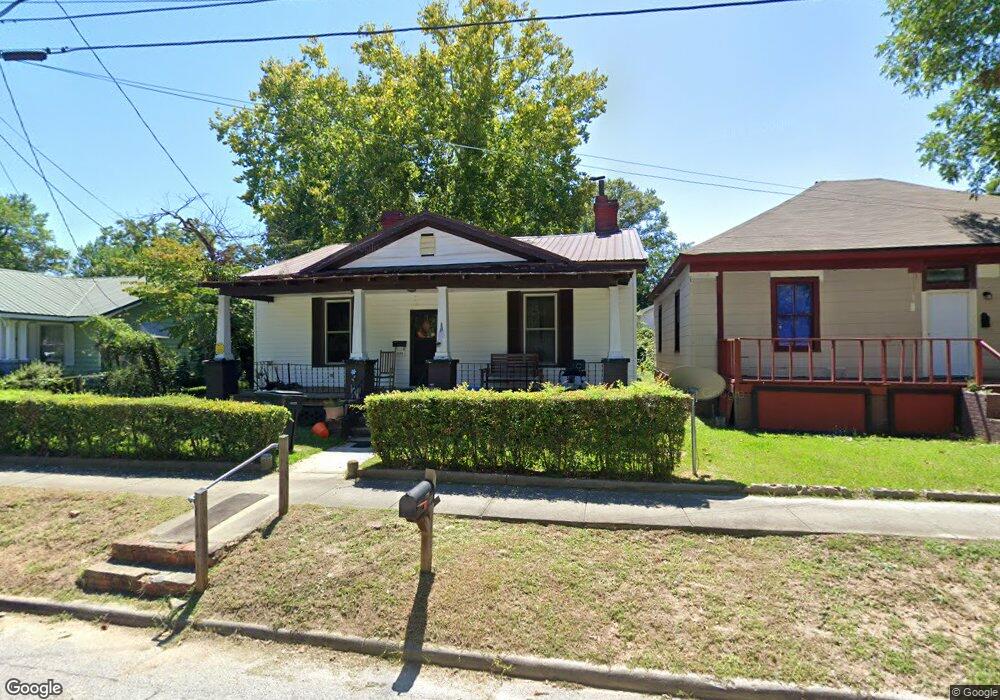
2066 Ellis St Augusta, GA 30904
West End NeighborhoodEstimated Value: $119,000 - $149,000
4
Beds
2
Baths
2,104
Sq Ft
$65/Sq Ft
Est. Value
About This Home
This home is located at 2066 Ellis St, Augusta, GA 30904 and is currently estimated at $136,207, approximately $64 per square foot. 2066 Ellis St is a home located in Richmond County with nearby schools including Lamar Elementary School, W.S. Hornsby Elementary School, and Johnson Magnet.
Ownership History
Date
Name
Owned For
Owner Type
Purchase Details
Closed on
Aug 31, 2001
Sold by
Fields Lori Renee and Fields Marc Alan
Bought by
Tate Doris N
Current Estimated Value
Home Financials for this Owner
Home Financials are based on the most recent Mortgage that was taken out on this home.
Original Mortgage
$55,430
Outstanding Balance
$20,621
Interest Rate
6.98%
Estimated Equity
$115,586
Purchase Details
Closed on
Sep 11, 1992
Sold by
Alberding Jill
Bought by
Fields Lori Renee
Purchase Details
Closed on
Mar 19, 1992
Sold by
Federal Home Loan M
Bought by
Alberding Jill
Purchase Details
Closed on
Feb 4, 1992
Sold by
Herring Kinneth R B
Bought by
Federal Home Loan M
Purchase Details
Closed on
Jun 29, 1990
Sold by
Herring Theresa L
Bought by
Herring Kinneth R
Purchase Details
Closed on
Dec 12, 1986
Sold by
Bennett Joseph W and J W
Bought by
Herring Kinneth R Herring Therisa L
Create a Home Valuation Report for This Property
The Home Valuation Report is an in-depth analysis detailing your home's value as well as a comparison with similar homes in the area
Home Values in the Area
Average Home Value in this Area
Purchase History
| Date | Buyer | Sale Price | Title Company |
|---|---|---|---|
| Tate Doris N | $56,300 | -- | |
| Fields Lori Renee | $42,500 | -- | |
| Alberding Jill | $9,000 | -- | |
| Federal Home Loan M | $25,700 | -- | |
| Herring Kinneth R | -- | -- | |
| Herring Kinneth R Herring Therisa L | $28,900 | -- |
Source: Public Records
Mortgage History
| Date | Status | Borrower | Loan Amount |
|---|---|---|---|
| Open | Tate Doris N | $55,430 | |
| Closed | Tate Doris N | $850 |
Source: Public Records
Tax History
| Year | Tax Paid | Tax Assessment Tax Assessment Total Assessment is a certain percentage of the fair market value that is determined by local assessors to be the total taxable value of land and additions on the property. | Land | Improvement |
|---|---|---|---|---|
| 2025 | $1,469 | $42,492 | $2,966 | $39,526 |
| 2024 | $1,469 | $34,056 | $2,966 | $31,090 |
| 2023 | $1,159 | $49,304 | $2,966 | $46,338 |
| 2022 | $1,332 | $38,400 | $2,966 | $35,434 |
| 2021 | $966 | $24,519 | $2,956 | $21,563 |
| 2020 | $990 | $25,563 | $4,000 | $21,563 |
| 2019 | $1,039 | $25,563 | $4,000 | $21,563 |
| 2018 | $1,045 | $25,563 | $4,000 | $21,563 |
| 2017 | $1,041 | $25,563 | $4,000 | $21,563 |
| 2016 | $1,041 | $25,563 | $4,000 | $21,563 |
| 2015 | $1,047 | $25,563 | $4,000 | $21,563 |
| 2014 | $1,048 | $25,563 | $4,000 | $21,563 |
Source: Public Records
Map
Nearby Homes
- 2063 Broad St
- 2025 Ellis St
- 2021 Ellis St
- 2052 Clark St
- 299 Milledge Rd
- 531 Carr St
- 2048 Edgar St
- 513 Beaufort Dr
- 2200 Country Club Ct
- 501 Milledge Rd Unit 9A
- 501 Milledge Rd Unit 14A
- 1933 Telfair St
- 1929 Watkins St
- 600 Hickman Rd
- 1918 Walker St
- 1916 Walker St
- 1915 Watkins St
- 2015 Starnes St
- 608 Eve St
- 605 Eve St
Your Personal Tour Guide
Ask me questions while you tour the home.