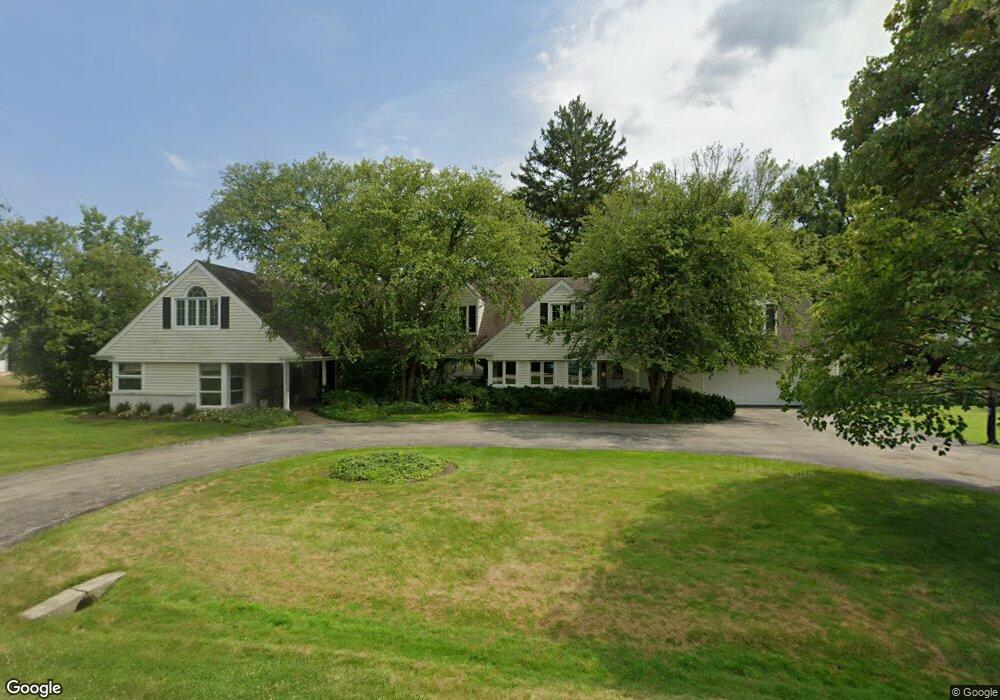
2066 Middlefork Rd Northfield, IL 60093
Estimated Value: $1,143,000 - $2,522,000
5
Beds
5
Baths
2,849
Sq Ft
$566/Sq Ft
Est. Value
About This Home
This home is located at 2066 Middlefork Rd, Northfield, IL 60093 and is currently estimated at $1,613,893, approximately $566 per square foot. 2066 Middlefork Rd is a home located in Cook County with nearby schools including Middlefork Primary School, Sunset Ridge Elementary School, and New Trier Township High School - Northfield.
Ownership History
Date
Name
Owned For
Owner Type
Purchase Details
Closed on
Oct 1, 2025
Sold by
Land Trust Company and Chicago Title Land Trust Company
Bought by
Tyska Paige Elizabeth
Current Estimated Value
Purchase Details
Closed on
Apr 4, 2005
Sold by
Edwards Rockwood S and Edwards Beth B
Bought by
Edwards Beth B and Beth B Edwards Trust
Create a Home Valuation Report for This Property
The Home Valuation Report is an in-depth analysis detailing your home's value as well as a comparison with similar homes in the area
Home Values in the Area
Average Home Value in this Area
Purchase History
| Date | Buyer | Sale Price | Title Company |
|---|---|---|---|
| Tyska Paige Elizabeth | $1,200,000 | Chicago Title | |
| Edwards Beth B | -- | -- |
Source: Public Records
Tax History
| Year | Tax Paid | Tax Assessment Tax Assessment Total Assessment is a certain percentage of the fair market value that is determined by local assessors to be the total taxable value of land and additions on the property. | Land | Improvement |
|---|---|---|---|---|
| 2025 | $22,991 | $110,000 | $55,461 | $54,539 |
| 2024 | $22,991 | $106,517 | $52,272 | $54,245 |
| 2023 | $22,363 | $106,517 | $52,272 | $54,245 |
| 2022 | $22,363 | $109,252 | $52,272 | $56,980 |
| 2021 | $17,707 | $73,019 | $36,590 | $36,429 |
| 2020 | $17,309 | $73,019 | $36,590 | $36,429 |
| 2019 | $17,022 | $80,241 | $36,590 | $43,651 |
| 2018 | $17,296 | $77,517 | $31,363 | $46,154 |
| 2017 | $16,024 | $77,517 | $31,363 | $46,154 |
| 2016 | $16,778 | $84,782 | $31,363 | $53,419 |
| 2015 | $16,305 | $75,253 | $26,136 | $49,117 |
| 2014 | $17,092 | $80,217 | $26,136 | $54,081 |
| 2013 | $16,363 | $80,217 | $26,136 | $54,081 |
Source: Public Records
Map
Nearby Homes
- 590 Briar Ln
- 2122 Middlefork Rd
- 898 Bridlegate Ln
- 513 Edens Ln
- 1990 Southridge Terrace
- 2154 Northgate Rd
- 1930 Sunset Ridge Rd
- 265 Dickens St
- 405 Voltz Rd
- 308 Happ Rd Unit 201
- 164 Wagner Rd
- 985 Pine Tree Ln
- 831 Balmoral Ln
- 220 Sunset Ridge Rd
- 118 Dickens Rd
- 2700 Summit Dr Unit 101
- 2033 Winnetka Rd
- 1900 Winnetka Ave
- 1492 Asbury Ave
- 947 Kensington Dr Unit 7E3
- 2044 Middlefork Rd
- 2062 Suffork Rd
- 2067 Norfork Rd
- 2041 Suffork Rd
- 2051 Middlefork Rd
- 2058 Suffork Rd
- 2060 Suffork Rd
- 2056 Suffork Rd
- 2094 Middlefork Rd
- 2040 Suffork Rd
- 2021 Suffork Rd
- 2080 Norfork Rd
- 2024 Suffork Rd
- 2050 Norfork Rd
- 615 Laurie Ln
- 2134 Middlefork Rd
- 630 Woodland Ln N
- 655 Briar Ln
- 715 Happ Rd
- 705 Happ Rd
Your Personal Tour Guide
Ask me questions while you tour the home.