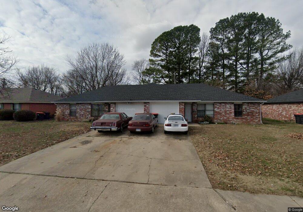
2067 Emily Circle Dr Unit A Springdale, AR 72762
Estimated Value: $285,537 - $305,000
--
Bed
4
Baths
2,210
Sq Ft
$136/Sq Ft
Est. Value
About This Home
This home is located at 2067 Emily Circle Dr Unit A, Springdale, AR 72762 and is currently estimated at $299,634, approximately $135 per square foot. 2067 Emily Circle Dr Unit A is a home located in Washington County with nearby schools including Southwest Junior High School, Westwood Elementary School, and Helen Tyson Middle School.
Ownership History
Date
Name
Owned For
Owner Type
Purchase Details
Closed on
Jan 12, 2007
Sold by
Tomlinson Larry Dean and Tomlinson Jeanie Carol
Bought by
Larry Dean & Jeannie Carol Tomlinson Tr
Current Estimated Value
Purchase Details
Closed on
Feb 27, 1997
Bought by
Tomlinson Larry Dean and Tomlinson Jeannie
Purchase Details
Closed on
Jan 25, 1990
Bought by
Albertson Chloe Dean and Albertson P
Purchase Details
Closed on
Jan 1, 1990
Bought by
Howard Stan and Mathias Sam
Purchase Details
Closed on
May 23, 1989
Bought by
Mccamey Real Estate Company
Create a Home Valuation Report for This Property
The Home Valuation Report is an in-depth analysis detailing your home's value as well as a comparison with similar homes in the area
Home Values in the Area
Average Home Value in this Area
Purchase History
| Date | Buyer | Sale Price | Title Company |
|---|---|---|---|
| Larry Dean & Jeannie Carol Tomlinson Tr | -- | None Available | |
| Tomlinson Larry Dean | $100,000 | -- | |
| Albertson Chloe Dean | $81,000 | -- | |
| Howard Stan | -- | -- | |
| Mccamey Real Estate Company | $180,000 | -- |
Source: Public Records
Tax History Compared to Growth
Tax History
| Year | Tax Paid | Tax Assessment Tax Assessment Total Assessment is a certain percentage of the fair market value that is determined by local assessors to be the total taxable value of land and additions on the property. | Land | Improvement |
|---|---|---|---|---|
| 2024 | $1,637 | $54,090 | $14,000 | $40,090 |
| 2023 | $1,530 | $54,090 | $14,000 | $40,090 |
| 2022 | $1,391 | $35,390 | $10,000 | $25,390 |
| 2021 | $1,284 | $35,390 | $10,000 | $25,390 |
| 2020 | $1,177 | $35,390 | $10,000 | $25,390 |
| 2019 | $1,070 | $20,300 | $5,000 | $15,300 |
| 2018 | $1,070 | $20,300 | $5,000 | $15,300 |
| 2017 | $1,060 | $20,300 | $5,000 | $15,300 |
| 2016 | $1,060 | $20,300 | $5,000 | $15,300 |
| 2015 | $1,060 | $20,300 | $5,000 | $15,300 |
| 2014 | $1,214 | $23,250 | $5,000 | $18,250 |
Source: Public Records
Map
Nearby Homes
- 2009 Emily Circle Dr Unit A
- 713 Carlton St
- 712 Carlton St
- 614 Zachary St
- 702 S West End St
- 506 Dyer St
- 508 Geneva St
- 706 Maria St
- 604 Maria St
- 406 Michael St
- 404 Henryetta St
- 510 Maria St
- 1902 Melissa Ln
- 2001 Pin Oak Dr
- 126 Rogers Circle Dr
- 1115 Eicher Ave
- 1304 Rebecca Ln
- 1701 S West End St
- 301 Michael St
- 2003 Dee Ave
- 2039 Emily Circle Dr
- 2091 Emily Circle Dr
- 2072 Emily Circle Dr Unit A
- 715 Dyer St
- 713 Dyer St
- 2048 Emily Circle Dr Unit A
- 2095 Emily Circle Dr Unit A
- 2095 Dr Unit B
- 717 Dyer St
- 711 Dyer St
- 2026 Emily Circle Dr
- 2111 Emily Circle Dr Unit A
- 1000 Heather St Unit A
- 2004 Emily Circle Dr Unit A
- 2133 Emily Circle Dr Unit A
- 709 Dyer St
- 719 Dyer St
- 970 Heather St Unit A
- 1983 Emily Circle Dr
- 940 Heather St