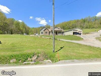
2067 Golden Oaks Rd Holbrook, PA 15341
Estimated Value: $166,000 - $297,004
--
Bed
--
Bath
--
Sq Ft
3.37
Acres
About This Home
This home is located at 2067 Golden Oaks Rd, Holbrook, PA 15341 and is currently estimated at $231,502. 2067 Golden Oaks Rd is a home with nearby schools including West Greene El Center, West Greene Junior/Senior High School, and West Greene High School.
Ownership History
Date
Name
Owned For
Owner Type
Purchase Details
Closed on
Sep 12, 2024
Sold by
Iron Pennsylvania Land Llc and Iron Coal Resources Llc
Bought by
Carbon Fade Energy Llc
Current Estimated Value
Purchase Details
Closed on
Aug 4, 2009
Sold by
Lewis Kenneth M
Bought by
Anderson Larry and Anderson Michelle L
Home Financials for this Owner
Home Financials are based on the most recent Mortgage that was taken out on this home.
Original Mortgage
$123,700
Interest Rate
5.19%
Mortgage Type
New Conventional
Create a Home Valuation Report for This Property
The Home Valuation Report is an in-depth analysis detailing your home's value as well as a comparison with similar homes in the area
Home Values in the Area
Average Home Value in this Area
Purchase History
| Date | Buyer | Sale Price | Title Company |
|---|---|---|---|
| Carbon Fade Energy Llc | $1,342,368 | None Listed On Document | |
| Anderson Larry | $165,000 | None Available |
Source: Public Records
Mortgage History
| Date | Status | Borrower | Loan Amount |
|---|---|---|---|
| Previous Owner | Anderson Larry L | $28,000 | |
| Previous Owner | Anderson Larry L | $417,000 | |
| Previous Owner | Anderson Larry | $123,700 |
Source: Public Records
Tax History Compared to Growth
Tax History
| Year | Tax Paid | Tax Assessment Tax Assessment Total Assessment is a certain percentage of the fair market value that is determined by local assessors to be the total taxable value of land and additions on the property. | Land | Improvement |
|---|---|---|---|---|
| 2024 | $6,506 | $206,510 | $12,170 | $194,340 |
| 2023 | $6,506 | $206,510 | $12,170 | $194,340 |
| 2022 | $6,506 | $206,510 | $12,170 | $194,340 |
| 2021 | $6,506 | $206,510 | $12,170 | $194,340 |
| 2020 | $6,203 | $206,510 | $12,170 | $194,340 |
| 2019 | $6,203 | $206,510 | $12,170 | $194,340 |
| 2018 | $62 | $206,510 | $12,170 | $194,340 |
| 2017 | $6,128 | $206,510 | $12,170 | $194,340 |
| 2016 | -- | $206,510 | $12,170 | $194,340 |
| 2015 | -- | $206,510 | $12,170 | $194,340 |
| 2014 | -- | $206,510 | $12,170 | $194,340 |
| 2013 | -- | $12,170 | $12,170 | $0 |
Source: Public Records
Map
Nearby Homes
- 1835 Toms Run Rd
- 119 Blockhouse Rd
- 1125 Toms Run Rd
- 0 Toms Run Rd Unit 1665173
- 120 2nd St
- 0 Pennsylvania 18
- 128 Main St
- 402 Deep Valley Rd
- 557 Toms Run Rd
- 4195 W Roy Furman Hwy
- 79 Front St
- 238 Crossroads Rd
- 101 3rd St
- 0 Sugar Run Rd
- 121 Hoy Run Rd
- 398 Sugar Run Rd
- 171 W Greene St
- 324 S Washington St
- 68 E Elm St
- 9 W Lincoln St