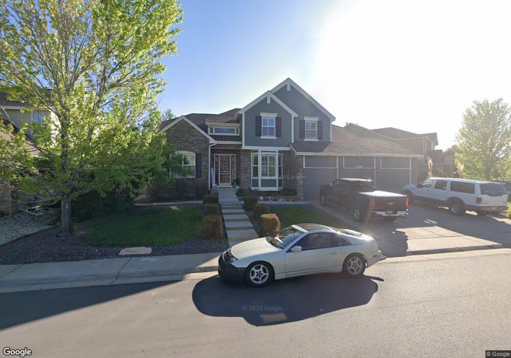
20671 E Euclid Dr Centennial, CO 80016
Greenfield NeighborhoodEstimated Value: $758,000 - $835,000
5
Beds
4
Baths
4,783
Sq Ft
$165/Sq Ft
Est. Value
About This Home
This home is located at 20671 E Euclid Dr, Centennial, CO 80016 and is currently estimated at $787,040, approximately $164 per square foot. 20671 E Euclid Dr is a home located in Arapahoe County with nearby schools including Rolling Hills Elementary School, Falcon Creek Middle School, and Grandview High School.
Ownership History
Date
Name
Owned For
Owner Type
Purchase Details
Closed on
Sep 10, 2024
Sold by
Szypulski Paul J and Szypulski Hope N
Bought by
Szypulski Family Trust
Current Estimated Value
Purchase Details
Closed on
Jun 29, 2009
Sold by
Gelhaar Todd A and Gelhaar Erin C
Bought by
Szypulski Paul J and Szypulski Hope N
Home Financials for this Owner
Home Financials are based on the most recent Mortgage that was taken out on this home.
Original Mortgage
$392,540
Interest Rate
4.97%
Mortgage Type
VA
Purchase Details
Closed on
Aug 15, 2003
Sold by
Village Homes Of Colorado Inc
Bought by
Gelhaar Todd A and Gelhaar Erin C
Home Financials for this Owner
Home Financials are based on the most recent Mortgage that was taken out on this home.
Original Mortgage
$320,350
Interest Rate
5.51%
Mortgage Type
Purchase Money Mortgage
Create a Home Valuation Report for This Property
The Home Valuation Report is an in-depth analysis detailing your home's value as well as a comparison with similar homes in the area
Home Values in the Area
Average Home Value in this Area
Purchase History
| Date | Buyer | Sale Price | Title Company |
|---|---|---|---|
| Szypulski Family Trust | -- | None Listed On Document | |
| Szypulski Paul J | $380,000 | Capital Title Llc | |
| Gelhaar Todd A | $400,497 | -- |
Source: Public Records
Mortgage History
| Date | Status | Borrower | Loan Amount |
|---|---|---|---|
| Previous Owner | Szypulski Paul J | $392,540 | |
| Previous Owner | Gelhaar Todd A | $320,350 |
Source: Public Records
Tax History
| Year | Tax Paid | Tax Assessment Tax Assessment Total Assessment is a certain percentage of the fair market value that is determined by local assessors to be the total taxable value of land and additions on the property. | Land | Improvement |
|---|---|---|---|---|
| 2025 | $5,988 | $47,650 | -- | -- |
| 2024 | $5,435 | $47,161 | -- | -- |
| 2023 | $5,435 | $47,161 | $0 | $0 |
| 2022 | $4,774 | $38,829 | $0 | $0 |
| 2021 | $4,813 | $38,829 | $0 | $0 |
| 2020 | $4,924 | $40,641 | $0 | $0 |
| 2019 | $4,783 | $40,641 | $0 | $0 |
| 2018 | $4,344 | $35,244 | $0 | $0 |
| 2017 | $4,278 | $35,244 | $0 | $0 |
| 2016 | $4,274 | $33,742 | $0 | $0 |
| 2015 | $4,148 | $33,742 | $0 | $0 |
| 2014 | $4,151 | $30,558 | $0 | $0 |
| 2013 | -- | $30,070 | $0 | $0 |
Source: Public Records
Map
Nearby Homes
- 20201 E Euclid Ln
- 6803 S Liverpool St
- 21324 E Briarwood Dr
- 21405 E Briarwood Dr
- 20788 E Maplewood Ln
- 6776 S Flanders Ct
- 20532 E Lake Cir
- 20568 E Lake Place
- 7067 S Malaya Ct
- 21213 E Rowland Dr
- 20273 E Lake Cir
- 6834 S Ensenada St
- 6963 S Espana Way
- 20426 E Orchard Place
- 19333 E Briarwood Place
- 21916 E Costilla Dr
- 5849 S Jebel Way
- 22019 E Arbor Dr
- 5915 S Nepal St
- 22124 E Euclid Dr
- 20691 E Euclid Dr
- 20631 E Euclid Dr
- 6585 S Killarney Ct
- 6545 S Killarney Ct
- 20611 E Euclid Dr
- 6535 S Killarney Ct
- 20682 E Euclid Dr
- 20632 E Euclid Dr
- 20672 E Euclid Dr
- 20612 E Euclid Dr
- 20709 E Euclid Dr
- 6525 S Killarney Ct
- 20601 E Euclid Dr
- 6586 S Killarney Ct
- 6607 S Killarney Ct
- 20602 E Euclid Dr
- 6546 S Killarney Ct
- 6608 S Killarney Ct
- 20739 E Euclid Dr
- 20573 E Euclid Dr
Your Personal Tour Guide
Ask me questions while you tour the home.