20675 No Name Rd Andalusia, AL 36420
Estimated Value: $130,000 - $158,000
--
Bed
1
Bath
1,328
Sq Ft
$108/Sq Ft
Est. Value
About This Home
This home is located at 20675 No Name Rd, Andalusia, AL 36420 and is currently estimated at $143,102, approximately $107 per square foot. 20675 No Name Rd is a home located in Covington County with nearby schools including Pleasant Home School, Cedar Grove Christian School, and Guardian Angel Christian Academy.
Ownership History
Date
Name
Owned For
Owner Type
Purchase Details
Closed on
Jan 27, 2017
Sold by
Wyatt James M and Wyatt Erika N
Bought by
Blair Jennifer Ann and Blair Marlin Lance
Current Estimated Value
Home Financials for this Owner
Home Financials are based on the most recent Mortgage that was taken out on this home.
Original Mortgage
$61,110
Outstanding Balance
$51,830
Interest Rate
4.32%
Mortgage Type
New Conventional
Estimated Equity
$73,262
Purchase Details
Closed on
Oct 4, 2016
Sold by
Chandler Benjiman Darrell
Bought by
Chandler Benjiman Darrell and Wyatt James M
Home Financials for this Owner
Home Financials are based on the most recent Mortgage that was taken out on this home.
Original Mortgage
$36,000
Interest Rate
3.52%
Mortgage Type
New Conventional
Create a Home Valuation Report for This Property
The Home Valuation Report is an in-depth analysis detailing your home's value as well as a comparison with similar homes in the area
Home Values in the Area
Average Home Value in this Area
Purchase History
| Date | Buyer | Sale Price | Title Company |
|---|---|---|---|
| Blair Jennifer Ann | $63,000 | -- | |
| Chandler Benjiman Darrell | $78,480 | -- |
Source: Public Records
Mortgage History
| Date | Status | Borrower | Loan Amount |
|---|---|---|---|
| Open | Blair Jennifer Ann | $61,110 | |
| Previous Owner | Wyatt James M | $36,000 |
Source: Public Records
Tax History Compared to Growth
Tax History
| Year | Tax Paid | Tax Assessment Tax Assessment Total Assessment is a certain percentage of the fair market value that is determined by local assessors to be the total taxable value of land and additions on the property. | Land | Improvement |
|---|---|---|---|---|
| 2024 | $280 | $12,100 | $3,920 | $8,180 |
| 2023 | $280 | $10,962 | $3,300 | $7,662 |
| 2022 | $203 | $9,244 | $2,750 | $6,494 |
| 2021 | $178 | $8,307 | $2,565 | $5,742 |
| 2020 | $177 | $8,300 | $2,580 | $5,720 |
| 2019 | $167 | $7,940 | $2,640 | $5,300 |
| 2018 | $164 | $7,800 | $2,500 | $5,300 |
| 2017 | $422 | $0 | $0 | $0 |
| 2016 | $423 | $0 | $0 | $0 |
| 2015 | $454 | $0 | $0 | $0 |
| 2014 | $459 | $0 | $0 | $0 |
| 2013 | $464 | $17,204 | $4,878 | $12,326 |
Source: Public Records
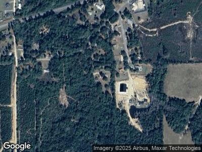
Map
Nearby Homes
- 11348 Adellum Dr
- 115 Highpoint Dr
- 1207 W Bypass
- 00 Western Bypass
- 840 Western Bypass
- 0 Astor Dr
- 0 Tanglewood Dr
- 303 Dahlia Dr
- 203 S Park Loop
- 111 Ridgecrest Dr
- 1207 Prestwood Bridge Rd
- 0 Prestwood Bridge Rd
- 606 Mclendon Ave
- 1706 Prestwood Bridge Rd
- 331 Pelham St
- 00 Powell Cir
- 1704 Rosewood Ln
- 603 S Three Notch St
- 00 Hwy 55 (Truck Route)
- 11321 Grassland Rd
- 20675 No Name Rd
- 206 Huckleberry St
- 109 Huckleberry St
- 107 Huckleberry St
- 107 Huckleberry St
- 108 Huckleberry St
- 212 Huckleberry St
- 212 Huckleberry St
- 105 Huckleberry Dr
- 105 Huckleberry St
- 104 Huckleberry St
- 11582 Adellum Dr
- 11399 Adellum Dr
- 103 Huckleberry St
- 11331 Adellum Dr
- 105 Adellum Dr
- 13008 Brooklyn Rd
- 101 Adellum Dr
- 11651 Adellum Dr
- 00 Adellum Dr