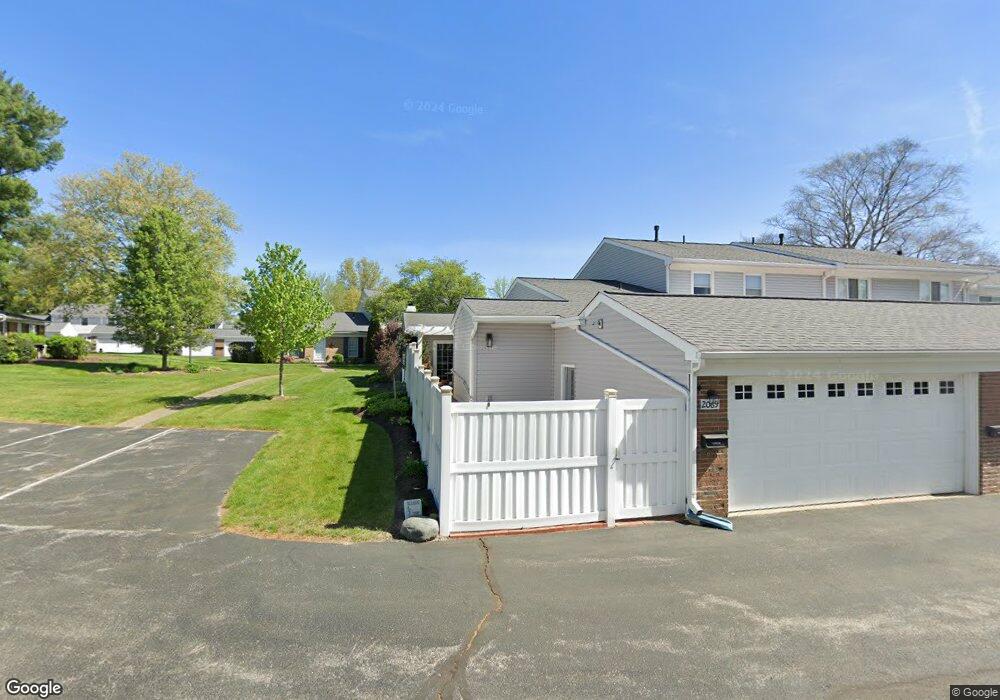
2069 Beechtree Ln Unit 69 Uniontown, OH 44685
Estimated Value: $209,686 - $235,000
2
Beds
2
Baths
1,587
Sq Ft
$140/Sq Ft
Est. Value
About This Home
This home is located at 2069 Beechtree Ln Unit 69, Uniontown, OH 44685 and is currently estimated at $222,922, approximately $140 per square foot. 2069 Beechtree Ln Unit 69 is a home located in Summit County with nearby schools including Chapel Hill Christian School-Green Campus, Mayfair Christian School, and Academy of the Immaculate Heart of Mary.
Ownership History
Date
Name
Owned For
Owner Type
Purchase Details
Closed on
Nov 29, 2006
Sold by
Drews Ruth Lange
Bought by
Janosi Judit C
Current Estimated Value
Home Financials for this Owner
Home Financials are based on the most recent Mortgage that was taken out on this home.
Original Mortgage
$98,450
Outstanding Balance
$59,154
Interest Rate
6.4%
Mortgage Type
Purchase Money Mortgage
Estimated Equity
$163,768
Create a Home Valuation Report for This Property
The Home Valuation Report is an in-depth analysis detailing your home's value as well as a comparison with similar homes in the area
Home Values in the Area
Average Home Value in this Area
Purchase History
| Date | Buyer | Sale Price | Title Company |
|---|---|---|---|
| Janosi Judit C | $123,100 | Attorney |
Source: Public Records
Mortgage History
| Date | Status | Borrower | Loan Amount |
|---|---|---|---|
| Open | Janosi Judit C | $98,450 |
Source: Public Records
Tax History Compared to Growth
Tax History
| Year | Tax Paid | Tax Assessment Tax Assessment Total Assessment is a certain percentage of the fair market value that is determined by local assessors to be the total taxable value of land and additions on the property. | Land | Improvement |
|---|---|---|---|---|
| 2025 | $2,952 | $60,459 | $6,328 | $54,131 |
| 2024 | $2,952 | $60,459 | $6,328 | $54,131 |
| 2023 | $2,952 | $60,459 | $6,328 | $54,131 |
| 2022 | $2,266 | $41,129 | $4,305 | $36,824 |
| 2021 | $2,132 | $41,129 | $4,305 | $36,824 |
| 2020 | $2,093 | $41,130 | $4,310 | $36,820 |
| 2019 | $2,064 | $37,990 | $4,260 | $33,730 |
| 2018 | $2,108 | $37,990 | $4,260 | $33,730 |
| 2017 | $1,959 | $37,990 | $4,260 | $33,730 |
| 2016 | $1,889 | $32,990 | $4,260 | $28,730 |
| 2015 | $1,959 | $32,990 | $4,260 | $28,730 |
| 2014 | $1,947 | $32,990 | $4,260 | $28,730 |
| 2013 | $2,144 | $36,310 | $4,260 | $32,050 |
Source: Public Records
Map
Nearby Homes
- 2043 Carlile Dr Unit 109
- 2694 Cardington Green Unit 23A
- 3605 Elmhurst Cir
- 3609 Glenshire Cir Unit 55B
- 3495 Chadwick Dr
- 2111 Prestwick Dr Unit 3A
- 2186 Prestwick Dr
- 2185 Prestwick Dr
- 2189 E Park Dr
- 2511 Royal County Down
- 3314 Millwood Ln NW
- 2535 Royal County Down Unit B
- 2500 Marlborough Dr
- 1763 Fairway Dr
- 0 Raber Terrace
- 3544 Raber Terrace
- Sarasota Plan at Spring Hill - Spring Hill Villas
- Chester Plan at Spring Hill - Spring Hill Villas
- Kenai Plan at Spring Hill - Spring Hill Villas
- Holston Plan at Spring Hill - Spring Hill Villas
- 2073 Beechtree Ln Unit 68
- 2077 Beechtree Ln
- 2077 Beechtree Dr Unit 67
- 2077 Beechtree Ln Unit 67
- 2081 Beechtree Ln
- 2087 Beechtree Ln
- 2087 Beechtree Ln Unit 65
- 2076 Carlile Dr
- 2048 Beechtree Dr Unit 75
- 2091 Beechtree Ln Unit 64
- 2090 Carlile Dr Unit 137
- 3633 Kenwood Dr Unit 74
- 2046 Beechtree Dr Unit 76
- 2058 Beechtree Dr
- 2095 Beechtree Ln
- 2095 Beechtree Ln Unit 63
- 2044 Beechtree Dr Unit 77
- 3631 Kenwood Dr Unit 73
- 2080 Carlile Dr Unit 134
- 2084 Carlile Dr Unit 135