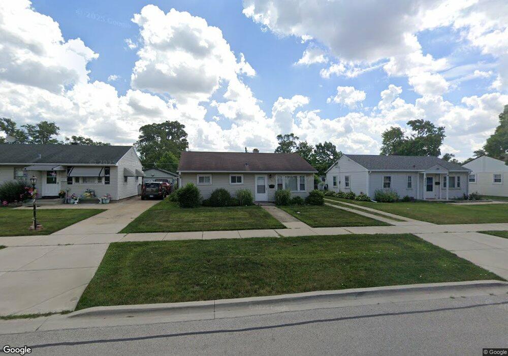
2069 Birch St Des Plaines, IL 60018
Estimated Value: $294,000 - $367,000
3
Beds
1
Bath
854
Sq Ft
$373/Sq Ft
Est. Value
About This Home
This home is located at 2069 Birch St, Des Plaines, IL 60018 and is currently estimated at $318,178, approximately $372 per square foot. 2069 Birch St is a home located in Cook County with nearby schools including South Elementary School, Algonquin Middle School, and Maine West High School.
Ownership History
Date
Name
Owned For
Owner Type
Purchase Details
Closed on
Mar 30, 2011
Sold by
Viscioni Beverly and Sintich Silvano
Bought by
Viscioni Beverly and Sintich Silvano
Current Estimated Value
Purchase Details
Closed on
Dec 16, 1999
Sold by
Visvioni Lance
Bought by
Viscioni Beverly and Sintich Silvano
Home Financials for this Owner
Home Financials are based on the most recent Mortgage that was taken out on this home.
Original Mortgage
$110,000
Outstanding Balance
$32,311
Interest Rate
7.7%
Estimated Equity
$285,867
Purchase Details
Closed on
Dec 2, 1993
Sold by
Hunt Anthony E and Hunt Katherine
Bought by
Viscioni Lance
Home Financials for this Owner
Home Financials are based on the most recent Mortgage that was taken out on this home.
Original Mortgage
$103,050
Interest Rate
6.95%
Create a Home Valuation Report for This Property
The Home Valuation Report is an in-depth analysis detailing your home's value as well as a comparison with similar homes in the area
Home Values in the Area
Average Home Value in this Area
Purchase History
| Date | Buyer | Sale Price | Title Company |
|---|---|---|---|
| Viscioni Beverly | -- | None Available | |
| Viscioni Beverly | $140,000 | -- | |
| Viscioni Lance | $76,333 | -- |
Source: Public Records
Mortgage History
| Date | Status | Borrower | Loan Amount |
|---|---|---|---|
| Open | Viscioni Beverly | $110,000 | |
| Previous Owner | Viscioni Lance | $103,050 |
Source: Public Records
Tax History Compared to Growth
Tax History
| Year | Tax Paid | Tax Assessment Tax Assessment Total Assessment is a certain percentage of the fair market value that is determined by local assessors to be the total taxable value of land and additions on the property. | Land | Improvement |
|---|---|---|---|---|
| 2025 | $4,227 | $26,000 | $5,985 | $20,015 |
| 2024 | $4,227 | $22,001 | $4,988 | $17,013 |
| 2023 | $2,891 | $22,001 | $4,988 | $17,013 |
| 2022 | $2,891 | $22,001 | $4,988 | $17,013 |
| 2021 | $3,159 | $16,936 | $4,156 | $12,780 |
| 2020 | $3,039 | $16,936 | $4,156 | $12,780 |
| 2019 | $2,991 | $19,030 | $4,156 | $14,874 |
| 2018 | $3,125 | $17,319 | $3,657 | $13,662 |
| 2017 | $3,303 | $17,319 | $3,657 | $13,662 |
| 2016 | $3,623 | $17,319 | $3,657 | $13,662 |
| 2015 | $2,965 | $14,304 | $3,158 | $11,146 |
| 2014 | $2,930 | $14,304 | $3,158 | $11,146 |
| 2013 | $3,369 | $14,304 | $3,158 | $11,146 |
Source: Public Records
Map
Nearby Homes
- 1980 Howard Ave
- 1721 Prospect Ave
- 2091 Sherwin Ave
- 1845 Everett Ave
- 1939 E Touhy Ave
- 1640 S River Rd
- 38 E Touhy Ave
- 2500 Maple St
- 1641 E Touhy Ave
- 1629 E Touhy Ave
- 1864 Illinois St
- 1686 Greenleaf Ave
- 2600 S Scott St
- 1625 Estes Ave
- 1445 Everett Ave
- 2609 Eisenhower Dr
- 1754 E Lincoln Ave
- 1689 S Elm St
- 1696 S Elm St
- 2646 Maple St