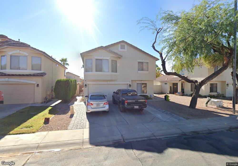
2069 E Appaloosa Rd Gilbert, AZ 85296
East Gilbert NeighborhoodEstimated Value: $354,000 - $452,000
3
Beds
3
Baths
1,625
Sq Ft
$254/Sq Ft
Est. Value
About This Home
This home is located at 2069 E Appaloosa Rd, Gilbert, AZ 85296 and is currently estimated at $413,373, approximately $254 per square foot. 2069 E Appaloosa Rd is a home located in Maricopa County with nearby schools including Finley Farms Elementary School, Greenfield Junior High School, and American Leadership Academy Gilbert North 7-12.
Ownership History
Date
Name
Owned For
Owner Type
Purchase Details
Closed on
Mar 11, 2004
Sold by
Shweiri Saday M and Shweiri Henry A
Bought by
Borbon Marco A Ramos and Ramos Ana L
Current Estimated Value
Home Financials for this Owner
Home Financials are based on the most recent Mortgage that was taken out on this home.
Original Mortgage
$158,000
Outstanding Balance
$73,273
Interest Rate
5.56%
Mortgage Type
New Conventional
Estimated Equity
$340,100
Purchase Details
Closed on
Nov 25, 1996
Sold by
Key Construction Inc
Bought by
Shweiri Saday M and Shweiri Henry A
Home Financials for this Owner
Home Financials are based on the most recent Mortgage that was taken out on this home.
Original Mortgage
$110,119
Interest Rate
7.63%
Mortgage Type
FHA
Create a Home Valuation Report for This Property
The Home Valuation Report is an in-depth analysis detailing your home's value as well as a comparison with similar homes in the area
Home Values in the Area
Average Home Value in this Area
Purchase History
| Date | Buyer | Sale Price | Title Company |
|---|---|---|---|
| Borbon Marco A Ramos | $158,000 | First American Title Ins Co | |
| Shweiri Saday M | $110,612 | Chicago Title Insurance Co |
Source: Public Records
Mortgage History
| Date | Status | Borrower | Loan Amount |
|---|---|---|---|
| Open | Borbon Marco A Ramos | $158,000 | |
| Previous Owner | Shweiri Saday M | $110,119 |
Source: Public Records
Tax History
| Year | Tax Paid | Tax Assessment Tax Assessment Total Assessment is a certain percentage of the fair market value that is determined by local assessors to be the total taxable value of land and additions on the property. | Land | Improvement |
|---|---|---|---|---|
| 2025 | $1,417 | $18,550 | -- | -- |
| 2024 | $1,372 | $17,667 | -- | -- |
| 2023 | $1,372 | $32,310 | $6,460 | $25,850 |
| 2022 | $1,330 | $24,130 | $4,820 | $19,310 |
| 2021 | $1,404 | $22,670 | $4,530 | $18,140 |
| 2020 | $1,382 | $20,830 | $4,160 | $16,670 |
| 2019 | $1,271 | $18,980 | $3,790 | $15,190 |
| 2018 | $1,233 | $17,580 | $3,510 | $14,070 |
| 2017 | $1,190 | $16,430 | $3,280 | $13,150 |
| 2016 | $1,233 | $15,910 | $3,180 | $12,730 |
| 2015 | $1,124 | $14,930 | $2,980 | $11,950 |
Source: Public Records
Map
Nearby Homes
- 2062 E Arabian Dr
- 2062 E Palomino Dr
- 2222 E Arabian Dr
- 1894 E Palomino Dr
- 2177 E Ranch Ct
- 2056 E San Tan Ct
- 952 S Canal Dr
- 1866 E Sagebrush St
- 2336 E San Tan Dr
- 1735 E Saratoga St
- 652 S Bahama Dr
- 557 S Lemon Ct
- 1648 E Palomino Dr
- 1678 E Rawhide St
- 633 S Parkcrest St
- 2297 E Cathy Ct
- 2611 E Catclaw St
- 1645 E Orangewood St
- 1105 S Portland Ave
- 2069 E Sierra Madre Ave
- 2075 E Appaloosa Rd
- 2053 E Appaloosa Rd
- 2070 E Pinto Dr
- 2062 E Pinto Dr
- 2076 E Pinto Dr
- 2054 E Pinto Dr
- 2045 E Appaloosa Rd
- 2091 E Appaloosa Rd
- 2070 E Appaloosa Rd
- 2062 E Appaloosa Rd
- 2078 E Appaloosa Rd
- 2054 E Appaloosa Rd
- 2046 E Pinto Dr
- 2039 E Appaloosa Rd
- 2084 E Appaloosa Rd
- 2046 E Appaloosa Rd
- 2101 E Appaloosa Rd
- 703 S Buckskin Terrace
- 2040 E Pinto Dr
- 2092 E Appaloosa Rd
Your Personal Tour Guide
Ask me questions while you tour the home.