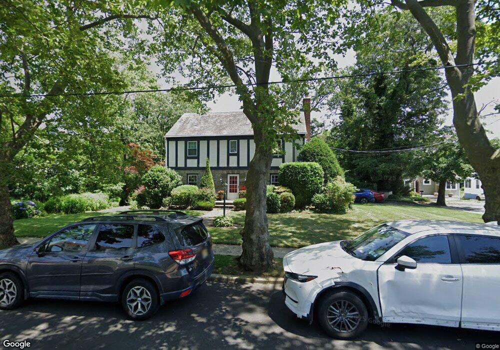
2069 Windsor Rd North Baldwin, NY 11510
Estimated Value: $833,000 - $927,486
3
Beds
3
Baths
2,282
Sq Ft
$386/Sq Ft
Est. Value
About This Home
This home is located at 2069 Windsor Rd, North Baldwin, NY 11510 and is currently estimated at $880,243, approximately $385 per square foot. 2069 Windsor Rd is a home located in Nassau County with nearby schools including Baldwin Senior High School.
Ownership History
Date
Name
Owned For
Owner Type
Purchase Details
Closed on
May 29, 2024
Sold by
Opendoor Property Trust I
Bought by
Ali Muhammad Qasim and Chaudry Sophia Nosheen
Current Estimated Value
Home Financials for this Owner
Home Financials are based on the most recent Mortgage that was taken out on this home.
Original Mortgage
$693,000
Outstanding Balance
$682,937
Interest Rate
7.03%
Mortgage Type
New Conventional
Estimated Equity
$197,306
Purchase Details
Closed on
Mar 7, 2003
Sold by
Gusso James
Bought by
Sudock Robert
Create a Home Valuation Report for This Property
The Home Valuation Report is an in-depth analysis detailing your home's value as well as a comparison with similar homes in the area
Home Values in the Area
Average Home Value in this Area
Purchase History
| Date | Buyer | Sale Price | Title Company |
|---|---|---|---|
| Ali Muhammad Qasim | $770,000 | Am Title Agency Inc | |
| Ali Muhammad Qasim | $770,000 | Am Title Agency Inc | |
| Ali Muhammad Qasim | $770,000 | Am Title Agency Inc | |
| Ali Muhammad Qasim | $770,000 | Am Title Agency Inc | |
| Sudock Robert | $470,000 | -- | |
| Sudock Robert | $470,000 | -- |
Source: Public Records
Mortgage History
| Date | Status | Borrower | Loan Amount |
|---|---|---|---|
| Open | Ali Muhammad Qasim | $693,000 | |
| Closed | Ali Muhammad Qasim | $693,000 |
Source: Public Records
Tax History
| Year | Tax Paid | Tax Assessment Tax Assessment Total Assessment is a certain percentage of the fair market value that is determined by local assessors to be the total taxable value of land and additions on the property. | Land | Improvement |
|---|---|---|---|---|
| 2025 | $20,262 | $657 | $296 | $361 |
| 2024 | $5,099 | $657 | $296 | $361 |
| 2023 | $18,689 | $657 | $296 | $361 |
| 2022 | $18,689 | $657 | $296 | $361 |
| 2021 | $25,194 | $637 | $287 | $350 |
| 2020 | $17,859 | $863 | $782 | $81 |
| 2019 | $16,806 | $863 | $580 | $283 |
| 2018 | $15,937 | $920 | $0 | $0 |
| 2017 | $14,011 | $1,164 | $782 | $382 |
| 2016 | $19,620 | $1,164 | $782 | $382 |
| 2015 | $5,324 | $1,164 | $782 | $382 |
| 2014 | $5,324 | $1,164 | $782 | $382 |
| 2013 | $4,986 | $1,164 | $782 | $382 |
Source: Public Records
Map
Nearby Homes
- 2098 Felix Ct
- 883 Mckenna Ave
- 15 Mckenna Ave
- 858 Seaman Ave E
- 215 N Brookside Ave
- 6 Beverly Pkwy
- 2 Florence St
- 89 Delaware Ave
- 1850 Voshage St
- 1878 Lake Dr W
- 757 Bixby Dr
- 661 Saint Lukes Place
- 619 Ashland Ave
- 107 California Ave
- 1 Willowbrook Ln
- 578 Seaman Ave
- 156 Juanita Ave
- 1900 Carleton Place
- 139 New York Ave
- 60 Connecticut Ave
Your Personal Tour Guide
Ask me questions while you tour the home.