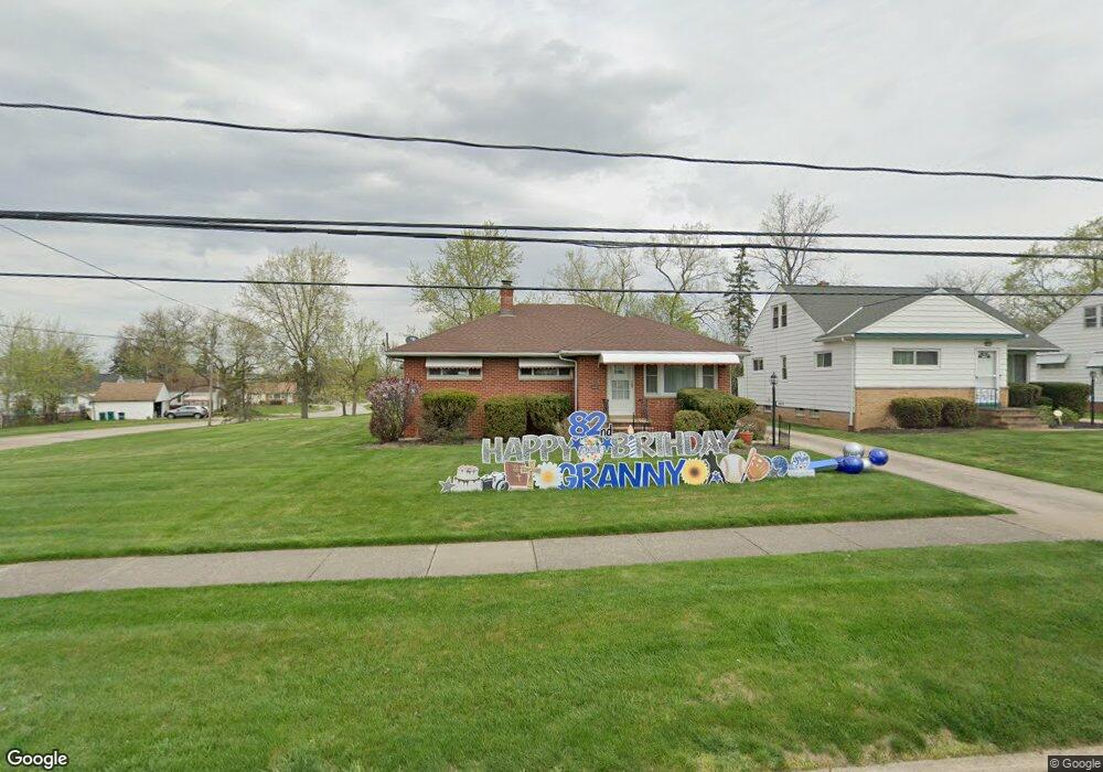
20699 Donny Brook Rd Maple Heights, OH 44137
Estimated Value: $146,000 - $169,000
3
Beds
2
Baths
1,198
Sq Ft
$131/Sq Ft
Est. Value
About This Home
This home is located at 20699 Donny Brook Rd, Maple Heights, OH 44137 and is currently estimated at $156,895, approximately $130 per square foot. 20699 Donny Brook Rd is a home located in Cuyahoga County with nearby schools including Abraham Lincoln Elementary School, Rockside/ J.F. Kennedy School, and Barack Obama School.
Ownership History
Date
Name
Owned For
Owner Type
Purchase Details
Closed on
Oct 26, 1999
Sold by
Alfons Siracusa and Siracusa Katherine
Bought by
Jackson Marva J
Current Estimated Value
Home Financials for this Owner
Home Financials are based on the most recent Mortgage that was taken out on this home.
Original Mortgage
$70,000
Outstanding Balance
$21,730
Interest Rate
7.97%
Estimated Equity
$135,165
Purchase Details
Closed on
May 16, 1977
Sold by
Kloss John J and Kloss Victoria D
Bought by
Siracusa Alfons
Purchase Details
Closed on
Jan 1, 1975
Bought by
Kloss John J and Kloss Victoria D
Create a Home Valuation Report for This Property
The Home Valuation Report is an in-depth analysis detailing your home's value as well as a comparison with similar homes in the area
Home Values in the Area
Average Home Value in this Area
Purchase History
| Date | Buyer | Sale Price | Title Company |
|---|---|---|---|
| Jackson Marva J | $103,500 | -- | |
| Siracusa Alfons | $41,000 | -- | |
| Kloss John J | -- | -- |
Source: Public Records
Mortgage History
| Date | Status | Borrower | Loan Amount |
|---|---|---|---|
| Open | Jackson Marva J | $70,000 |
Source: Public Records
Tax History Compared to Growth
Tax History
| Year | Tax Paid | Tax Assessment Tax Assessment Total Assessment is a certain percentage of the fair market value that is determined by local assessors to be the total taxable value of land and additions on the property. | Land | Improvement |
|---|---|---|---|---|
| 2024 | $3,575 | $50,715 | $7,945 | $42,770 |
| 2023 | $2,707 | $25,980 | $5,220 | $20,760 |
| 2022 | $1,852 | $25,970 | $5,215 | $20,755 |
| 2021 | $1,972 | $25,970 | $5,220 | $20,760 |
| 2020 | $1,462 | $19,670 | $3,960 | $15,720 |
| 2019 | $1,448 | $56,200 | $11,300 | $44,900 |
| 2018 | $1,289 | $19,670 | $3,960 | $15,720 |
| 2017 | $1,232 | $17,540 | $3,960 | $13,580 |
| 2016 | $1,185 | $17,540 | $3,960 | $13,580 |
| 2015 | $2,005 | $17,540 | $3,960 | $13,580 |
| 2014 | $2,005 | $26,780 | $4,340 | $22,440 |
Source: Public Records
Map
Nearby Homes
- 20739 Donny Brook Rd
- 20750 Bowling Green Rd
- 20634 Centuryway Rd
- 20620 Donny Brook Rd
- 20625 Centuryway Rd
- 54 Willard Ave
- 179 Willard Ave
- 62 Willard Ave
- 66 Hubbell Way
- 62 Hubbell Way
- 58 Hubbell Way
- 54 Hubbell Way
- 0 Hubbell Cir
- 20716 Kenyon Dr
- 61 Hubbell Way
- 57 Hubbell Way
- 377 Hubbell Cir
- 19812 Stockton Ave
- 5301 Mardale Ave
- 19289 Stafford Ave
- 20703 Donny Brook Rd
- 20695 Donny Brook Rd
- 20707 Donny Brook Rd
- 20711 Donny Brook Rd
- 20687 Donny Brook Rd
- 20700 Donny Brook Rd
- 20704 Donny Brook Rd
- 20696 Donny Brook Rd
- 20683 Donny Brook Rd
- 20715 Donny Brook Rd
- 20696 Applegate Rd
- 20688 Donny Brook Rd
- 20684 Applegate Rd
- 20708 Donny Brook Rd
- 20688 Applegate Rd
- 20700 Applegate Rd
- 20679 Donny Brook Rd
- 5569 Sunnyslope Rd
- 20719 Donny Brook Rd
- 20712 Donny Brook Rd