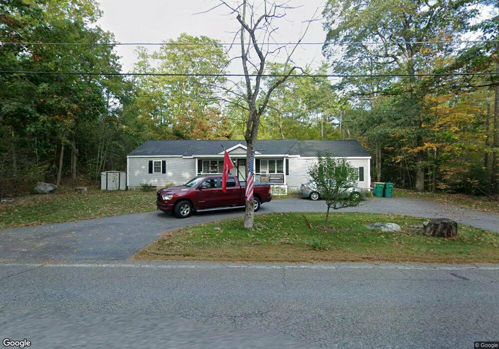
207 Ashburnham State Rd Westminster, MA 01473
Estimated Value: $416,762 - $559,000
3
Beds
1
Bath
1,782
Sq Ft
$264/Sq Ft
Est. Value
About This Home
This home is located at 207 Ashburnham State Rd, Westminster, MA 01473 and is currently estimated at $469,691, approximately $263 per square foot. 207 Ashburnham State Rd is a home located in Worcester County with nearby schools including Oakmont Regional High School and Cushing Academy.
Ownership History
Date
Name
Owned For
Owner Type
Purchase Details
Closed on
Dec 27, 2021
Sold by
Transue Amy and Perini Stacy
Bought by
Perini Stacy
Current Estimated Value
Home Financials for this Owner
Home Financials are based on the most recent Mortgage that was taken out on this home.
Original Mortgage
$327,000
Outstanding Balance
$300,136
Interest Rate
3.11%
Mortgage Type
New Conventional
Estimated Equity
$169,555
Purchase Details
Closed on
Oct 4, 2017
Sold by
Beaulieu Leon G and Beaulieu Marion E
Bought by
Transue Amy and Perini Stacy
Purchase Details
Closed on
Jun 23, 1976
Bought by
Beaulieu Leon G and Beaulieu Marion F
Create a Home Valuation Report for This Property
The Home Valuation Report is an in-depth analysis detailing your home's value as well as a comparison with similar homes in the area
Home Values in the Area
Average Home Value in this Area
Purchase History
| Date | Buyer | Sale Price | Title Company |
|---|---|---|---|
| Perini Stacy | -- | None Available | |
| Perini Stacy | -- | None Available | |
| Transue Amy | -- | -- | |
| Beaulieu Leon G | $22,000 | -- | |
| Transue Amy | -- | -- |
Source: Public Records
Mortgage History
| Date | Status | Borrower | Loan Amount |
|---|---|---|---|
| Open | Perini Stacy | $327,000 | |
| Closed | Perini Stacy | $327,000 | |
| Previous Owner | Beaulieu Leon G | $15,000 |
Source: Public Records
Tax History
| Year | Tax Paid | Tax Assessment Tax Assessment Total Assessment is a certain percentage of the fair market value that is determined by local assessors to be the total taxable value of land and additions on the property. | Land | Improvement |
|---|---|---|---|---|
| 2025 | $4,376 | $355,800 | $96,800 | $259,000 |
| 2024 | $4,249 | $346,600 | $96,800 | $249,800 |
| 2023 | $4,335 | $331,900 | $90,500 | $241,400 |
| 2022 | $2,964 | $187,600 | $78,600 | $109,000 |
| 2021 | $4,807 | $165,700 | $61,800 | $103,900 |
| 2020 | $2,699 | $153,800 | $56,100 | $97,700 |
| 2019 | $2,628 | $144,000 | $46,300 | $97,700 |
| 2018 | $2,536 | $136,700 | $46,300 | $90,400 |
| 2017 | $2,381 | $130,900 | $40,500 | $90,400 |
| 2016 | $2,332 | $124,200 | $33,800 | $90,400 |
| 2015 | $2,388 | $126,000 | $33,800 | $92,200 |
| 2014 | $2,391 | $126,000 | $33,800 | $92,200 |
Source: Public Records
Map
Nearby Homes
- 208 Ashburnham State Rd
- 2 Laws Rd
- 212 Ashburnham State Rd
- 203 Ashburnham State Rd
- 202 Ashburnham State Rd
- 214 Ashburnham State Rd
- 23 Dean Hill Rd
- 198 Ashburnham State Rd
- 216 Ashburnham State Rd
- 19 Dean Hill Rd
- 39 Dean Hill Rd
- 222 Ashburnham State Rd Unit 226
- 43 Dean Hill Rd
- 50 Dean Hill Rd
- 45 Dean Hill Rd
- 189 Ashburnham State Rd
- 233 Ashburnham State Rd
- 49 Dean Hill Rd
- 234 Ashburnham State Rd
- 52 Dean Hill Rd
Your Personal Tour Guide
Ask me questions while you tour the home.