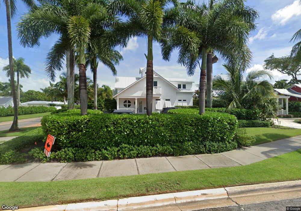
207 Broad Ave S Naples, FL 34102
Old Naples NeighborhoodEstimated Value: $4,534,000 - $6,417,000
6
Beds
2
Baths
1,865
Sq Ft
$2,918/Sq Ft
Est. Value
About This Home
This home is located at 207 Broad Ave S, Naples, FL 34102 and is currently estimated at $5,442,759, approximately $2,918 per square foot. 207 Broad Ave S is a home located in Collier County with nearby schools including Lake Park Elementary School, Naples High School, and Gulfview Middle School.
Ownership History
Date
Name
Owned For
Owner Type
Purchase Details
Closed on
Jun 10, 2019
Sold by
Larson Bruce C and Larson Karen L
Bought by
Larson Karen L
Current Estimated Value
Purchase Details
Closed on
Dec 18, 2014
Sold by
207 Broad Avenue South Llc
Bought by
Larson Bruce C and Larson Karen L
Purchase Details
Closed on
Jun 15, 2012
Sold by
Johnson Richard and Johnson Barry
Bought by
207 Broad Avenue South Llc
Purchase Details
Closed on
May 3, 2010
Sold by
Johnson Richard E
Bought by
Johnson Richard E and Johnson Barry
Create a Home Valuation Report for This Property
The Home Valuation Report is an in-depth analysis detailing your home's value as well as a comparison with similar homes in the area
Home Values in the Area
Average Home Value in this Area
Purchase History
| Date | Buyer | Sale Price | Title Company |
|---|---|---|---|
| Larson Karen L | -- | Attorney | |
| Larson Bruce C | -- | Attorney | |
| 207 Broad Avenue South Llc | $1,400,000 | Attorney | |
| Johnson Richard E | -- | Attorney |
Source: Public Records
Tax History Compared to Growth
Tax History
| Year | Tax Paid | Tax Assessment Tax Assessment Total Assessment is a certain percentage of the fair market value that is determined by local assessors to be the total taxable value of land and additions on the property. | Land | Improvement |
|---|---|---|---|---|
| 2025 | $29,134 | $3,328,013 | -- | -- |
| 2024 | $28,701 | $3,234,221 | -- | -- |
| 2023 | $28,701 | $3,140,020 | $0 | $0 |
| 2022 | $29,516 | $3,048,563 | $0 | $0 |
| 2021 | $29,981 | $2,959,770 | $0 | $0 |
| 2020 | $29,249 | $2,918,905 | $0 | $0 |
| 2019 | $28,898 | $2,853,280 | $1,437,480 | $1,415,800 |
| 2018 | $30,767 | $3,041,019 | $0 | $0 |
| 2017 | $30,302 | $2,978,471 | $1,658,340 | $1,320,131 |
| 2016 | $24,425 | $1,942,117 | $0 | $0 |
| 2015 | $18,780 | $1,765,561 | $0 | $0 |
| 2014 | $12,556 | $1,166,500 | $0 | $0 |
Source: Public Records
Map
Nearby Homes
- 162 11th Ave S
- 1100 3rd St S Unit 202
- 231 11th Ave S
- 88 11th Ave S
- 1222 Gordon Dr Unit 4
- 1222 Gordon Dr Unit 15
- 1021 3rd St S Unit 110
- 1021 3rd St S Unit 306
- 370 11th Ave S Unit 2
- 273 10th Ave S
- 187 10th Ave S
- 263 10th Ave S
- 61 12th Ave S
- 1295 Gulf Shore Blvd S Unit 136
- 1295 Gulf Shore Blvd S Unit 134
- 1295 Gulf Shore Blvd S Unit 128
- 239 Broad Ave S Unit 15
- 245 Broad Ave S
- 187 Broad Ave S
- 210 11th Ave S
- 202 Broad Ave S Unit 411
- 230 11th Ave S
- 271 Broad Ave S Unit 203
- 271 Broad Ave S
- 271 Broad Ave S Unit 202
- 186 11th Ave S
- 244 11th Ave S
- 256 11th Ave S
- 1160 Gordon Dr
- 151 Broad Ave S Unit REAR
- 151 Broad Ave S
- 272 11th Ave S
- 1170 Gordon Dr
- 1100 3rd St S Unit 201
- 1100 3rd St S Unit 102
- 1100 3rd St S Unit 101