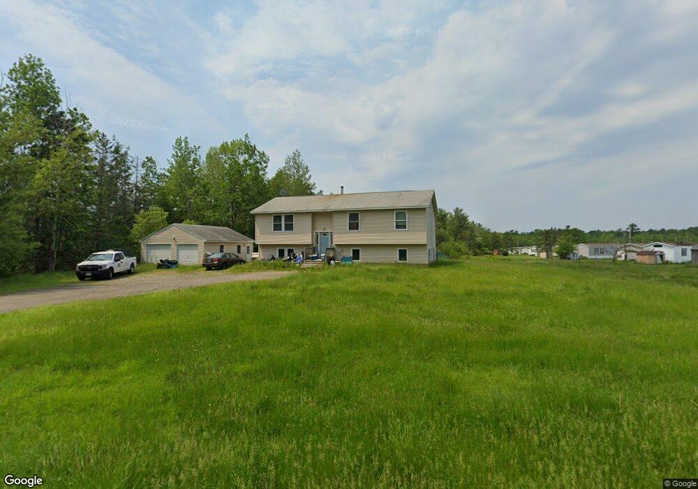
207 Day Rd Brewer, ME 04412
Estimated Value: $291,000 - $366,812
3
Beds
2
Baths
1,215
Sq Ft
$267/Sq Ft
Est. Value
About This Home
This home is located at 207 Day Rd, Brewer, ME 04412 and is currently estimated at $324,453, approximately $267 per square foot. 207 Day Rd is a home located in Penobscot County with nearby schools including Brewer Community School, Brewer High School, and All Saints Catholic School St. Mary's campus PreK-3.
Ownership History
Date
Name
Owned For
Owner Type
Purchase Details
Closed on
Apr 30, 2007
Sold by
Verrill Robert
Bought by
Herbert Anthony D
Current Estimated Value
Home Financials for this Owner
Home Financials are based on the most recent Mortgage that was taken out on this home.
Original Mortgage
$175,000
Outstanding Balance
$104,934
Interest Rate
6.18%
Mortgage Type
Unknown
Estimated Equity
$219,519
Create a Home Valuation Report for This Property
The Home Valuation Report is an in-depth analysis detailing your home's value as well as a comparison with similar homes in the area
Home Values in the Area
Average Home Value in this Area
Purchase History
| Date | Buyer | Sale Price | Title Company |
|---|---|---|---|
| Herbert Anthony D | -- | -- |
Source: Public Records
Mortgage History
| Date | Status | Borrower | Loan Amount |
|---|---|---|---|
| Open | Herbert Anthony D | $175,000 |
Source: Public Records
Tax History
| Year | Tax Paid | Tax Assessment Tax Assessment Total Assessment is a certain percentage of the fair market value that is determined by local assessors to be the total taxable value of land and additions on the property. | Land | Improvement |
|---|---|---|---|---|
| 2025 | $5,336 | $346,500 | $38,500 | $308,000 |
| 2024 | $5,008 | $266,400 | $38,500 | $227,900 |
| 2023 | $4,824 | $240,000 | $37,200 | $202,800 |
| 2021 | $4,507 | $202,100 | $35,900 | $166,200 |
| 2020 | $4,013 | $201,400 | $35,900 | $165,500 |
| 2019 | $3,846 | $201,400 | $35,900 | $165,500 |
| 2018 | $3,689 | $182,700 | $35,900 | $146,800 |
| 2017 | $4,111 | $182,700 | $35,900 | $146,800 |
| 2016 | $3,932 | $182,700 | $35,900 | $146,800 |
| 2015 | $3,717 | $182,700 | $35,900 | $146,800 |
| 2014 | $3,822 | $182,700 | $35,900 | $146,800 |
| 2013 | $3,747 | $179,100 | $32,400 | $146,700 |
Source: Public Records
Map
Nearby Homes
- 4 Black Bear Rd
- 33 Black Bear Rd
- 15 Main Rd
- 00 Lambert Rd(map 4-14 & 4-14-01)
- 29 Thompson Rd
- 43 Lambert Rd
- 41 Bowdoin Dr
- 90 Woodridge Rd
- 725 N Main St
- 20 Lakeman Ln
- 40 Kathryn Ln Unit 40
- 36 Kathryn Ln Unit 36
- 122 Chickadee Ln Unit 17
- 1106 Chase Rd
- 1166 Eastern Ave
- 245 Eastern Ave
- 23 Killarney Ct
- 1010 Olive St
- 6 Russett St
- 205 Riverside Dr
Your Personal Tour Guide
Ask me questions while you tour the home.