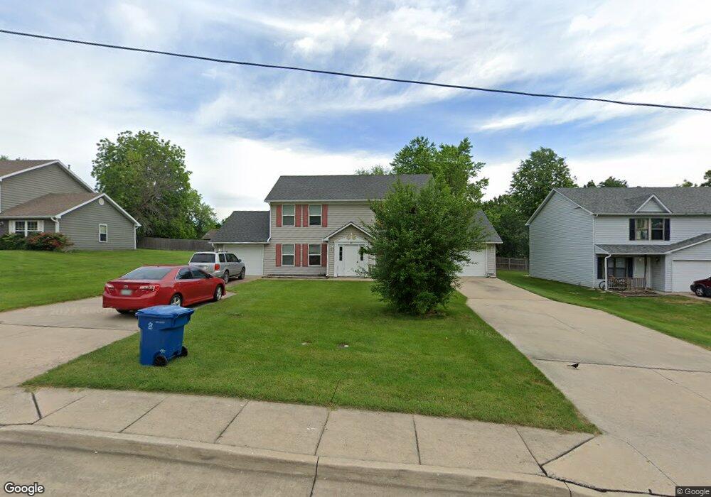
207 E Liberty Ln Unit A & B Ashland, MO 65010
Estimated Value: $273,360 - $317,000
4
Beds
2
Baths
2,160
Sq Ft
$139/Sq Ft
Est. Value
About This Home
This home is located at 207 E Liberty Ln Unit A & B, Ashland, MO 65010 and is currently estimated at $299,787, approximately $138 per square foot. 207 E Liberty Ln Unit A & B is a home located in Boone County with nearby schools including Southern Boone Primary School, Southern Boone Elementary School, and Southern Boone Middle School.
Ownership History
Date
Name
Owned For
Owner Type
Purchase Details
Closed on
May 29, 2025
Sold by
Armstrong Family Trust and Armstrong Seth
Bought by
Rensing Michael R
Current Estimated Value
Home Financials for this Owner
Home Financials are based on the most recent Mortgage that was taken out on this home.
Original Mortgage
$310,000
Outstanding Balance
$309,207
Interest Rate
6.83%
Mortgage Type
New Conventional
Estimated Equity
-$9,420
Purchase Details
Closed on
Apr 28, 2022
Sold by
Roanoke1 Llc
Bought by
Armstrong Family Trust
Home Financials for this Owner
Home Financials are based on the most recent Mortgage that was taken out on this home.
Original Mortgage
$170,250
Interest Rate
4.42%
Mortgage Type
New Conventional
Purchase Details
Closed on
Jan 3, 2008
Sold by
South Woods Properties Inc
Bought by
South Woods Properties Llc
Create a Home Valuation Report for This Property
The Home Valuation Report is an in-depth analysis detailing your home's value as well as a comparison with similar homes in the area
Home Values in the Area
Average Home Value in this Area
Purchase History
| Date | Buyer | Sale Price | Title Company |
|---|---|---|---|
| Rensing Michael R | -- | None Listed On Document | |
| Rensing Michael R | -- | None Listed On Document | |
| Armstrong Family Trust | -- | None Listed On Document | |
| South Woods Properties Llc | -- | None Available |
Source: Public Records
Mortgage History
| Date | Status | Borrower | Loan Amount |
|---|---|---|---|
| Open | Rensing Michael R | $310,000 | |
| Closed | Rensing Michael R | $310,000 | |
| Previous Owner | Armstrong Family Trust | $170,250 |
Source: Public Records
Tax History
| Year | Tax Paid | Tax Assessment Tax Assessment Total Assessment is a certain percentage of the fair market value that is determined by local assessors to be the total taxable value of land and additions on the property. | Land | Improvement |
|---|---|---|---|---|
| 2025 | $2,075 | $29,431 | $1,083 | $28,348 |
| 2024 | $1,894 | $26,752 | $1,083 | $25,669 |
| 2023 | $1,893 | $26,752 | $1,083 | $25,669 |
| 2022 | $1,768 | $24,776 | $1,083 | $23,693 |
| 2021 | $1,765 | $24,776 | $1,083 | $23,693 |
| 2020 | $1,583 | $22,116 | $1,083 | $21,033 |
| 2019 | $1,583 | $22,116 | $1,083 | $21,033 |
| 2018 | $1,401 | $0 | $0 | $0 |
| 2017 | $1,401 | $22,116 | $1,083 | $21,033 |
| 2016 | $1,405 | $22,116 | $1,083 | $21,033 |
| 2015 | $1,389 | $22,116 | $1,083 | $21,033 |
| 2014 | $1,394 | $22,116 | $1,083 | $21,033 |
Source: Public Records
Map
Nearby Homes
- 208 Renee Dr
- 502 Woodland Ct
- 502 Douglas Dr
- 204 Redtail Dr
- 209 E Johnson Ave
- 104 Maple St
- 103 Watson Ct
- 5066 Patriot Ln
- 112 E Broadway
- 400 Eagle Lake Dr
- 511 Sue Dr
- LOT 2 & 5 Eastside Dr
- 600 Peterson Ln
- 16110 Blue Heron Dr
- 4850 Rebellion Ln
- 15960 Allegiance Ave
- 5580 Charlotte Dr
- 601 Turner Ave
- 15157 Denali Dr
- 4885 Rebellion Ln
- 207 E Liberty Ln
- 301 E Liberty Ln
- 301 E Liberty Ln
- 301 E Liberty Ln Unit A&B
- 205 E Liberty Ln
- 204 Norma Ln
- 202 Norma Ln
- 303 E Liberty Ln
- 303 E Liberty Ln
- 206 Norma Ln
- LOT 37A Norma Ln
- LOT 38A Norma Ln
- 203 E Liberty Ln
- 206 E Liberty Ln
- 300 E Liberty Ln
- 300 E Liberty Ln Unit A & B
- 305 E Liberty Ln
- 0 Norma Ln
- TBD Norma Ln
- 200 Norma Ln
Your Personal Tour Guide
Ask me questions while you tour the home.