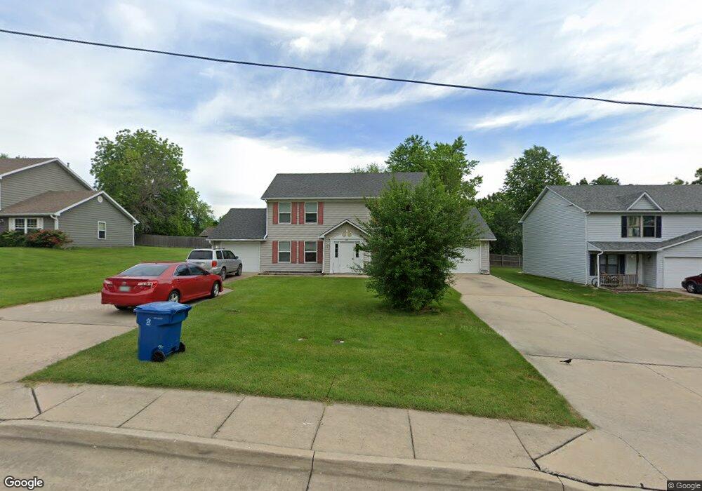
207 E Liberty Ln Unit A & B Ashland, MO 65010
Ashland AreaEstimated Value: $231,000 - $379,000
About This Home
This home is located at 207 E Liberty Ln Unit A & B, Ashland, MO 65010 and is currently estimated at $303,450, approximately $140 per square foot. 207 E Liberty Ln Unit A & B is a home located in Boone County with nearby schools including Southern Boone Primary School, Southern Boone Elementary School, and Southern Boone Middle School.
Ownership History
We collect this data history from publicly available records. To have your information removed, we recommend requesting removal directly through your county’s website.
Purchase Details
Home Financials for this Owner
Home Financials are based on the most recent Mortgage that was taken out on this home.Purchase Details
Home Financials for this Owner
Home Financials are based on the most recent Mortgage that was taken out on this home.Purchase Details
Home Values in the Area
Average Home Value in this Area
Purchase History
We collect this data history from publicly available records. To have your information removed, we recommend requesting removal directly through your county’s website.
| Date | Buyer | Sale Price | Title Company |
|---|---|---|---|
| -- | None Listed On Document | ||
| -- | None Listed On Document | ||
| -- | None Available |
Mortgage History
We collect this data history from publicly available records. To have your information removed, we recommend requesting removal directly through your county’s website.
| Date | Status | Borrower | Loan Amount |
|---|---|---|---|
| Open | $310,000 | ||
| Previous Owner | $170,250 |
Tax History
We collect this data history from publicly available records. To have your information removed, we recommend requesting removal directly through your county’s website.
| Year | Tax Paid | Tax Assessment Tax Assessment Total Assessment is a certain percentage of the fair market value that is determined by local assessors to be the total taxable value of land and additions on the property. | Land | Improvement |
|---|---|---|---|---|
| 2025 | $2,075 | $29,431 | $1,083 | $28,348 |
| 2024 | $1,894 | $26,752 | $1,083 | $25,669 |
| 2023 | $1,893 | $26,752 | $1,083 | $25,669 |
| 2022 | $1,768 | $24,776 | $1,083 | $23,693 |
| 2021 | $1,765 | $24,776 | $1,083 | $23,693 |
| 2020 | $1,583 | $22,116 | $1,083 | $21,033 |
| 2019 | $1,583 | $22,116 | $1,083 | $21,033 |
| 2018 | $1,401 | $0 | $0 | $0 |
| 2017 | $1,401 | $22,116 | $1,083 | $21,033 |
| 2016 | $1,405 | $22,116 | $1,083 | $21,033 |
| 2015 | $1,389 | $22,116 | $1,083 | $21,033 |
| 2014 | $1,394 | $22,116 | $1,083 | $21,033 |
Map
- 303 E Liberty Ln Unit A&B
- 305 E Liberty Ln Unit A & B
- 312 E Liberty Ln Unit A&B
- 204 Redtail Dr
- 203 E Johnson Ave
- 209 E Johnson Ave
- 5130 Patriot Ln
- 104 Maple St
- 5000 E Liberty Ln
- 15780 Allegiance Ave
- 504 Eagle Lake Dr
- 5200 Democracy Dr
- 100 Peterson Ln
- 4893 Loyalist Ln
- 16110 Blue Heron Dr
- 930 Stacy Dr
- 511 Turner Ave
- 4850 E Liberty Ln
- 5875 Eagle Lake Dr
- 4805 Treaty Dr
- 207 E Liberty Ln
- 301 E Liberty Ln
- 301 E Liberty Ln
- 301 E Liberty Ln Unit A&B
- 205 E Liberty Ln
- 204 Norma Ln
- 303 E Liberty Ln
- 303 E Liberty Ln
- 202 Norma Ln
- 206 Norma Ln
- LOT 37A Norma Ln
- LOT 38A Norma Ln
- 203 E Liberty Ln
- 206 E Liberty Ln
- 300 E Liberty Ln
- 300 E Liberty Ln Unit A & B
- 305 E Liberty Ln
- 0 Norma Ln
- TBD Norma Ln
- 200 Norma Ln
Ask me questions while you tour the home.