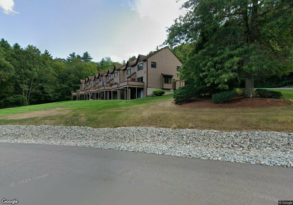
207 Eastview Dr Wilton, NH 03086
Estimated Value: $298,102 - $327,000
3
Beds
2
Baths
1,500
Sq Ft
$207/Sq Ft
Est. Value
About This Home
This home is located at 207 Eastview Dr, Wilton, NH 03086 and is currently estimated at $310,526, approximately $207 per square foot. 207 Eastview Dr is a home located in Hillsborough County with nearby schools including Florence Rideout Elementary School, Wilton-Lyndeborough Cooperative Middle School, and Wilton-Lyndeborough Cooperative High School.
Ownership History
Date
Name
Owned For
Owner Type
Purchase Details
Closed on
Nov 20, 2006
Sold by
Strout Terry W and Strout Carolyn B
Bought by
Berube Benjamin David
Current Estimated Value
Home Financials for this Owner
Home Financials are based on the most recent Mortgage that was taken out on this home.
Original Mortgage
$178,400
Interest Rate
6.33%
Create a Home Valuation Report for This Property
The Home Valuation Report is an in-depth analysis detailing your home's value as well as a comparison with similar homes in the area
Home Values in the Area
Average Home Value in this Area
Purchase History
| Date | Buyer | Sale Price | Title Company |
|---|---|---|---|
| Berube Benjamin David | $178,400 | -- |
Source: Public Records
Mortgage History
| Date | Status | Borrower | Loan Amount |
|---|---|---|---|
| Open | Berube Benjamin David | $141,000 | |
| Closed | Berube Benjamin David | $178,400 |
Source: Public Records
Tax History Compared to Growth
Tax History
| Year | Tax Paid | Tax Assessment Tax Assessment Total Assessment is a certain percentage of the fair market value that is determined by local assessors to be the total taxable value of land and additions on the property. | Land | Improvement |
|---|---|---|---|---|
| 2024 | $4,773 | $191,900 | $0 | $191,900 |
| 2023 | $4,260 | $191,900 | $0 | $191,900 |
| 2022 | $3,965 | $191,900 | $0 | $191,900 |
| 2021 | $3,688 | $191,900 | $0 | $191,900 |
| 2020 | $3,712 | $126,300 | $0 | $126,300 |
| 2019 | $3,668 | $126,300 | $0 | $126,300 |
| 2018 | $3,485 | $126,300 | $0 | $126,300 |
| 2017 | $3,432 | $126,300 | $0 | $126,300 |
| 2016 | $3,327 | $126,300 | $0 | $126,300 |
| 2015 | $3,387 | $128,600 | $0 | $128,600 |
| 2014 | $3,318 | $128,600 | $0 | $128,600 |
| 2013 | $3,346 | $128,600 | $0 | $128,600 |
Source: Public Records
Map
Nearby Homes
- 8 Maple St
- F-88-11 Aria Hill Dr
- F-88-12 Aria Hill Dr
- F-88-7 Aria Hill Dr
- F-88-10 Aria Hill Dr
- 134 Falcon Ridge Rd Unit 23
- 30 Robbins Rd
- 25 Burns Hill Rd
- Lot F-88-9 Aria Hill Dr
- 44 Burns Hill Rd
- 18 Richfield Way
- 415 Savage Rd
- F/88-5 McGettigan Rd
- F/88-4 McGettigan Rd
- Lots 4 & 7 Gibbons & Robbins Rd
- 294 Mason Rd
- 58-2 Davisville Rd
- 21 Ledgewood Rd
- 344 Elm St Unit 14
- 344 Elm St Unit 16
- 503 Eastview Dr Unit 3
- 409 Eastview Dr
- 408 Eastview Dr
- 407 Eastview Dr
- 406 Eastview Dr
- 405 Eastview Dr
- 403 Eastview Dr
- 401 Eastview Dr
- 209 Eastview Dr
- 208 Eastview Dr
- 206 Eastview Dr
- 205 Eastview Dr
- 204 Eastview Dr
- 203 Eastview Dr
- 202 Eastview Dr
- 109 Eastview Dr
- 108 Eastview Dr
- 107 Eastview Dr
- 106 Eastview Dr
- 105 Eastview Dr