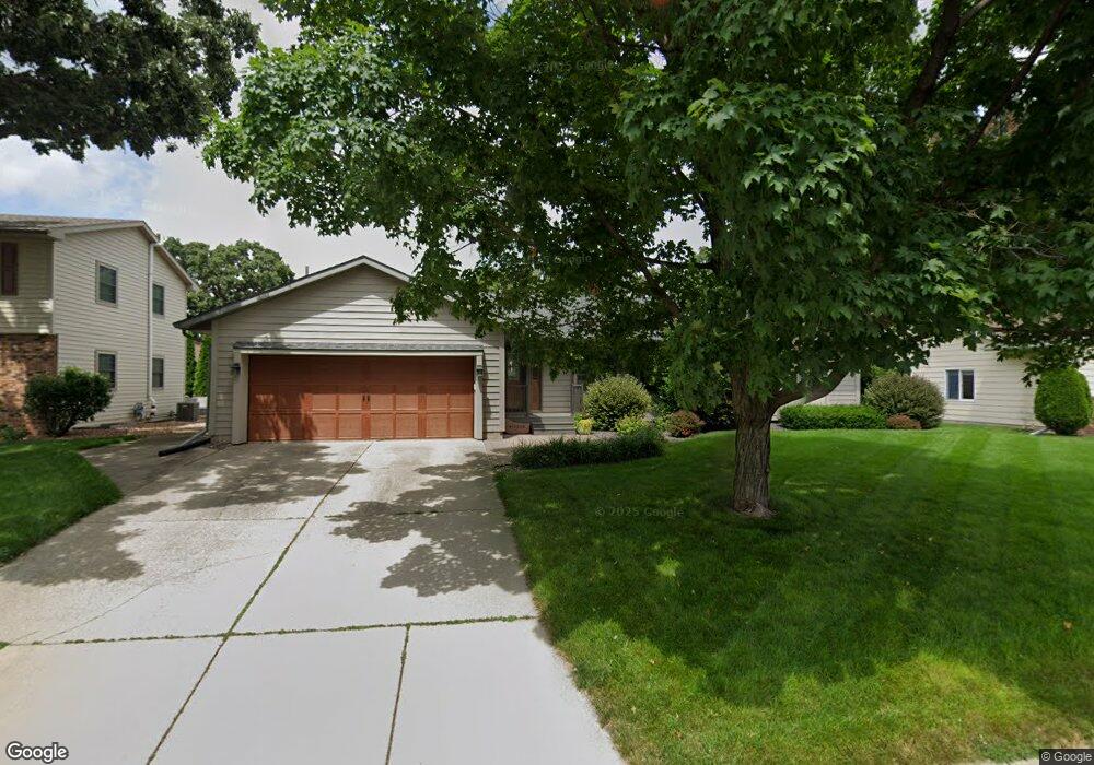
207 Glenn Rd Albert Lea, MN 56007
Estimated Value: $342,000 - $371,342
3
Beds
3
Baths
3,340
Sq Ft
$108/Sq Ft
Est. Value
About This Home
This home is located at 207 Glenn Rd, Albert Lea, MN 56007 and is currently estimated at $360,586, approximately $107 per square foot. 207 Glenn Rd is a home located in Freeborn County with nearby schools including Hawthorne Elementary School, Southwest Middle School, and Albert Lea Senior High School.
Ownership History
Date
Name
Owned For
Owner Type
Purchase Details
Closed on
Sep 3, 2021
Sold by
Tubbs Brie A and Tubbs Matthew M
Bought by
Wilson Whitney and Wilson Nathan
Current Estimated Value
Home Financials for this Owner
Home Financials are based on the most recent Mortgage that was taken out on this home.
Original Mortgage
$279,000
Outstanding Balance
$253,490
Interest Rate
2.7%
Mortgage Type
New Conventional
Estimated Equity
$107,096
Purchase Details
Closed on
Apr 1, 2013
Sold by
Miller William T and Miller Melodie M
Bought by
Tubbs Brie Anne and Tubbs Matthew M
Purchase Details
Closed on
Apr 1, 2011
Sold by
Miller William T and Miller Melodie M
Bought by
Tubbs Brie Anne and Tubbs Matthew M
Home Financials for this Owner
Home Financials are based on the most recent Mortgage that was taken out on this home.
Original Mortgage
$204,020
Interest Rate
4.75%
Create a Home Valuation Report for This Property
The Home Valuation Report is an in-depth analysis detailing your home's value as well as a comparison with similar homes in the area
Home Values in the Area
Average Home Value in this Area
Purchase History
| Date | Buyer | Sale Price | Title Company |
|---|---|---|---|
| Wilson Whitney | $310,000 | None Available | |
| Tubbs Brie Anne | -- | -- | |
| Tubbs Brie Anne | -- | -- | |
| Wilson Whitney Whitney | $310,000 | -- |
Source: Public Records
Mortgage History
| Date | Status | Borrower | Loan Amount |
|---|---|---|---|
| Open | Wilson Whitney | $279,000 | |
| Previous Owner | Tubbs Brie Anne | $204,020 | |
| Closed | Wilson Whitney Whitney | $310,000 |
Source: Public Records
Tax History
| Year | Tax Paid | Tax Assessment Tax Assessment Total Assessment is a certain percentage of the fair market value that is determined by local assessors to be the total taxable value of land and additions on the property. | Land | Improvement |
|---|---|---|---|---|
| 2025 | $4,944 | $380,900 | $19,700 | $361,200 |
| 2024 | $4,924 | $331,700 | $19,700 | $312,000 |
| 2023 | $4,562 | $331,700 | $19,700 | $312,000 |
| 2022 | $4,164 | $309,400 | $19,700 | $289,700 |
| 2021 | $4,074 | $246,900 | $19,700 | $227,200 |
| 2020 | $4,004 | $237,200 | $19,700 | $217,500 |
| 2019 | $3,438 | $209,100 | $16,700 | $192,400 |
| 2018 | $3,368 | $0 | $0 | $0 |
| 2016 | $2,924 | $0 | $0 | $0 |
| 2015 | $2,720 | $0 | $0 | $0 |
| 2014 | $3,014 | $0 | $0 | $0 |
| 2012 | $2,846 | $0 | $0 | $0 |
Source: Public Records
Map
Nearby Homes
- 313 Glenn Rd
- 319 Glenn Rd
- 105 E Hawthorne St
- 307 E Richway Dr
- 613 & 615 Giles Place
- 618 & 620 Giles Place
- 902 Clausen Ave
- 1626 Keystone Dr
- 1805 Lakewood Ave
- 1823 Lakewood Ave Unit 2
- 1106 Foothills Cir
- 522 Alice Ave
- 406 Robin Rd
- 640 Marshall St
- 1807 Brookside Dr
- 529 W Park Ln
- 1814 Brookside Cir
- 210 Lee Place
- 418 Ridge Rd
- 808 Freeborn Ave
Your Personal Tour Guide
Ask me questions while you tour the home.