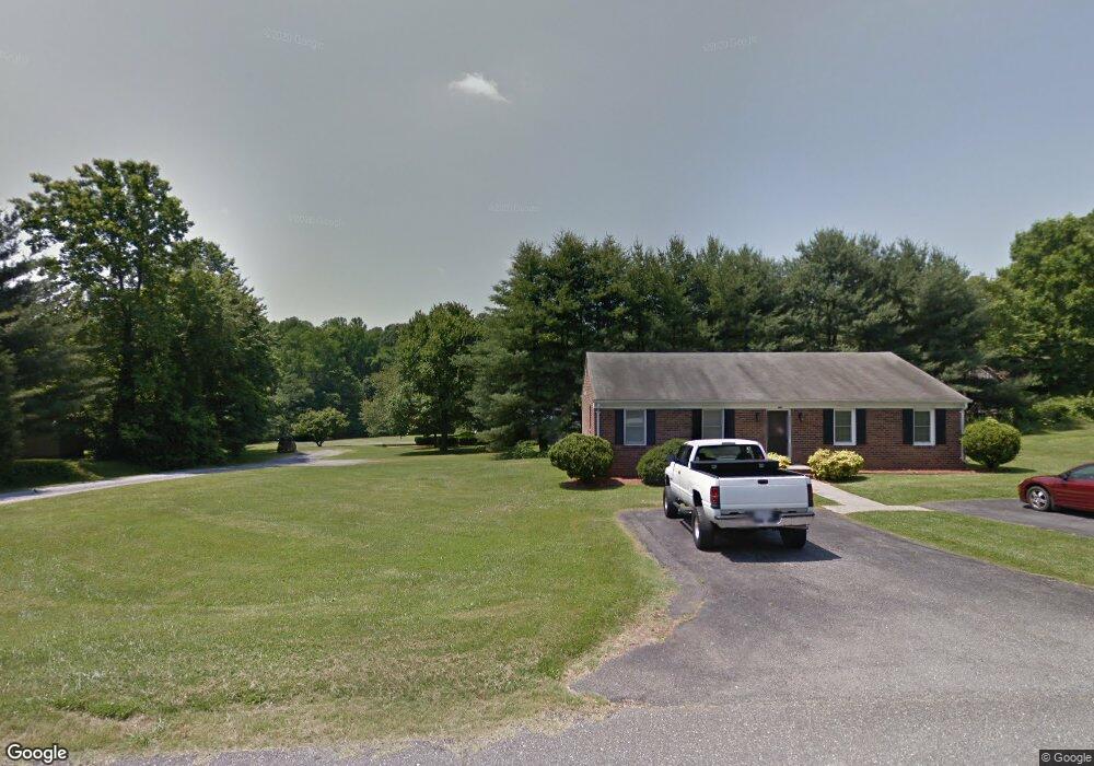
207 Graves Dr Forest, VA 24551
Estimated Value: $307,000 - $452,000
2
Beds
2
Baths
1,308
Sq Ft
$310/Sq Ft
Est. Value
About This Home
This home is located at 207 Graves Dr, Forest, VA 24551 and is currently estimated at $405,395, approximately $309 per square foot. 207 Graves Dr is a home located in Bedford County with nearby schools including Thomas Jefferson Elementary School, Forest Middle School, and Jefferson Forest High School.
Ownership History
Date
Name
Owned For
Owner Type
Purchase Details
Closed on
Dec 28, 2009
Sold by
Fannie Mae
Bought by
Tiffany Peter D
Current Estimated Value
Purchase Details
Closed on
Apr 11, 2009
Sold by
Farinholt Martha C
Bought by
Federal National Mortgage Association
Purchase Details
Closed on
Mar 23, 2006
Sold by
Smith Andrew C and Smith Cressida
Bought by
Farinholt Martha C
Home Financials for this Owner
Home Financials are based on the most recent Mortgage that was taken out on this home.
Original Mortgage
$174,600
Interest Rate
6.75%
Mortgage Type
New Conventional
Create a Home Valuation Report for This Property
The Home Valuation Report is an in-depth analysis detailing your home's value as well as a comparison with similar homes in the area
Home Values in the Area
Average Home Value in this Area
Purchase History
| Date | Buyer | Sale Price | Title Company |
|---|---|---|---|
| Tiffany Peter D | $130,000 | None Available | |
| Federal National Mortgage Association | $215,294 | Wittstadt Title | |
| Farinholt Martha C | -- | None Available |
Source: Public Records
Mortgage History
| Date | Status | Borrower | Loan Amount |
|---|---|---|---|
| Previous Owner | Farinholt Martha C | $174,600 |
Source: Public Records
Tax History
| Year | Tax Paid | Tax Assessment Tax Assessment Total Assessment is a certain percentage of the fair market value that is determined by local assessors to be the total taxable value of land and additions on the property. | Land | Improvement |
|---|---|---|---|---|
| 2025 | $1,300 | $317,000 | $75,000 | $242,000 |
| 2024 | $1,300 | $317,000 | $75,000 | $242,000 |
| 2023 | $1,300 | $158,500 | $0 | $0 |
| 2022 | $1,486 | $148,550 | $0 | $0 |
| 2021 | $1,486 | $297,100 | $60,000 | $237,100 |
| 2020 | $1,486 | $297,100 | $60,000 | $237,100 |
| 2019 | $1,486 | $297,100 | $60,000 | $237,100 |
| 2018 | $1,496 | $287,700 | $45,000 | $242,700 |
| 2017 | $1,496 | $287,700 | $45,000 | $242,700 |
| 2016 | $1,496 | $287,700 | $45,000 | $242,700 |
| 2015 | $1,385 | $266,300 | $45,000 | $221,300 |
| 2014 | $1,002 | $192,700 | $42,000 | $150,700 |
Source: Public Records
Map
Nearby Homes
- 206 Simsbury Ln
- 17513 Forest Rd
- 115 Thornfield Dr
- 506 Robin Dr
- 1664 Graves Mill Rd
- 1055 Jefferson Oaks Ct Unit 3
- 1305 Summerpark Dr
- 1074 Jefferson Dr W
- 207 Northwynd Cir
- 736 Wyndhurst Dr
- 1136 Jefferson Dr W
- 725 Wyndhurst Dr
- 405 Homestead Dr
- 1249 Sleepy Oak Ln
- 651 Wyndhurst Dr
- 211 Robin Dr
- 1084 Tori Ct
- 117 Crestline Dr
- 213 Margate Dr
- 205 Robin Dr
- 205 Graves Dr
- 203 Graves Dr
- 209 Graves Dr
- 201 Graves Dr
- 211 Graves Dr
- 111 Graves Dr
- 208 Graves Dr
- 213 Graves Dr
- 210 Graves Dr
- 206 Graves Dr
- 325 Brook Park Place
- 109 Graves Dr
- 212 Graves Dr
- 204 Graves Dr
- 316 Brook Park Place
- 215 Graves Dr
- 214 Graves Dr
- 202 Graves Dr
- 207 Forest Dale Dr
- 205 Forest Dale Dr
Your Personal Tour Guide
Ask me questions while you tour the home.